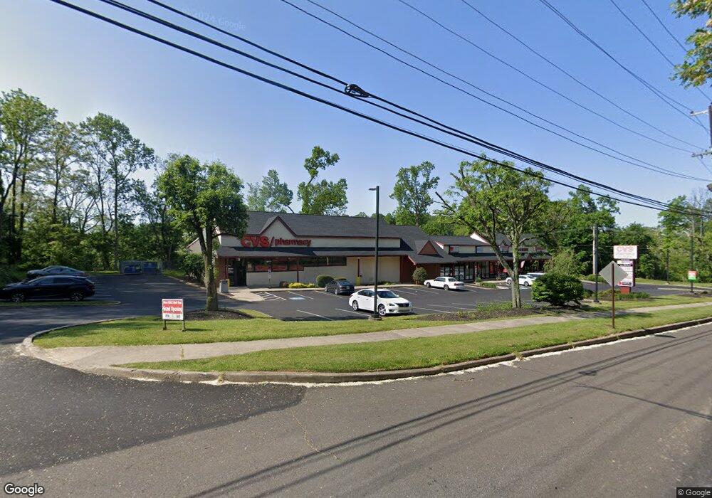
1862 W Maple Ave Langhorne, PA 19047
Estimated Value: $5,489,774
--
Bed
--
Bath
14,490
Sq Ft
$379/Sq Ft
Est. Value
About This Home
This home is located at 1862 W Maple Ave, Langhorne, PA 19047 and is currently estimated at $5,489,774, approximately $378 per square foot. 1862 W Maple Ave is a home located in Bucks County with nearby schools including Tawanka Elementary School, Maple Point Middle School, and Neshaminy High School.
Ownership History
Date
Name
Owned For
Owner Type
Purchase Details
Closed on
Mar 11, 2010
Sold by
Langhorne Realty Partners Lp
Bought by
Adelphia Realty Lp
Current Estimated Value
Home Financials for this Owner
Home Financials are based on the most recent Mortgage that was taken out on this home.
Original Mortgage
$2,000,000
Outstanding Balance
$1,330,186
Interest Rate
5.05%
Mortgage Type
Future Advance Clause Open End Mortgage
Estimated Equity
$4,159,588
Purchase Details
Closed on
Feb 3, 2004
Sold by
1862 West Bridgetown Pike Associates Lp
Bought by
Langhorne Realty Partners Lp
Home Financials for this Owner
Home Financials are based on the most recent Mortgage that was taken out on this home.
Original Mortgage
$1,625,000
Interest Rate
5.83%
Mortgage Type
Commercial
Purchase Details
Closed on
Jan 10, 1994
Sold by
Craig Development Corp
Bought by
1862 West Bridgetown Pike Associates Ltd
Create a Home Valuation Report for This Property
The Home Valuation Report is an in-depth analysis detailing your home's value as well as a comparison with similar homes in the area
Home Values in the Area
Average Home Value in this Area
Purchase History
| Date | Buyer | Sale Price | Title Company |
|---|---|---|---|
| Adelphia Realty Lp | $3,055,000 | None Available | |
| Langhorne Realty Partners Lp | $1,625,000 | -- | |
| 1862 West Bridgetown Pike Associates Ltd | $1,675,000 | -- |
Source: Public Records
Mortgage History
| Date | Status | Borrower | Loan Amount |
|---|---|---|---|
| Open | Adelphia Realty Lp | $2,000,000 | |
| Previous Owner | Langhorne Realty Partners Lp | $1,625,000 |
Source: Public Records
Tax History Compared to Growth
Tax History
| Year | Tax Paid | Tax Assessment Tax Assessment Total Assessment is a certain percentage of the fair market value that is determined by local assessors to be the total taxable value of land and additions on the property. | Land | Improvement |
|---|---|---|---|---|
| 2025 | $46,110 | $211,800 | $45,480 | $166,320 |
| 2024 | $46,110 | $211,800 | $45,480 | $166,320 |
| 2023 | $45,378 | $211,800 | $45,480 | $166,320 |
| 2022 | $44,186 | $211,800 | $45,480 | $166,320 |
| 2021 | $44,186 | $211,800 | $45,480 | $166,320 |
| 2020 | $43,656 | $211,800 | $45,480 | $166,320 |
| 2019 | $42,682 | $211,800 | $45,480 | $166,320 |
| 2018 | $41,898 | $211,800 | $45,480 | $166,320 |
| 2017 | $40,829 | $211,800 | $45,480 | $166,320 |
| 2016 | $40,829 | $211,800 | $45,480 | $166,320 |
| 2015 | $40,829 | $211,800 | $45,480 | $166,320 |
| 2014 | $40,829 | $211,800 | $45,480 | $166,320 |
Source: Public Records
Map
Nearby Homes
- 257 Wisteria Ave
- 935 Edgewood Ln
- 739 Bridgeview Rd
- 29 Langhorne Ave
- 2623 Sunnyside Ave
- 518 Pebble Ridge Ct
- 812 Green Ridge Cir
- 230 Playwicki St
- 527 Ashton Cir
- 225 Playwicki St
- 537 Ashton Cir
- 716 Ross Dr
- 147 Watergate Dr
- 178 Buckshire Dr
- 166 N Hawthorne Ave
- 737 Lynwood Dr
- 1210 Brownsville Rd
- 722 Autumn Dr
- 1021 W Maple Ave
- 216 Buttonwood Dr
- 509 N Elmwood Ave
- 1834 W Maple Ave
- 510 N Elmwood Ave
- 504 N Elmwood Ave
- 474 Bluebell Ave
- 469 N Elmwood Ave
- 525 Periwinkle Ave
- 470 N Elmwood Ave
- 563 Periwinkle Ave
- 464 Forrest Ave
- 1808 W Maple Ave
- 461 N Elmwood Ave
- 452 N Elmwood Ave
- 451 N Elmwood Ave
- 1964 W Maple Ave
- 542 Periwinkle Ave
- 556 Periwinkle Ave
- 504 Periwinkle Ave
- 444 Forrest Ave
- 440 Forrest Ave