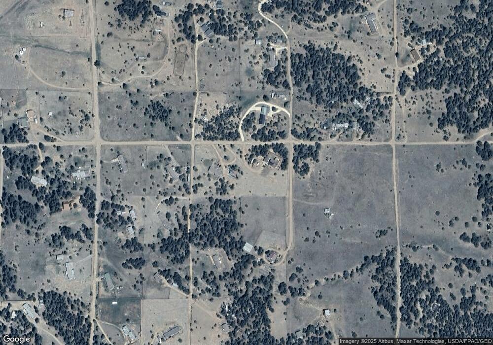
1863 16th Trail Unit 61 Cotopaxi, CO 81223
Estimated Value: $215,000 - $241,000
2
Beds
2
Baths
1,008
Sq Ft
$222/Sq Ft
Est. Value
About This Home
This home is located at 1863 16th Trail Unit 61, Cotopaxi, CO 81223 and is currently estimated at $224,066, approximately $222 per square foot. 1863 16th Trail Unit 61 is a home located in Fremont County with nearby schools including Cotopaxi Elementary School and Cotopaxi Junior/Senior High School.
Ownership History
Date
Name
Owned For
Owner Type
Purchase Details
Closed on
Oct 2, 2025
Sold by
Secretary Of Veterans Affairs
Bought by
Dawn White Group Llc
Current Estimated Value
Purchase Details
Closed on
Aug 5, 2025
Sold by
Bokf Na
Bought by
Secretary Of Veterans Affairs
Purchase Details
Closed on
Jun 12, 2025
Sold by
Fremont County Public Trustee
Bought by
Bokf Na
Purchase Details
Closed on
Dec 18, 2020
Sold by
Donaldson Leslie Martin and Sutter Ireland Jo
Bought by
Fries Clarence
Home Financials for this Owner
Home Financials are based on the most recent Mortgage that was taken out on this home.
Original Mortgage
$195,000
Interest Rate
2.7%
Mortgage Type
VA
Purchase Details
Closed on
May 18, 2018
Sold by
Pinsinski Lawrence J and Pinsinski Napa
Bought by
Donaldson Leslie Martin and Sutter Ireland Jo
Purchase Details
Closed on
Oct 1, 1987
Sold by
Colorado Acres Inc
Bought by
Pensenki
Create a Home Valuation Report for This Property
The Home Valuation Report is an in-depth analysis detailing your home's value as well as a comparison with similar homes in the area
Purchase History
| Date | Buyer | Sale Price | Title Company |
|---|---|---|---|
| Dawn White Group Llc | $213,500 | None Listed On Document | |
| Secretary Of Veterans Affairs | -- | Servicelink | |
| Bokf Na | -- | None Listed On Document | |
| Fries Clarence | $195,000 | Homestead Title & Escrow | |
| Donaldson Leslie Martin | $9,500 | Unified Title Co | |
| Pensenki | $4,800 | -- |
Source: Public Records
Mortgage History
| Date | Status | Borrower | Loan Amount |
|---|---|---|---|
| Previous Owner | Fries Clarence | $195,000 |
Source: Public Records
Tax History
| Year | Tax Paid | Tax Assessment Tax Assessment Total Assessment is a certain percentage of the fair market value that is determined by local assessors to be the total taxable value of land and additions on the property. | Land | Improvement |
|---|---|---|---|---|
| 2024 | $865 | $17,349 | $0 | $0 |
| 2023 | $642 | $13,239 | $0 | $0 |
| 2022 | $499 | $10,742 | $0 | $0 |
| 2021 | $502 | $11,051 | $0 | $0 |
| 2020 | $446 | $9,995 | $0 | $0 |
| 2019 | $125 | $2,799 | $2,799 | $0 |
| 2018 | $112 | $2,504 | $0 | $0 |
| 2017 | $112 | $2,504 | $0 | $0 |
| 2016 | $103 | $2,320 | $0 | $0 |
| 2015 | $103 | $2,320 | $0 | $0 |
| 2012 | $119 | $2,900 | $2,900 | $0 |
Source: Public Records
Map
Nearby Homes
- 1863 16th Trail
- 1838 17th Trail
- 1812 17th Trail
- 1839 19th Trail
- TBD 20th Trail
- TBD 21st Trail
- TR-36 23rd Trail
- Lot 90 7th Trail
- 1739 17th Trail
- 0 Trail
- 0 Q Path Unit 7992612
- 2225 P Path
- TBD 7th Trail
- 1446 13th Trail
- Lot 100 7th Trail
- 1888 6th Tri Unit 98704297
- 6th Trail Unit Cotopaxi CO 81223
- Lot 53 6th Trail
- 1888 6th Trail
- 1806 Corral Rd N
- 1575 R Path
- 1575 South Path
- 0 R Path Unit 4451519
- 1862 15th Trail
- 1863 17th Trail
- 1526 R Path
- 1887 17th Trail
- 1813 17th Trail Unit 47
- 1813 17th Trail
- 1862 17th Trail
- 0 R Path Unit 7781547
- 0 R Path Unit 3685089
- TR-83 17th Trail
- TR-83 17th Trail Unit TR-83
- 1787 17th Trail
- 0 R Path Unit 1991254
- 0 R Path Unit REC6340149
- 1863 18th Trail
- 00 County Road 29
- 1813 14th Trail
