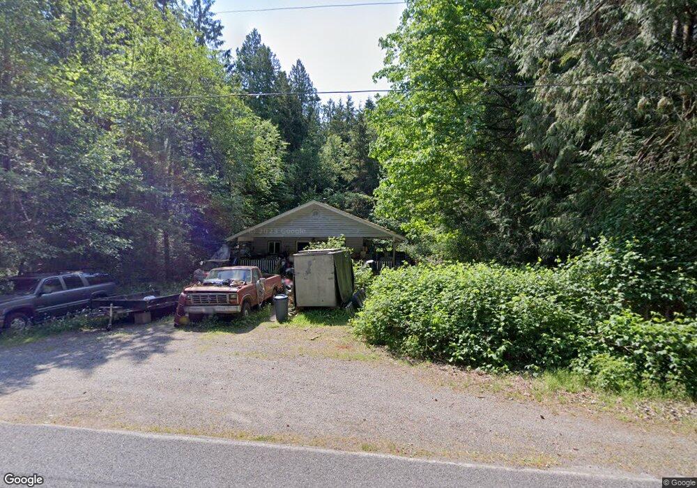
1863 Johnson Rd Point Roberts, WA 98281
Estimated Value: $267,026 - $330,000
2
Beds
1
Bath
832
Sq Ft
$352/Sq Ft
Est. Value
About This Home
This home is located at 1863 Johnson Rd, Point Roberts, WA 98281 and is currently estimated at $293,257, approximately $352 per square foot. 1863 Johnson Rd is a home located in Whatcom County with nearby schools including Point Roberts Primary School, Blaine Middle School, and Blaine High School.
Ownership History
Date
Name
Owned For
Owner Type
Purchase Details
Closed on
Jun 6, 2024
Sold by
Anderson Laurie J
Bought by
Parsons Marinus R
Current Estimated Value
Purchase Details
Closed on
Jul 1, 2014
Sold by
Ogmundson Anita L
Bought by
Anderson Laurie J
Purchase Details
Closed on
Nov 7, 2006
Sold by
Williams Michael
Bought by
Anderson Robert H
Home Financials for this Owner
Home Financials are based on the most recent Mortgage that was taken out on this home.
Original Mortgage
$25,000
Interest Rate
6.28%
Mortgage Type
Seller Take Back
Purchase Details
Closed on
Mar 9, 2004
Sold by
Turner Lorne and Turner Naida
Bought by
Williams Michael
Home Financials for this Owner
Home Financials are based on the most recent Mortgage that was taken out on this home.
Original Mortgage
$14,500
Interest Rate
5.57%
Mortgage Type
Seller Take Back
Create a Home Valuation Report for This Property
The Home Valuation Report is an in-depth analysis detailing your home's value as well as a comparison with similar homes in the area
Home Values in the Area
Average Home Value in this Area
Purchase History
| Date | Buyer | Sale Price | Title Company |
|---|---|---|---|
| Parsons Marinus R | $268,528 | Whatcom Land Title | |
| Anderson Laurie J | -- | None Available | |
| Anderson Robert H | $55,280 | Whatcom Land Title | |
| Williams Michael | -- | First American Title Ins | |
| Turner Lorne | -- | First American Title Ins |
Source: Public Records
Mortgage History
| Date | Status | Borrower | Loan Amount |
|---|---|---|---|
| Previous Owner | Anderson Robert H | $25,000 | |
| Previous Owner | Williams Michael | $14,500 |
Source: Public Records
Tax History
| Year | Tax Paid | Tax Assessment Tax Assessment Total Assessment is a certain percentage of the fair market value that is determined by local assessors to be the total taxable value of land and additions on the property. | Land | Improvement |
|---|---|---|---|---|
| 2025 | $2,402 | $283,380 | $133,815 | $149,565 |
| 2024 | $2,297 | $280,573 | $132,495 | $148,078 |
| 2023 | $2,297 | $268,528 | $120,450 | $148,078 |
| 2022 | $1,696 | $245,231 | $110,000 | $135,231 |
| 2021 | $1,689 | $160,674 | $40,128 | $120,546 |
| 2020 | $1,685 | $148,770 | $37,155 | $111,615 |
| 2019 | $1,569 | $142,704 | $35,640 | $107,064 |
| 2018 | $1,419 | $128,289 | $32,040 | $96,249 |
| 2017 | $1,231 | $122,523 | $30,600 | $91,923 |
| 2016 | $1,404 | $120,121 | $30,000 | $90,121 |
| 2015 | $1,493 | $133,430 | $32,847 | $100,583 |
| 2014 | -- | $139,491 | $34,340 | $105,151 |
| 2013 | -- | $133,323 | $32,980 | $100,343 |
Source: Public Records
Map
Nearby Homes
- 1857 Washington Dr
- 2 Mill Rd
- 1928 Sanders Ct Unit 2
- 245 Shady Glen Ave
- 1774 Centennial Place
- 0 15 Whalen Dr
- 19 Whalen Dr
- 25 Roosevelt Way
- 0 3 73 Acres Derby Ave
- 157 Northwood Dr
- 1987 Cedar Park Dr
- 2138 Benson Rd
- 103 Goodman Rd
- 0 Deer Rd
- 0 Tyee Dr
- 251 Elizabeth Dr
- 1542 Columbia Vista Dr
- 6 Weasel Run Rd
- 1555 Panorama Dr
- 2045 Apa Rd
- 1869 Jonhson Rd
- 1871 Johnson Rd
- 1843 Washington Dr
- 184 Kennedy Rd
- 1840 Washington Dr
- 1845 Washington Dr
- 1842 Washington Dr
- 183 Kennedy Rd
- 178 Kennedy Rd
- 1847 Washington Dr
- 198 Burns Way
- 1846 Washington Dr
- 1831 Johnson Rd
- 192 Burns Way
- 1849 Washington Dr
- 186 Burns Way
- 1889 Washington Dr
- 2092 Johnson Rd
- 0 Johnson Rd
- 180 Burns Way
Your Personal Tour Guide
Ask me questions while you tour the home.