Estimated Value: $691,000 - $735,381
3
Beds
3
Baths
1,920
Sq Ft
$376/Sq Ft
Est. Value
About This Home
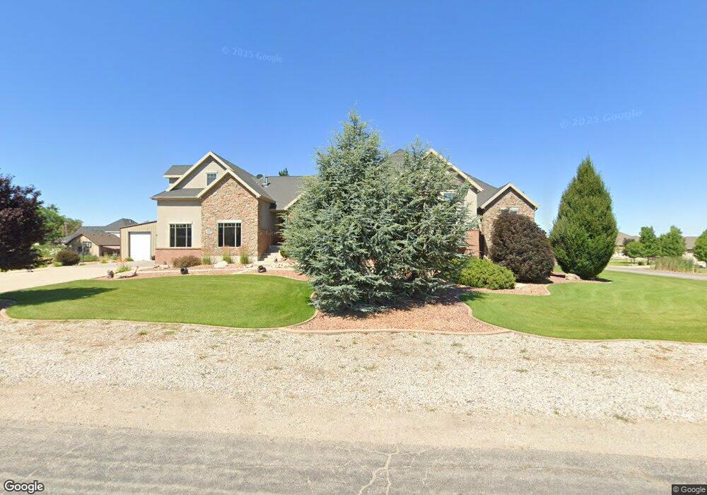
This home is located at 1863 S 4150 W Unit 12, Ogden, UT 84401 and is currently estimated at $721,095, approximately $375 per square foot. 1863 S 4150 W Unit 12 is a home located in Weber County with nearby schools including Kanesville Elementary School, Quest Academy, and Deamude Adventist Christian School.
Ownership History
Date
Name
Owned For
Owner Type
Purchase Details
Closed on
Mar 28, 2025
Sold by
Peterson Bryson L and Peterson Lory
Bought by
Blp 1975 Trust and Lory Peterson Trust
Current Estimated Value
Purchase Details
Closed on
Aug 29, 2005
Sold by
Ted Holtry Construction & Development Co
Bought by
Peterson Bryson L and Peterson Lory
Home Financials for this Owner
Home Financials are based on the most recent Mortgage that was taken out on this home.
Original Mortgage
$67,500
Interest Rate
5.64%
Mortgage Type
Purchase Money Mortgage
Create a Home Valuation Report for This Property
The Home Valuation Report is an in-depth analysis detailing your home's value as well as a comparison with similar homes in the area
Home Values in the Area
Average Home Value in this Area
Purchase History
| Date | Buyer | Sale Price | Title Company |
|---|---|---|---|
| Blp 1975 Trust | -- | None Listed On Document | |
| Peterson Bryson L | -- | Mountain View Title |
Source: Public Records
Mortgage History
| Date | Status | Borrower | Loan Amount |
|---|---|---|---|
| Previous Owner | Peterson Bryson L | $67,500 |
Source: Public Records
Tax History Compared to Growth
Tax History
| Year | Tax Paid | Tax Assessment Tax Assessment Total Assessment is a certain percentage of the fair market value that is determined by local assessors to be the total taxable value of land and additions on the property. | Land | Improvement |
|---|---|---|---|---|
| 2025 | $3,884 | $681,389 | $221,710 | $459,679 |
| 2024 | $3,737 | $367,399 | $121,940 | $245,459 |
| 2023 | $3,648 | $355,300 | $122,454 | $232,846 |
| 2022 | $3,779 | $376,200 | $94,877 | $281,323 |
| 2021 | $3,370 | $566,000 | $108,702 | $457,298 |
| 2020 | $3,289 | $509,000 | $93,852 | $415,148 |
| 2019 | $3,288 | $486,000 | $87,714 | $398,286 |
| 2018 | $3,240 | $459,000 | $87,714 | $371,286 |
| 2017 | $2,676 | $376,000 | $86,130 | $289,870 |
| 2016 | $2,606 | $198,169 | $41,147 | $157,022 |
| 2015 | $2,564 | $192,412 | $41,147 | $151,265 |
| 2014 | $2,372 | $173,770 | $41,081 | $132,689 |
Source: Public Records
Map
Nearby Homes
- 4181 W 1725 S
- 1449 S 4125 W Unit 103
- 1732 S 4300 West St Unit 102
- 1722 S 4300 St W Unit 103
- 4269 W 2025 S
- 4043 W 2025 S
- 4043 W 2025 S Unit 41
- 4031 W 2025 S Unit 42
- 4031 W 2025 S
- 2044 S 4300 W
- 2062 S 4300 W
- 3966 W 2025 S Unit 29
- 3956 W 2025 S Unit LOT 18
- 3944 W 2025 S Unit 17
- 2112 S 4300 W
- 4207 1575 South St Unit 308
- 4192 1575 South St Unit 202
- Bryce Plan at Taylor Landing - Seasons
- Bronze Plan at Taylor Landing - Aspire
- Harris Plan at Taylor Landing - Seasons
- 1863 S 4150 W
- 1821 S 4150 W
- 1821 S 4150 W Unit 11
- 1858 S 4200 W
- 1858 S 4200 W Unit 9
- 1891 S 4150 W
- 1891 S 4150 W Unit 13
- 1824 S 4150 W
- 1824 S 4150 W Unit 16
- 1870 S 4200 W
- 1870 S 4200 W Unit 8
- 1860 S 4150 W
- 1860 S 4150 W Unit 15
- 1826 S 4200 W
- 1886 S 4150 W Unit 14
- 1826 S 4200 W Unit 10
- 1886 S 4150 W
- 4113 W 1800 S
- 4113 W 1800 S Unit 17
- 1855 S 4200 W