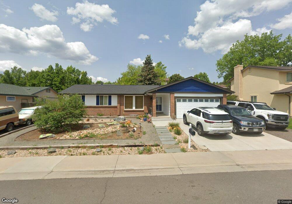
1863 S Pierson Ct Denver, CO 80232
Green Mountain NeighborhoodEstimated Value: $548,000 - $666,000
3
Beds
3
Baths
1,485
Sq Ft
$407/Sq Ft
Est. Value
About This Home
This home is located at 1863 S Pierson Ct, Denver, CO 80232 and is currently estimated at $605,097, approximately $407 per square foot. 1863 S Pierson Ct is a home located in Jefferson County with nearby schools including Kendrick Lakes Elementary School, Carmody Middle School, and Bear Creek High School.
Ownership History
Date
Name
Owned For
Owner Type
Purchase Details
Closed on
Feb 13, 2007
Sold by
Thorpe Terry and Thorpe Frances M
Bought by
Mathieu Grant W and Price Kristine A
Current Estimated Value
Home Financials for this Owner
Home Financials are based on the most recent Mortgage that was taken out on this home.
Original Mortgage
$265,000
Outstanding Balance
$158,459
Interest Rate
6.13%
Mortgage Type
Purchase Money Mortgage
Estimated Equity
$446,638
Purchase Details
Closed on
May 4, 2006
Sold by
Wells Fargo Bank Na
Bought by
Thorpe Terry and Thorpe Frances M
Home Financials for this Owner
Home Financials are based on the most recent Mortgage that was taken out on this home.
Original Mortgage
$183,920
Interest Rate
7.12%
Mortgage Type
Fannie Mae Freddie Mac
Purchase Details
Closed on
Dec 8, 2005
Sold by
Lindsay Beverly A and Lindsay James N
Bought by
Wells Fargo Bank Na and Certificateholders Of Securitized Asset
Create a Home Valuation Report for This Property
The Home Valuation Report is an in-depth analysis detailing your home's value as well as a comparison with similar homes in the area
Home Values in the Area
Average Home Value in this Area
Purchase History
| Date | Buyer | Sale Price | Title Company |
|---|---|---|---|
| Mathieu Grant W | $265,000 | Fahtco | |
| Thorpe Terry | $229,900 | Fahtco | |
| Wells Fargo Bank Na | -- | -- |
Source: Public Records
Mortgage History
| Date | Status | Borrower | Loan Amount |
|---|---|---|---|
| Open | Mathieu Grant W | $265,000 | |
| Previous Owner | Thorpe Terry | $183,920 |
Source: Public Records
Tax History Compared to Growth
Tax History
| Year | Tax Paid | Tax Assessment Tax Assessment Total Assessment is a certain percentage of the fair market value that is determined by local assessors to be the total taxable value of land and additions on the property. | Land | Improvement |
|---|---|---|---|---|
| 2024 | $3,367 | $34,013 | $16,327 | $17,686 |
| 2023 | $3,367 | $34,013 | $16,327 | $17,686 |
| 2022 | $2,971 | $29,415 | $13,596 | $15,819 |
| 2021 | $3,008 | $30,261 | $13,987 | $16,274 |
| 2020 | $2,650 | $26,692 | $11,526 | $15,166 |
| 2019 | $2,617 | $26,692 | $11,526 | $15,166 |
| 2018 | $2,464 | $24,239 | $7,833 | $16,406 |
| 2017 | $2,252 | $24,239 | $7,833 | $16,406 |
| 2016 | $2,252 | $23,361 | $6,852 | $16,509 |
| 2015 | $1,901 | $23,361 | $6,852 | $16,509 |
| 2014 | $1,901 | $18,491 | $6,368 | $12,123 |
Source: Public Records
Map
Nearby Homes
- 1822 S Robb St
- 11165 W Asbury Ave
- 1577 S Pierson St
- 1865 S Union Blvd
- 11465 W Atlantic Ave
- 2154 S Parfet Dr
- 1847 S Union Blvd Unit 36
- 1901 S Union Place
- 1537 S Owens St Unit 31
- 10866 W Evans Ave Unit 56
- 10490 W Jewell Ave Unit C
- 10490 W Jewell Ave Unit D
- 10890 W Evans Ave Unit 2E
- 2064 S Robb Way
- 1517 S Owens St Unit 5
- 1474 S Pierson St Unit 65
- 10430 W Jewell Ave Unit B
- 10910 W Florida Ave Unit 502
- 2252 S Queen St
- 1679 S Lee St Unit C
- 1853 S Pierson Ct
- 1873 S Pierson Ct
- 1858 S Quail St
- 1868 S Quail St
- 1862 S Pierson Ct
- 1848 S Quail St
- 1843 S Pierson Ct
- 1852 S Pierson Ct
- 1872 S Pierson Ct
- 1842 S Pierson Ct
- 1838 S Quail St
- 1833 S Pierson Ct
- 1861 S Parfet Ct
- 1851 S Parfet Ct
- 11222 W Utah Place
- 1871 S Parfet Ct
- 11221 W Utah Place
- 1832 S Pierson Ct
- 1841 S Parfet Ct
- 1879 S Quail St