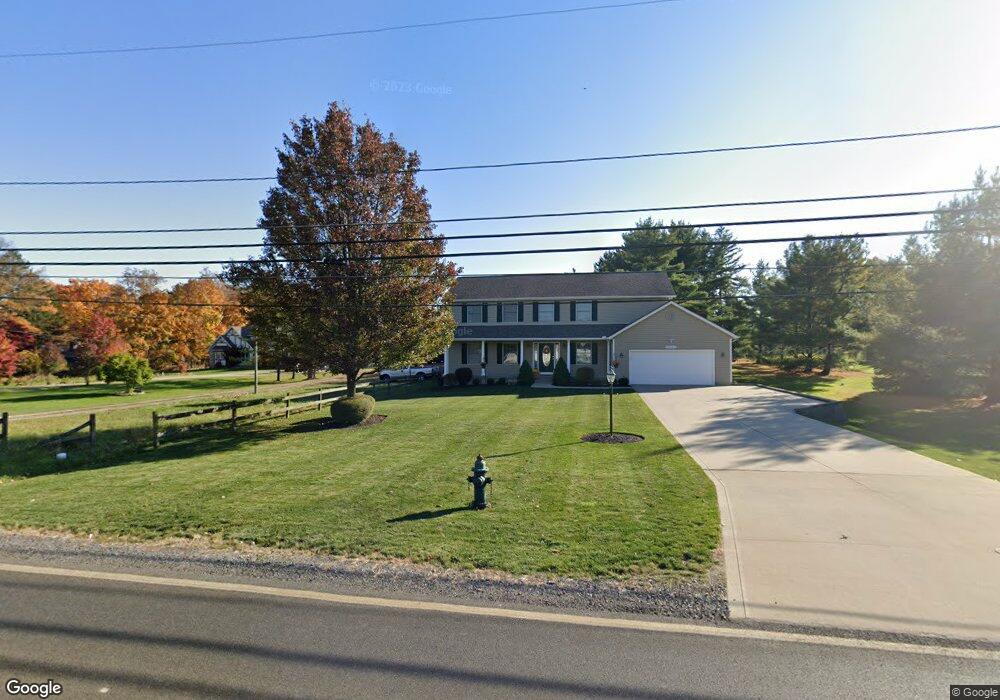
18631 Howe Rd Strongsville, OH 44136
Estimated Value: $390,000 - $401,000
4
Beds
3
Baths
2,660
Sq Ft
$149/Sq Ft
Est. Value
About This Home
This home is located at 18631 Howe Rd, Strongsville, OH 44136 and is currently estimated at $395,222, approximately $148 per square foot. 18631 Howe Rd is a home located in Cuyahoga County with nearby schools including Strongsville High School.
Ownership History
Date
Name
Owned For
Owner Type
Purchase Details
Closed on
Jan 19, 2016
Sold by
Dozanti Daniel L and Dozanti Lindsey K
Bought by
Dozanti Danny Lee and Dozanti Lindsey K
Current Estimated Value
Purchase Details
Closed on
Sep 10, 2002
Sold by
Krehel Joseph M and Krehel Constance M
Bought by
Dozanti Danny L and Dozanti Lindsey K
Home Financials for this Owner
Home Financials are based on the most recent Mortgage that was taken out on this home.
Original Mortgage
$100,000
Interest Rate
6.4%
Purchase Details
Closed on
Apr 6, 1998
Sold by
Dozanti Danny L and Dozanti Lindsey K
Bought by
Krehel Joseph M and Krehel Constance M
Create a Home Valuation Report for This Property
The Home Valuation Report is an in-depth analysis detailing your home's value as well as a comparison with similar homes in the area
Home Values in the Area
Average Home Value in this Area
Purchase History
| Date | Buyer | Sale Price | Title Company |
|---|---|---|---|
| Dozanti Danny Lee | -- | Attorney | |
| Dozanti Danny L | $125,000 | American Title & Trust | |
| Krehel Joseph M | $113,000 | Transcounty Title Agency Inc |
Source: Public Records
Mortgage History
| Date | Status | Borrower | Loan Amount |
|---|---|---|---|
| Closed | Dozanti Danny L | $100,000 |
Source: Public Records
Tax History Compared to Growth
Tax History
| Year | Tax Paid | Tax Assessment Tax Assessment Total Assessment is a certain percentage of the fair market value that is determined by local assessors to be the total taxable value of land and additions on the property. | Land | Improvement |
|---|---|---|---|---|
| 2024 | $4,665 | $97,055 | $22,855 | $74,200 |
| 2023 | $3,983 | $62,270 | $18,200 | $44,070 |
| 2022 | $3,955 | $62,270 | $18,200 | $44,070 |
| 2021 | $3,927 | $62,270 | $18,200 | $44,070 |
| 2020 | $3,637 | $51,030 | $14,910 | $36,120 |
| 2019 | $3,533 | $145,800 | $42,600 | $103,200 |
| 2018 | $3,214 | $51,030 | $14,910 | $36,120 |
| 2017 | $3,110 | $45,710 | $13,440 | $32,270 |
| 2016 | $3,011 | $45,710 | $13,440 | $32,270 |
| 2015 | $3,054 | $45,710 | $13,440 | $32,270 |
| 2014 | $3,054 | $45,710 | $13,440 | $32,270 |
Source: Public Records
Map
Nearby Homes
- 18229 Howe Rd
- 17130 Golden Star Dr
- 16486 S Red Rock Dr
- 16711 Beech Cir
- 14985 Camden Cir
- 19694 Benbow Rd
- 18987 Laurell Cir
- 15772 Boston Rd
- 15604-REAR Boston Rd
- 19740 Benbow Rd
- 15188 Trails Landing
- 17159 Turkey Meadow Ln
- 14558 Drake Rd
- 19813 Cross Trail S
- 97 Weathervane Ln
- 14132 Walking Stick Way
- 16650 Lanier Ave
- 17745 Brick Mill Run
- 17682 Drake Rd
- 3137 Blackburn Ln