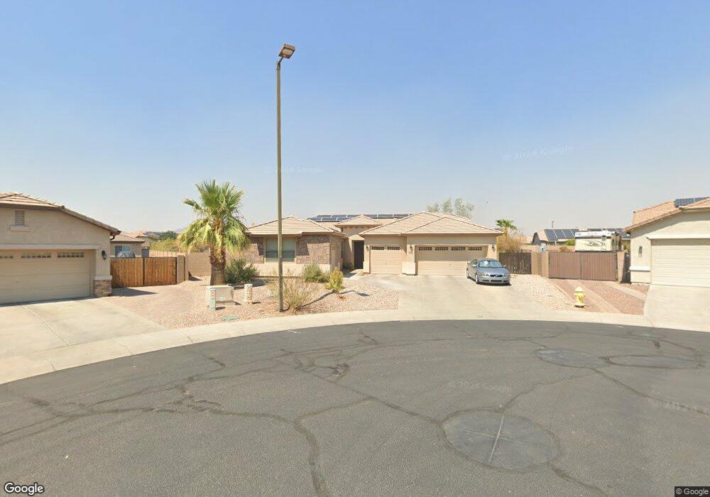
1864 S 222nd Ave Buckeye, AZ 85326
Estimated Value: $551,000 - $596,000
4
Beds
3
Baths
3,219
Sq Ft
$181/Sq Ft
Est. Value
About This Home
This home is located at 1864 S 222nd Ave, Buckeye, AZ 85326 and is currently estimated at $582,435, approximately $180 per square foot. 1864 S 222nd Ave is a home located in Maricopa County with nearby schools including Freedom Elementary School, Youngker High School, and The Odyssey Institute for Advanced and International Studies.
Ownership History
Date
Name
Owned For
Owner Type
Purchase Details
Closed on
Mar 13, 2008
Sold by
Canterra Homes Inc
Bought by
Hardy Laurence L
Current Estimated Value
Home Financials for this Owner
Home Financials are based on the most recent Mortgage that was taken out on this home.
Original Mortgage
$287,850
Outstanding Balance
$162,622
Interest Rate
4.06%
Mortgage Type
Purchase Money Mortgage
Estimated Equity
$419,813
Purchase Details
Closed on
Feb 25, 2008
Sold by
Hardy Tammy Lee
Bought by
Hardy Laurence L
Home Financials for this Owner
Home Financials are based on the most recent Mortgage that was taken out on this home.
Original Mortgage
$287,850
Outstanding Balance
$162,622
Interest Rate
4.06%
Mortgage Type
Purchase Money Mortgage
Estimated Equity
$419,813
Create a Home Valuation Report for This Property
The Home Valuation Report is an in-depth analysis detailing your home's value as well as a comparison with similar homes in the area
Home Values in the Area
Average Home Value in this Area
Purchase History
| Date | Buyer | Sale Price | Title Company |
|---|---|---|---|
| Hardy Laurence L | $303,000 | Stewart Title & Trust Of Pho | |
| Canterra Homes Inc | -- | Stewart Title & Trust Of Pho | |
| Canterra Contracting Llc | -- | Stewart Title & Trust Of Pho | |
| Hardy Laurence L | -- | Stewart Title & Trust Of Pho |
Source: Public Records
Mortgage History
| Date | Status | Borrower | Loan Amount |
|---|---|---|---|
| Open | Canterra Contracting Llc | $287,850 | |
| Closed | Canterra Homes Inc | $287,850 | |
| Closed | Hardy Laurence L | $287,850 |
Source: Public Records
Tax History Compared to Growth
Tax History
| Year | Tax Paid | Tax Assessment Tax Assessment Total Assessment is a certain percentage of the fair market value that is determined by local assessors to be the total taxable value of land and additions on the property. | Land | Improvement |
|---|---|---|---|---|
| 2025 | $3,611 | $28,315 | -- | -- |
| 2024 | $3,428 | $26,966 | -- | -- |
| 2023 | $3,428 | $46,670 | $9,330 | $37,340 |
| 2022 | $3,161 | $34,330 | $6,860 | $27,470 |
| 2021 | $3,409 | $31,230 | $6,240 | $24,990 |
| 2020 | $3,127 | $30,060 | $6,010 | $24,050 |
| 2019 | $3,007 | $27,900 | $5,580 | $22,320 |
| 2018 | $2,902 | $24,980 | $4,990 | $19,990 |
| 2017 | $2,772 | $23,450 | $4,690 | $18,760 |
| 2016 | $2,757 | $25,000 | $5,000 | $20,000 |
| 2015 | $2,767 | $23,160 | $4,630 | $18,530 |
Source: Public Records
Map
Nearby Homes
- 22145 W Ashleigh Marie Dr
- 22354 W Mohave St
- 1799 S 221st Ave
- 22038 W Hilton Ave
- 2038 S 221st Ave
- 22333 W Papago St
- 22029 W Hopi St
- 1779 S 225th Ave
- 1325 S 223rd Dr
- 22461 W Pima St
- 1493 S 224th Ln
- 22504 W Meade Ln
- 22523 W Pima St
- 22543 W Cocopah St
- 22534 W Pima St
- 21972 W Pima St
- 22610 W Mohave St
- 0000 S 222nd Ave
- 22394 W Desert Bloom St
- 22637 W Kimberly Dr
- 1876 S 222nd Ave
- 22235 W Ashleigh Marie Dr
- 22225 W Ashleigh Marie Dr
- 22245 W Ashleigh Marie Dr
- 1863 S 222nd Ave
- 1829 S 222nd Ln
- 22215 W Ashleigh Marie Dr
- 1849 S 222nd Ln
- 1898 S 222nd Ave
- 1809 S 222nd Ln
- 1869 S 222nd Ln
- 1875 S 222nd Ave
- 1889 S 222nd Ln
- 1899 S 222nd Ave
- 22185 W Ashleigh Marie Dr
- 22230 W Ashleigh Marie Dr
- 22358 W Ashleigh Marie Dr
- 22220 W Ashleigh Marie Dr
- 22250 W Ashleigh Marie Dr
- 22175 W Ashleigh Marie Dr