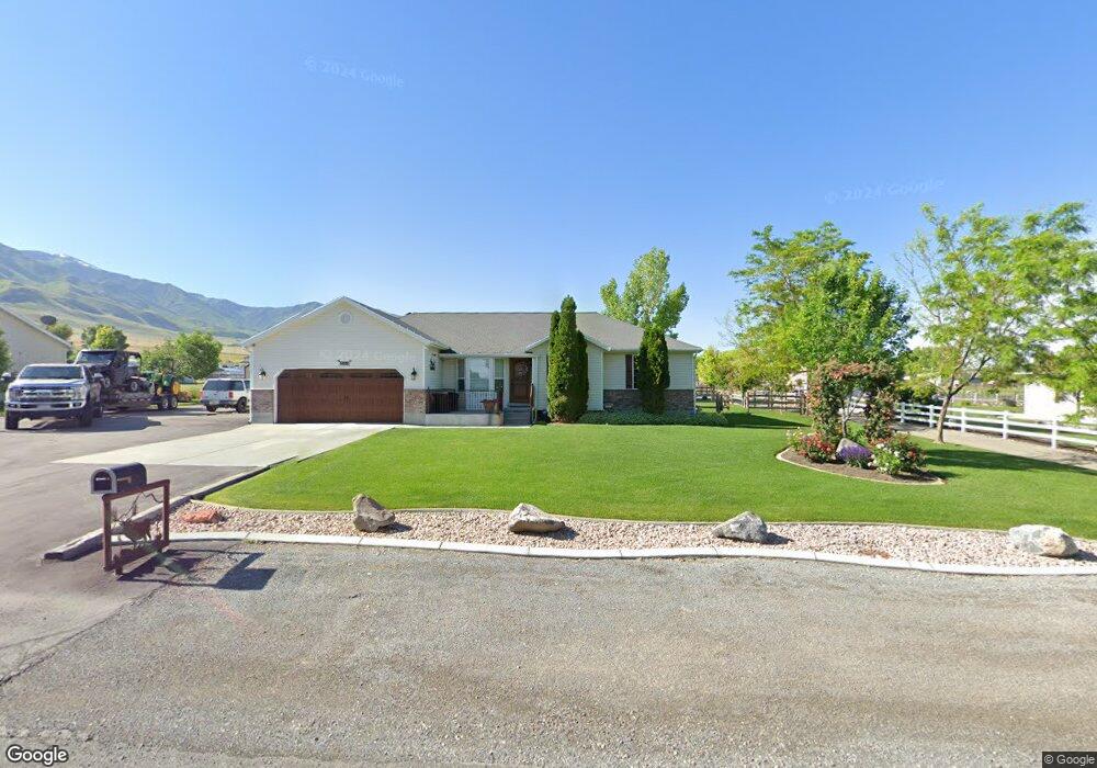
1864 Shepard Ln Tooele, UT 84074
Estimated Value: $631,000 - $766,000
--
Bed
--
Bath
3,020
Sq Ft
$227/Sq Ft
Est. Value
About This Home
This home is located at 1864 Shepard Ln, Tooele, UT 84074 and is currently estimated at $684,409, approximately $226 per square foot. 1864 Shepard Ln is a home with nearby schools including Old Mill Elementary School, Clarke N. Johnsen Junior High School, and Stansbury High School.
Ownership History
Date
Name
Owned For
Owner Type
Purchase Details
Closed on
Apr 11, 2018
Sold by
Quibell Larry and Quibell Anita
Bought by
Quibell Jeffrey and Quibell Sandra L
Current Estimated Value
Home Financials for this Owner
Home Financials are based on the most recent Mortgage that was taken out on this home.
Original Mortgage
$75,000
Interest Rate
4.43%
Mortgage Type
Credit Line Revolving
Purchase Details
Closed on
Feb 1, 2017
Sold by
Quibell Quibell S and Quibell Sandra L
Bought by
Quibell Quibell S and Quibell Jeffrey
Create a Home Valuation Report for This Property
The Home Valuation Report is an in-depth analysis detailing your home's value as well as a comparison with similar homes in the area
Home Values in the Area
Average Home Value in this Area
Purchase History
| Date | Buyer | Sale Price | Title Company |
|---|---|---|---|
| Quibell Jeffrey | -- | None Available | |
| Quibell Quibell S | -- | None Available |
Source: Public Records
Mortgage History
| Date | Status | Borrower | Loan Amount |
|---|---|---|---|
| Closed | Quibell Jeffrey | $75,000 |
Source: Public Records
Tax History Compared to Growth
Tax History
| Year | Tax Paid | Tax Assessment Tax Assessment Total Assessment is a certain percentage of the fair market value that is determined by local assessors to be the total taxable value of land and additions on the property. | Land | Improvement |
|---|---|---|---|---|
| 2025 | $4,432 | $637,299 | $222,500 | $414,799 |
| 2024 | $4,914 | $382,689 | $123,500 | $259,189 |
| 2023 | $4,914 | $385,812 | $142,750 | $243,062 |
| 2022 | $4,964 | $438,805 | $167,500 | $271,305 |
| 2021 | $4,157 | $307,519 | $74,000 | $233,519 |
| 2020 | $4,103 | $485,708 | $102,000 | $383,708 |
| 2019 | $3,554 | $410,894 | $102,000 | $308,894 |
| 2018 | $2,873 | $324,169 | $77,000 | $247,169 |
| 2017 | $2,464 | $295,498 | $77,000 | $218,498 |
| 2016 | $2,374 | $170,730 | $43,250 | $127,480 |
| 2015 | $2,374 | $170,730 | $0 | $0 |
| 2014 | -- | $170,730 | $0 | $0 |
Source: Public Records
Map
Nearby Homes
- 1884 Shepard Ln
- 8035 N Park Meadow Ln Unit 2
- 1887 E Rock Hollow Rd
- 1904 E Rock Hollow Rd
- 1897 E Rock Hollow Rd
- 7925 N Spring Valley Ln Unit 322
- 1668 E Corey's Way
- 1950 Pebble Cir
- 1426 E Cluff Ln
- Ponderosa Plan at Pastures at Saddleback
- Bedford Plan at Pastures at Saddleback
- 8635 N Halloran Ct Unit 1322
- Anika Plan at Pastures at Saddleback
- Hemingway Plan at Pastures at Saddleback
- Coronado Plan at Pastures at Saddleback
- 8761 N Lakeshore Dr Unit 1203
- 8635 N Halloran Ct
- Presley Plan at Pastures at Saddleback
- Bryce Plan at Pastures at Saddleback
- Helena II Plan at Pastures at Saddleback
- 1884 Shepard Ln Unit 181
- 1884 Shepard Ln Unit 21
- 1844 Shepard Ln
- 1851 Shepard Ln
- 1843 Shepard Ln
- 1881 Shepherd Rd
- 1837 Shepard Ln
- 1822 Shepard Ln
- 1906 Shepherd Rd
- 1901 Shepherd Rd
- 1926 Shepherd Rd
- 1921 Shepherd Rd
- 1926 Shepard Ln
- 1811 Shepard Ln
- 8048 Park Meadow Ln Unit 2
- 1806 Shepard Ln
- 1860 E Rock Hollow Rd Unit 1020
- 1836 E Rock Hollow Rd
- 1872 E Rock Hollow Rd
- 1848 E Rock Hollow Rd