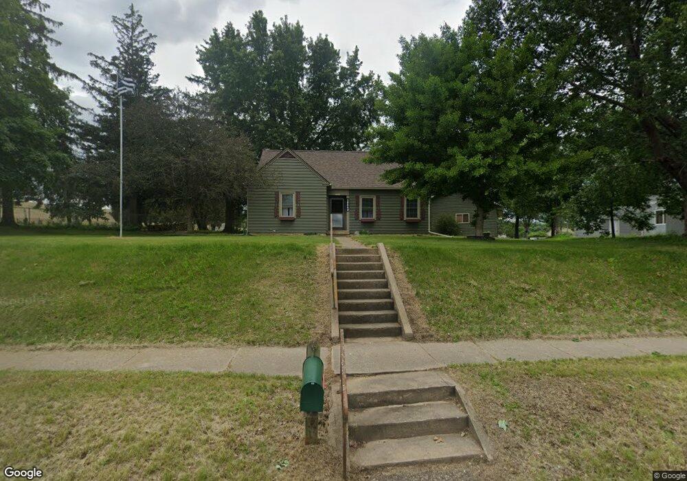
18649 Lincoln St Whitehall, WI 54773
Estimated Value: $180,000 - $217,000
--
Bed
--
Bath
--
Sq Ft
4,893
Acres
About This Home
This home is located at 18649 Lincoln St, Whitehall, WI 54773 and is currently estimated at $193,082. 18649 Lincoln St is a home located in Trempealeau County with nearby schools including Whitehall Memorial Elementary School, Whitehall Memorial Jr./Sr. High School, and Fly Creek Amish School.
Ownership History
Date
Name
Owned For
Owner Type
Purchase Details
Closed on
Dec 28, 2023
Sold by
Waldera Mark and Waldera Lori
Bought by
Buda Denise M
Current Estimated Value
Purchase Details
Closed on
Sep 1, 2005
Sold by
Koxlien Andrew J and Koxlien Erica C
Bought by
Waldera Mark T and Larson Lori J
Home Financials for this Owner
Home Financials are based on the most recent Mortgage that was taken out on this home.
Original Mortgage
$119,000
Interest Rate
7.62%
Mortgage Type
Adjustable Rate Mortgage/ARM
Create a Home Valuation Report for This Property
The Home Valuation Report is an in-depth analysis detailing your home's value as well as a comparison with similar homes in the area
Home Values in the Area
Average Home Value in this Area
Purchase History
| Date | Buyer | Sale Price | Title Company |
|---|---|---|---|
| Buda Denise M | $165,000 | Total Title Services, Llc | |
| Waldera Mark T | $119,000 | Total Title Services Llc |
Source: Public Records
Mortgage History
| Date | Status | Borrower | Loan Amount |
|---|---|---|---|
| Previous Owner | Waldera Mark T | $119,000 |
Source: Public Records
Tax History Compared to Growth
Tax History
| Year | Tax Paid | Tax Assessment Tax Assessment Total Assessment is a certain percentage of the fair market value that is determined by local assessors to be the total taxable value of land and additions on the property. | Land | Improvement |
|---|---|---|---|---|
| 2024 | $3,085 | $145,600 | $12,800 | $132,800 |
| 2023 | $2,693 | $145,600 | $12,800 | $132,800 |
| 2022 | $2,723 | $145,600 | $12,800 | $132,800 |
| 2021 | $2,727 | $101,300 | $10,700 | $90,600 |
| 2020 | $2,694 | $19,760 | $10,700 | $9,060 |
| 2019 | $2,606 | $101,300 | $10,700 | $90,600 |
| 2018 | $2,378 | $101,300 | $10,700 | $90,600 |
| 2017 | $2,491 | $101,300 | $10,700 | $90,600 |
| 2016 | $2,411 | $101,300 | $10,700 | $90,600 |
| 2015 | $2,315 | $100,100 | $10,700 | $89,400 |
| 2014 | $2,192 | $100,100 | $10,700 | $89,400 |
| 2011 | $2,263 | $91,100 | $9,700 | $81,400 |
Source: Public Records
Map
Nearby Homes
- 36015 Main St
- 18430 Hillside Dr
- 36290 Camp St
- 18144 Anderson St
- 18124 Fredrickson St
- N36836 Us Highway 53 121
- N32838 Briten Rd
- 36121 Ash St
- 35433 Wayne St
- 35979 Osseo Rd
- 23898 Adams St
- 23942 Tracy St
- N34701 County Rd N
- N34855 County Rd S
- N30732 Square Bluff Rd
- 517 W Broadway St
- 102 S Peterson Ave
- 39971 Anderson St
- 328 S Urberg Ave
- N34701 County Rd S
- 18659 Lincoln St
- 18667 Lincoln St
- 18675 Lincoln St
- 18643 Lincoln St
- 18681 Lincoln St
- 18639 Lincoln St
- 36104 Sunset Blvd
- 36124 Sunset Blvd
- 18673 Hobson St
- 18689 Lincoln St
- 18679 Hobson St
- 18677 Hobson St
- 18663 Hobson St
- 36136 Sunset Blvd
- 18627 Lincoln St
- 18651 Hobson St
- 18697 Lincoln St
- 36158 Sunset Blvd
- 18637 Hobson St
- 18657 Hobson St