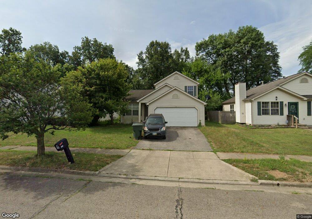
1865 Big Tree Dr Columbus, OH 43223
Estimated Value: $236,000 - $264,000
3
Beds
3
Baths
1,270
Sq Ft
$198/Sq Ft
Est. Value
About This Home
This home is located at 1865 Big Tree Dr, Columbus, OH 43223 and is currently estimated at $251,980, approximately $198 per square foot. 1865 Big Tree Dr is a home located in Franklin County with nearby schools including Finland Elementary School, Franklin Woods Intermediate School, and Finland Middle School.
Ownership History
Date
Name
Owned For
Owner Type
Purchase Details
Closed on
Jul 18, 1997
Sold by
Parkmead Corp
Bought by
M/I Schottenstein Homes Inc
Current Estimated Value
Create a Home Valuation Report for This Property
The Home Valuation Report is an in-depth analysis detailing your home's value as well as a comparison with similar homes in the area
Home Values in the Area
Average Home Value in this Area
Purchase History
| Date | Buyer | Sale Price | Title Company |
|---|---|---|---|
| M/I Schottenstein Homes Inc | $16,500 | -- |
Source: Public Records
Tax History Compared to Growth
Tax History
| Year | Tax Paid | Tax Assessment Tax Assessment Total Assessment is a certain percentage of the fair market value that is determined by local assessors to be the total taxable value of land and additions on the property. | Land | Improvement |
|---|---|---|---|---|
| 2024 | $2,955 | $75,010 | $18,660 | $56,350 |
| 2023 | $2,907 | $75,005 | $18,655 | $56,350 |
| 2022 | $2,172 | $43,370 | $8,300 | $35,070 |
| 2021 | $2,159 | $43,370 | $8,300 | $35,070 |
| 2020 | $2,147 | $43,370 | $8,300 | $35,070 |
| 2019 | $1,885 | $33,600 | $6,650 | $26,950 |
| 2018 | $1,984 | $33,600 | $6,650 | $26,950 |
| 2017 | $1,980 | $33,600 | $6,650 | $26,950 |
| 2016 | $2,092 | $34,580 | $6,090 | $28,490 |
| 2015 | $2,092 | $34,580 | $6,090 | $28,490 |
| 2014 | $2,094 | $34,580 | $6,090 | $28,490 |
| 2013 | $1,094 | $36,400 | $6,405 | $29,995 |
Source: Public Records
Map
Nearby Homes
- 1417 Fahy Dr
- 1390 Gray Meadow Dr
- 1723 Farberdale Dr
- 1659 Westmeadow Dr
- 1607 Red Leaf Ln
- 1543 Red Leaf Ln
- 2210 October Ridge Dr
- 1532 Westmeadow Dr
- 1417 Brown Rd
- 1994 Little Ave
- 1663 Hopkins Ave
- 0 S Central Ave
- 1948 Big Run Bluffs Blvd
- 1949 Big Run Bluffs Blvd
- 1540 Little Ave
- 1757 Linnet Ave
- 2180 Eakin Rd
- 2336 Woodbrook Cir N Unit 92 B
- 2362 Woodbrook Cir N Unit 81
- 1119 Hardesty Place E Unit 1
- 1873 Big Tree Dr
- 1857 Big Tree Dr
- 1849 Big Tree Dr
- 1881 Big Tree Dr
- 1841 Big Tree Dr
- 1889 Big Tree Dr
- 1874 Little Water Dr
- 1479 Pinehurst Ct
- 1850 Big Tree Dr
- 1895 Big Tree Dr
- 1833 Big Tree Dr
- 1880 Little Water Dr
- 1842 Big Tree Dr
- 1471 Pinehurst Ct
- 1478 Pinestone Dr
- 1834 Big Tree Dr
- 1901 Big Tree Dr
- 1825 Big Tree Dr
- 1825 Big Tree Dr Unit L112
- 1886 Little Water Dr