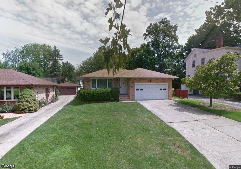
1865 Dansy Dr Euclid, OH 44117
Estimated Value: $158,418 - $218,000
3
Beds
2
Baths
1,300
Sq Ft
$138/Sq Ft
Est. Value
About This Home
This home is located at 1865 Dansy Dr, Euclid, OH 44117 and is currently estimated at $179,605, approximately $138 per square foot. 1865 Dansy Dr is a home located in Cuyahoga County with nearby schools including Thomas Jefferson Elementary School, Euclid Middle School, and Euclid High School.
Ownership History
Date
Name
Owned For
Owner Type
Purchase Details
Closed on
Apr 25, 2022
Sold by
Resident Investments Llc
Bought by
Ria Realty Ii Llc
Current Estimated Value
Purchase Details
Closed on
Nov 12, 2019
Sold by
Lenderskis Joseph and U S Bank National Association
Bought by
Residential Investments Llc
Purchase Details
Closed on
Jul 29, 1993
Sold by
Tijunelis Kajetonas
Bought by
Lenderskis Joseph
Purchase Details
Closed on
Nov 16, 1987
Sold by
Tijunelis Kajetonas and Tijunelis Marta
Bought by
Tijunelis Kajetonas
Purchase Details
Closed on
Jan 1, 1975
Bought by
Tijunelis Kajetonas and Tijunelis Marta
Create a Home Valuation Report for This Property
The Home Valuation Report is an in-depth analysis detailing your home's value as well as a comparison with similar homes in the area
Home Values in the Area
Average Home Value in this Area
Purchase History
| Date | Buyer | Sale Price | Title Company |
|---|---|---|---|
| Ria Realty Ii Llc | $67,000 | Deniyan John W | |
| Residential Investments Llc | $52,763 | Allodial Title | |
| Lenderskis Joseph | -- | -- | |
| Tijunelis Kajetonas | -- | -- | |
| Tijunelis Kajetonas | -- | -- |
Source: Public Records
Tax History
| Year | Tax Paid | Tax Assessment Tax Assessment Total Assessment is a certain percentage of the fair market value that is determined by local assessors to be the total taxable value of land and additions on the property. | Land | Improvement |
|---|---|---|---|---|
| 2025 | $3,810 | $56,560 | $9,030 | $47,530 |
| 2024 | $3,932 | $56,560 | $9,030 | $47,530 |
| 2023 | $3,418 | $39,060 | $7,070 | $31,990 |
| 2022 | $3,341 | $39,060 | $7,070 | $31,990 |
| 2021 | $3,728 | $39,060 | $7,070 | $31,990 |
| 2020 | $3,535 | $33,670 | $6,090 | $27,580 |
| 2019 | $2,349 | $96,200 | $17,400 | $78,800 |
| 2018 | $2,324 | $33,670 | $6,090 | $27,580 |
| 2017 | $2,468 | $30,420 | $4,870 | $25,550 |
| 2016 | $2,473 | $30,420 | $4,870 | $25,550 |
| 2015 | $2,253 | $30,420 | $4,870 | $25,550 |
| 2014 | $2,253 | $30,420 | $4,870 | $25,550 |
Source: Public Records
Map
Nearby Homes
- 21950 Euclid Ave
- 2010 E 226th St
- 1554 E 221st St
- 1545 E 214th St
- 1597 E 230th St
- 1789 E 232nd St
- 1754 E 236th St
- 1401 E 219th St
- 1765 E 238th St
- 22601 Harms Rd
- 1810 Glenridge Rd
- 22791 Harms Rd
- 22530 Harms Rd
- 24105 Chardon Rd
- 20051 Hillcrest Dr
- 1791 Forest Dr
- 24 Washington Square Unit 15
- 363 Balmoral Dr
- 11 Trenton Square Unit T27
- 24720 Dundee Dr
- 1861 Dansy Dr
- 1875 Dansy Dr
- 1855 Dansy Dr
- 1860 E 223rd St
- 1851 Dansy Dr
- 1852 E 223rd St
- 22181 Chardon Rd
- 22201 Chardon Rd
- 1850 E 223rd St
- 1845 Dansy Dr
- 22281 Chardon Rd
- 1846 E 223rd St
- 22231 Chardon Rd
- 1841 Dansy Dr
- 1835 Dansy Dr
- 1871 E 223rd St
- 1865 E 223rd St
- 1842 E 223rd St
- 1875 E 223rd St
- 1861 E 223rd St
Your Personal Tour Guide
Ask me questions while you tour the home.