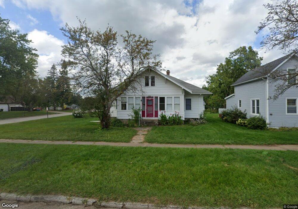
18654 Blair St Whitehall, WI 54773
Estimated Value: $163,575 - $194,000
--
Bed
--
Bath
--
Sq Ft
7,187
Sq Ft Lot
About This Home
This home is located at 18654 Blair St, Whitehall, WI 54773 and is currently estimated at $178,644. 18654 Blair St is a home located in Trempealeau County with nearby schools including Whitehall Memorial Elementary School, Whitehall Memorial Jr./Sr. High School, and Fly Creek Amish School.
Ownership History
Date
Name
Owned For
Owner Type
Purchase Details
Closed on
Jun 29, 2018
Sold by
Johnson Trey M and Johnson Abby
Bought by
Carlson Brittany J
Current Estimated Value
Home Financials for this Owner
Home Financials are based on the most recent Mortgage that was taken out on this home.
Original Mortgage
$92,150
Outstanding Balance
$79,862
Interest Rate
4.5%
Mortgage Type
Purchase Money Mortgage
Estimated Equity
$98,782
Purchase Details
Closed on
Aug 24, 2015
Sold by
Devries Joan L
Bought by
Johnson Trey M
Create a Home Valuation Report for This Property
The Home Valuation Report is an in-depth analysis detailing your home's value as well as a comparison with similar homes in the area
Home Values in the Area
Average Home Value in this Area
Purchase History
| Date | Buyer | Sale Price | Title Company |
|---|---|---|---|
| Carlson Brittany J | -- | -- | |
| Johnson Trey M | $85,000 | -- |
Source: Public Records
Mortgage History
| Date | Status | Borrower | Loan Amount |
|---|---|---|---|
| Open | Carlson Brittany J | $92,150 |
Source: Public Records
Tax History Compared to Growth
Tax History
| Year | Tax Paid | Tax Assessment Tax Assessment Total Assessment is a certain percentage of the fair market value that is determined by local assessors to be the total taxable value of land and additions on the property. | Land | Improvement |
|---|---|---|---|---|
| 2024 | $2,559 | $131,000 | $7,100 | $123,900 |
| 2023 | $2,391 | $131,000 | $7,100 | $123,900 |
| 2022 | $2,426 | $131,000 | $7,100 | $123,900 |
| 2021 | $1,951 | $75,400 | $5,900 | $69,500 |
| 2020 | $1,946 | $12,850 | $5,900 | $6,950 |
| 2019 | $1,872 | $75,400 | $5,900 | $69,500 |
| 2018 | $1,867 | $75,400 | $5,900 | $69,500 |
| 2017 | $1,918 | $75,400 | $5,900 | $69,500 |
| 2016 | $1,871 | $75,400 | $5,900 | $69,500 |
| 2015 | $1,808 | $75,400 | $5,900 | $69,500 |
| 2014 | $1,607 | $75,400 | $5,900 | $69,500 |
| 2011 | $1,483 | $61,500 | $5,400 | $56,100 |
Source: Public Records
Map
Nearby Homes
- 36015 Main St
- 36290 Camp St
- 18430 Hillside Dr
- 18144 Anderson St
- 18124 Fredrickson St
- N36836 Us Highway 53 121
- N32838 Briten Rd
- 36121 Ash St
- 35979 Osseo Rd
- 35433 Wayne St
- 23898 Adams St
- 23942 Tracy St
- N34701 County Rd N
- N34855 County Rd S
- N30732 Square Bluff Rd
- 39971 Anderson St
- 517 W Broadway St
- 39885 Winsand Dr
- 102 S Peterson Ave
- N34701 County Rd S
- 18651 Blair St
- 18626 Blair St
- 18632 Blair St
- 18648 Blair St
- 36443 Hancock St
- 36437 Hancock St
- 36487 Hancock St
- 36381 Earle St
- 36451 Earle St
- 36492 Earle St
- 36493 Hancock St
- 18650 Scranton St
- 18624 Scranton St
- 36484 Hancock St
- 36497 Hancock St
- 18668 Scranton St
- 18668 Blair St
- 18672 Blair St
- 18696 Blair St
- 36432 Hancock St