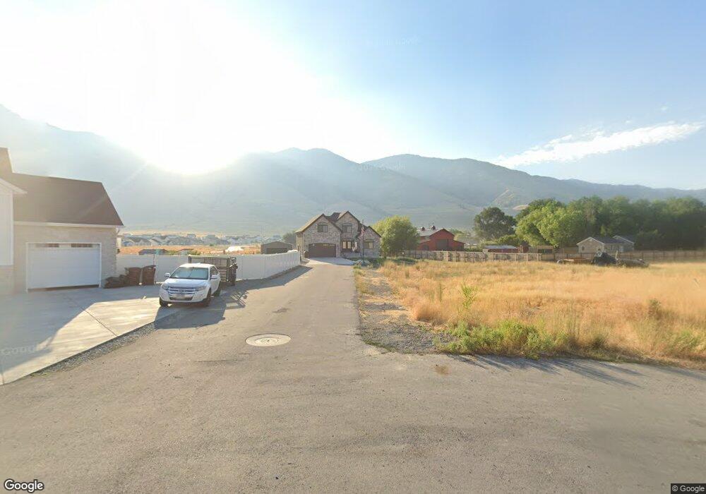
1866 E Davies Place Lake Point, UT 84074
Estimated Value: $624,000 - $775,000
--
Bed
--
Bath
3,561
Sq Ft
$198/Sq Ft
Est. Value
About This Home
This home is located at 1866 E Davies Place, Lake Point, UT 84074 and is currently estimated at $705,302, approximately $198 per square foot. 1866 E Davies Place is a home with nearby schools including Old Mill Elementary School, Clarke N. Johnsen Junior High School, and Stansbury High School.
Ownership History
Date
Name
Owned For
Owner Type
Purchase Details
Closed on
Jul 13, 2020
Sold by
Young Diane D and Young Steven
Bought by
Young Steven and Young Diane
Current Estimated Value
Purchase Details
Closed on
Jul 19, 2019
Sold by
Saddleback Pastures Llc
Bought by
Young Steven and Young Diane B
Create a Home Valuation Report for This Property
The Home Valuation Report is an in-depth analysis detailing your home's value as well as a comparison with similar homes in the area
Home Values in the Area
Average Home Value in this Area
Purchase History
| Date | Buyer | Sale Price | Title Company |
|---|---|---|---|
| Young Steven | -- | None Available | |
| Young Steven | -- | None Available |
Source: Public Records
Tax History Compared to Growth
Tax History
| Year | Tax Paid | Tax Assessment Tax Assessment Total Assessment is a certain percentage of the fair market value that is determined by local assessors to be the total taxable value of land and additions on the property. | Land | Improvement |
|---|---|---|---|---|
| 2025 | $4,071 | $629,086 | $215,200 | $413,886 |
| 2024 | $4,452 | $346,658 | $118,360 | $228,298 |
| 2023 | $4,452 | $305,670 | $132,000 | $173,670 |
| 2022 | $3,828 | $338,350 | $154,770 | $183,580 |
| 2021 | $3,025 | $223,805 | $84,480 | $139,325 |
| 2020 | $2,356 | $306,190 | $133,000 | $173,190 |
| 2019 | $0 | $0 | $0 | $0 |
Source: Public Records
Map
Nearby Homes
- 8537 N Tiffany Ln
- 2080 E Colette St
- 8483 N Colette St
- 2056 E Dolan Dr Unit 1334
- 2056 E Dolan Dr
- 2068 E Dolan Dr
- 2068 E Dolan Dr Unit 1333
- 8636 N Weston Way Unit 1321
- 8636 N Weston Way
- 2080 E Dolan Dr Unit 1332
- 2080 E Dolan Dr
- 1885 E Burger St Unit 1415
- 8645 N Halloran Ct
- 8645 N Halloran Ct Unit 1323
- 8622 N Halloran Ct Unit 1330
- 8622 N Halloran Ct
- 8655 N Halloran Ct Unit 1324
- 8655 N Haloran Ct
- 1992 E Burger St Unit 1234
- 1992 E Burger St
- 1865 E Davies Place
- 1843 E Davies Place
- 1842 E Davies Place
- 1825 E Davies Place Unit 10
- 1808 E Davies Place
- 1809 E Davies Place
- 1794 E Davies Place
- 1795 E Davies Place Unit 12
- 1857 E Sunset Rd
- 1825 E Sunset Rd
- 1778 E Davies Place
- 1779 E Davies Place Unit 13
- 8472 Mountain View Rd
- 1807 E Sunset Rd
- 1905 E Sunset Rd
- 1850 E Sunset Rd
- 373 E 1970 N
- 1755 E Sunset Rd
- 51710 Sunset Ln
- 1401 Sunset Rd