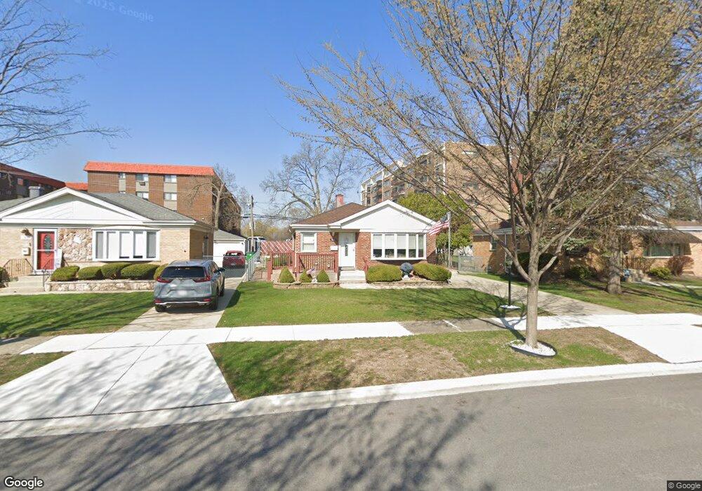
1866 Mandel Ave Westchester, IL 60154
Estimated Value: $325,128 - $370,000
2
Beds
1
Bath
1,003
Sq Ft
$348/Sq Ft
Est. Value
About This Home
This home is located at 1866 Mandel Ave, Westchester, IL 60154 and is currently estimated at $348,782, approximately $347 per square foot. 1866 Mandel Ave is a home located in Cook County with nearby schools including Hillside Elementary School, Proviso West High School, and Immanuel Christian Academy.
Ownership History
Date
Name
Owned For
Owner Type
Purchase Details
Closed on
Jun 7, 2000
Sold by
Harris Bank Hinsdale
Bought by
Carrano Frank C and Carrano Mary Ann
Current Estimated Value
Home Financials for this Owner
Home Financials are based on the most recent Mortgage that was taken out on this home.
Original Mortgage
$136,000
Outstanding Balance
$48,253
Interest Rate
8.31%
Estimated Equity
$300,529
Purchase Details
Closed on
Nov 30, 1999
Sold by
Pagnano Nicholas J
Bought by
Harris Bank Hinsdale and Trust #L-3888
Create a Home Valuation Report for This Property
The Home Valuation Report is an in-depth analysis detailing your home's value as well as a comparison with similar homes in the area
Home Values in the Area
Average Home Value in this Area
Purchase History
| Date | Buyer | Sale Price | Title Company |
|---|---|---|---|
| Carrano Frank C | $156,000 | -- | |
| Harris Bank Hinsdale | -- | -- |
Source: Public Records
Mortgage History
| Date | Status | Borrower | Loan Amount |
|---|---|---|---|
| Open | Carrano Frank C | $136,000 |
Source: Public Records
Tax History Compared to Growth
Tax History
| Year | Tax Paid | Tax Assessment Tax Assessment Total Assessment is a certain percentage of the fair market value that is determined by local assessors to be the total taxable value of land and additions on the property. | Land | Improvement |
|---|---|---|---|---|
| 2024 | $4,995 | $25,000 | $4,284 | $20,716 |
| 2023 | $3,531 | $25,000 | $4,284 | $20,716 |
| 2022 | $3,531 | $21,652 | $3,672 | $17,980 |
| 2021 | $4,427 | $21,651 | $3,672 | $17,979 |
| 2020 | $4,636 | $21,651 | $3,672 | $17,979 |
| 2019 | $3,287 | $17,809 | $3,366 | $14,443 |
| 2018 | $3,241 | $17,809 | $3,366 | $14,443 |
| 2017 | $3,209 | $17,809 | $3,366 | $14,443 |
| 2016 | $4,341 | $14,885 | $3,060 | $11,825 |
| 2015 | $2,991 | $14,885 | $3,060 | $11,825 |
| 2014 | $3,433 | $16,609 | $3,060 | $13,549 |
| 2013 | $3,020 | $16,520 | $3,060 | $13,460 |
Source: Public Records
Map
Nearby Homes
- 1905 S Wolf Rd Unit 302
- 11157 Shaw St
- 1847 Boeger Ave
- 2130 Mandel Ave
- 1948 Boeger Ave
- 2300 Boeger Ave
- 11140 Windsor Dr
- 2205 Mayfair Ave
- 1413 Highridge Pkwy
- 1811 Downing Ave
- 1860 Buckingham Ave
- 1327 S Wolf Rd
- 1326 Heidorn Ave
- 10630 W Cermak Rd Unit 2E
- 11449 Prescott Ln
- 2401 Mayfair Ave
- 2337 Kensington Ave
- 10916 Kingston St
- 1242 Heidorn Ave
- 2508 Camberley Cir Unit 1648
- 1870 Mandel Ave
- 1862 Mandel Ave
- 1874 Mandel Ave
- 1858 Mandel Ave Unit 2
- 1854 Mandel Ave
- 1865 Mandel Ave
- 1861 Mandel Ave
- 1871 Mandel Ave
- 1908 Mandel Ave
- 1875 Mandel Ave
- 1857 Mandel Ave
- 1879 Mandel Ave
- 11226 Mandel Ct
- 1912 Mandel Ave
- 11222 Mandel Ct
- 1909 Mandel Ave
- 11201 Mandel Ct
- 11148 Boeger Ct
- 1905 S Wolf Rd Unit P56
- 1905 S Wolf Rd Unit P55