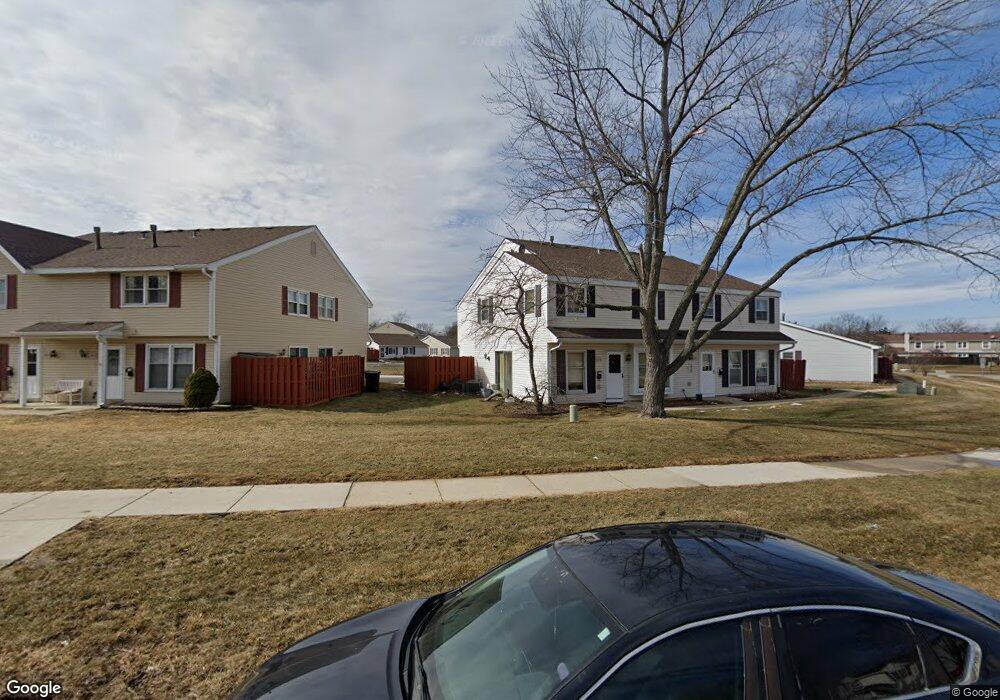
1866 Stockton Dr Unit 3271 Hoffman Estates, IL 60169
South Hoffman Estates NeighborhoodEstimated Value: $228,091 - $238,000
2
Beds
1
Bath
1,100
Sq Ft
$213/Sq Ft
Est. Value
About This Home
This home is located at 1866 Stockton Dr Unit 3271, Hoffman Estates, IL 60169 and is currently estimated at $234,273, approximately $212 per square foot. 1866 Stockton Dr Unit 3271 is a home located in Cook County with nearby schools including John Muir Literacy Academy, Dwight D Eisenhower Junior High School, and Hoffman Estates High School.
Ownership History
Date
Name
Owned For
Owner Type
Purchase Details
Closed on
Apr 30, 2025
Sold by
Fullerton William and Ragland Harold
Bought by
Muhammad Syed H and Khan Fizzah Mahnoor
Current Estimated Value
Home Financials for this Owner
Home Financials are based on the most recent Mortgage that was taken out on this home.
Original Mortgage
$181,520
Outstanding Balance
$180,671
Interest Rate
6.38%
Mortgage Type
New Conventional
Estimated Equity
$53,602
Purchase Details
Closed on
Jun 26, 2019
Sold by
Julian Reverend Paul T
Bought by
Regland Harold and Fulleton William
Home Financials for this Owner
Home Financials are based on the most recent Mortgage that was taken out on this home.
Original Mortgage
$50,000
Interest Rate
3.82%
Mortgage Type
New Conventional
Purchase Details
Closed on
Aug 8, 2003
Sold by
Walters Richard E
Bought by
Walters Richard E and Richard E Walters 2003 Trust
Create a Home Valuation Report for This Property
The Home Valuation Report is an in-depth analysis detailing your home's value as well as a comparison with similar homes in the area
Home Values in the Area
Average Home Value in this Area
Purchase History
| Date | Buyer | Sale Price | Title Company |
|---|---|---|---|
| Muhammad Syed H | $227,000 | Chicago Title | |
| Regland Harold | $80,000 | Chicago Title | |
| Walters Richard E | -- | -- |
Source: Public Records
Mortgage History
| Date | Status | Borrower | Loan Amount |
|---|---|---|---|
| Open | Muhammad Syed H | $181,520 | |
| Previous Owner | Regland Harold | $50,000 |
Source: Public Records
Tax History Compared to Growth
Tax History
| Year | Tax Paid | Tax Assessment Tax Assessment Total Assessment is a certain percentage of the fair market value that is determined by local assessors to be the total taxable value of land and additions on the property. | Land | Improvement |
|---|---|---|---|---|
| 2024 | $3,774 | $12,301 | $3,038 | $9,263 |
| 2023 | $3,653 | $12,301 | $3,038 | $9,263 |
| 2022 | $3,653 | $12,301 | $3,038 | $9,263 |
| 2021 | $3,264 | $9,743 | $4,784 | $4,959 |
| 2020 | $3,188 | $9,743 | $4,784 | $4,959 |
| 2019 | $3,185 | $10,880 | $4,784 | $6,096 |
| 2018 | $2,067 | $6,339 | $4,177 | $2,162 |
| 2017 | $0 | $6,339 | $4,177 | $2,162 |
| 2016 | $0 | $6,339 | $4,177 | $2,162 |
| 2015 | $0 | $4,260 | $3,645 | $615 |
| 2014 | -- | $4,260 | $3,645 | $615 |
| 2013 | -- | $4,260 | $3,645 | $615 |
Source: Public Records
Map
Nearby Homes
- 1862 Stockton Dr Unit 3283
- 1886 Stockton Dr Unit 3253
- 1925 Georgetown Ln Unit 4
- 1956 Georgetown Ln Unit 4
- 1840 Huntington Blvd Unit 415
- 1840 Huntington Blvd Unit 412
- 1854 Huntington Blvd Unit C
- 1808 Fayette Walk Unit H
- 1800 Huntington Blvd Unit AE615
- 1738 Ardwick Dr
- 1704 Fayette Walk Unit B
- 1977 Kenilworth Cir Unit D
- 1940 Kenilworth Cir Unit D
- 1763 Bristol Walk Unit 1763
- 1685 Cornell Dr
- 2004 E Parkview Cir
- 2230 Stratham Place
- 1672 Cornell Dr
- 1996 Blackberry Ln Unit 14
- 1475 Rebecca Dr Unit 217
- 1868 Stockton Dr Unit 3272
- 1872 Stockton Dr Unit 3274
- 1860 Stockton Dr Unit 3282
- 1858 Stockton Dr Unit 3281
- 1864 Stockton Dr Unit 3284
- 1880 Stockton Dr Unit 3262
- 1850 Stockton Dr Unit 3291
- 1852 Stockton Dr Unit 3292
- 1854 Stockton Dr Unit 3293
- 1846 Stockton Dr Unit 3301
- 1878 Stockton Dr Unit 3261
- 1856 Stockton Dr Unit 3294
- 1856 Stockton Dr Unit 1856
- 1844 Stockton Dr Unit 3304
- 1876 Stockton Dr Unit 3264
- 1882 Stockton Dr Unit 3251
- 1842 Stockton Dr Unit 3303
- 1840 Stockton Dr Unit 3314
- 1838 Stockton Dr Unit 3313
- 1836 Stockton Dr Unit 3312