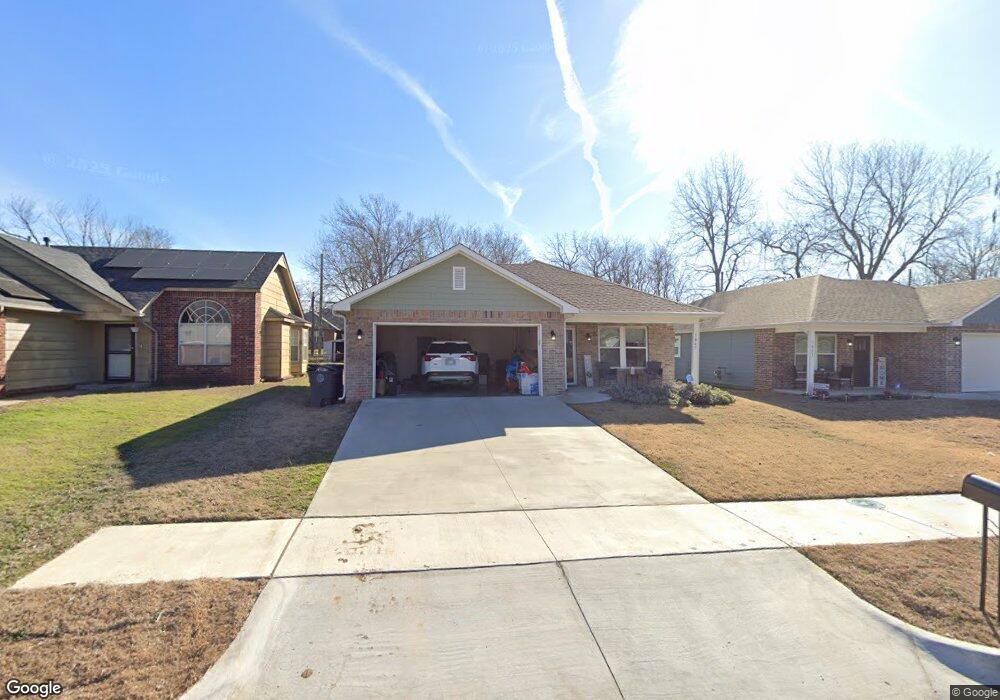
1867 N Norfolk Ave Tulsa, OK 74106
University Park NeighborhoodEstimated Value: $183,439 - $211,000
--
Bed
--
Bath
1,210
Sq Ft
$166/Sq Ft
Est. Value
About This Home
This home is located at 1867 N Norfolk Ave, Tulsa, OK 74106 and is currently estimated at $201,360, approximately $166 per square foot. 1867 N Norfolk Ave is a home located in Tulsa County with nearby schools including Central Middle School, Central Junior High School, and Central High School.
Ownership History
Date
Name
Owned For
Owner Type
Purchase Details
Closed on
Aug 23, 2022
Sold by
Tulsa Habitat For Humanity Inc
Bought by
Watson Jasmine S
Current Estimated Value
Home Financials for this Owner
Home Financials are based on the most recent Mortgage that was taken out on this home.
Original Mortgage
$138,750
Outstanding Balance
$132,292
Interest Rate
5.51%
Mortgage Type
New Conventional
Estimated Equity
$69,068
Purchase Details
Closed on
Jan 31, 2022
Sold by
Tulsa Habitat For Humanity Inc
Bought by
Boomtown Development Co
Purchase Details
Closed on
Jun 21, 2011
Sold by
Semler J Dennis
Bought by
Tulsa Habitat For Humanity Inc
Create a Home Valuation Report for This Property
The Home Valuation Report is an in-depth analysis detailing your home's value as well as a comparison with similar homes in the area
Home Values in the Area
Average Home Value in this Area
Purchase History
| Date | Buyer | Sale Price | Title Company |
|---|---|---|---|
| Watson Jasmine S | $175,000 | Community Title Services | |
| Boomtown Development Co | -- | None Listed On Document | |
| Tulsa Habitat For Humanity Inc | -- | None Listed On Document | |
| Tulsa Habitat For Humanity Inc | $400 | None Available |
Source: Public Records
Mortgage History
| Date | Status | Borrower | Loan Amount |
|---|---|---|---|
| Open | Watson Jasmine S | $138,750 | |
| Closed | Watson Jasmine S | $8,000 |
Source: Public Records
Tax History Compared to Growth
Tax History
| Year | Tax Paid | Tax Assessment Tax Assessment Total Assessment is a certain percentage of the fair market value that is determined by local assessors to be the total taxable value of land and additions on the property. | Land | Improvement |
|---|---|---|---|---|
| 2025 | $2,603 | $19,423 | $520 | $18,903 |
| 2024 | $2,316 | $18,827 | $605 | $18,222 |
| 2023 | $2,316 | $19,250 | $660 | $18,590 |
| 2022 | $50 | $374 | $374 | $0 |
| 2021 | $49 | $374 | $374 | $0 |
| 2020 | $49 | $374 | $374 | $0 |
| 2019 | $51 | $374 | $374 | $0 |
| 2018 | $51 | $374 | $374 | $0 |
| 2017 | $51 | $374 | $374 | $0 |
| 2016 | $50 | $374 | $374 | $0 |
| 2015 | $50 | $374 | $374 | $0 |
| 2014 | $50 | $374 | $374 | $0 |
Source: Public Records
Map
Nearby Homes
- 1836 N Madison Place
- 3236 N Peoria Ave
- 2124 N Norfolk Ave
- 2545 N Quaker Ave
- 1837 N Madison Ave
- 199 E Xyler St
- 728 E Tecumseh St
- 2219 N Lansing Ave
- 2240 N Madison Ave
- 2125 N Rockford Ave
- 759 E Queen St N
- 1014 E Pine Place
- 2249 N Lansing Ave
- 1833 N Troost Ave
- 2520 N Madison Ave
- 1837 N Troost Ave
- 2525 N Lansing Ave
- 2529 N Quaker Ave
- 1728 N Rockford Ave
- 1728 N Rockford Ave
- 1873 N Norfolk Ave
- 1863 N Norfolk Ave
- 1875 N Norfolk Ave
- 1859 N Norfolk Ave
- 1855 N Norfolk Ave
- 1879 N Norfolk Ave N
- 1868 N Owasso Ave
- 1864 N Owasso Ave
- 1872 N Owasso Ave
- 1876 N Owasso Ave
- 1858 N Owasso Ave
- 1866 N Norfolk Ave
- 1849 N Norfolk Ave
- 1860 N Norfolk Ave
- 1874 N Norfolk Ave
- 1856 N Owasso Ave
- 2003 N Norfolk Ave
- 1880 N Norfolk Ave
- 1850 N Owasso Ave
- 2004 N Owasso Ave