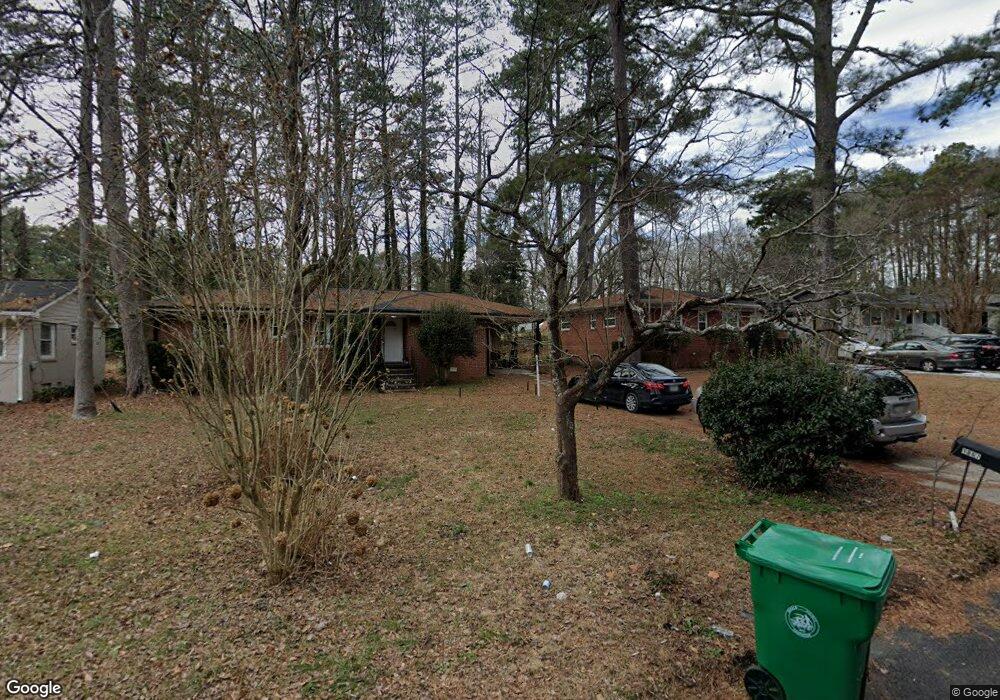
1867 Shamrock Dr Decatur, GA 30032
Estimated Value: $188,487 - $242,000
3
Beds
1
Bath
1,167
Sq Ft
$177/Sq Ft
Est. Value
About This Home
This home is located at 1867 Shamrock Dr, Decatur, GA 30032 and is currently estimated at $206,622, approximately $177 per square foot. 1867 Shamrock Dr is a home located in DeKalb County with nearby schools including Snapfinger Elementary School, Columbia Middle School, and Columbia High School.
Ownership History
Date
Name
Owned For
Owner Type
Purchase Details
Closed on
Jun 24, 2013
Sold by
Schulman Eric
Bought by
Dekalb Fulton Properties Llc
Current Estimated Value
Purchase Details
Closed on
Mar 24, 2009
Sold by
Soundview Home Ln 2006-2
Bought by
Schulman Eric
Purchase Details
Closed on
Oct 7, 2008
Sold by
Coke Patricia A
Bought by
Soundview Home Loan 2006-2
Purchase Details
Closed on
Nov 8, 2005
Sold by
Coke Patricia A
Bought by
Coke Patricia A
Home Financials for this Owner
Home Financials are based on the most recent Mortgage that was taken out on this home.
Original Mortgage
$87,710
Interest Rate
9.55%
Mortgage Type
New Conventional
Create a Home Valuation Report for This Property
The Home Valuation Report is an in-depth analysis detailing your home's value as well as a comparison with similar homes in the area
Home Values in the Area
Average Home Value in this Area
Purchase History
| Date | Buyer | Sale Price | Title Company |
|---|---|---|---|
| Dekalb Fulton Properties Llc | -- | -- | |
| Schulman Eric | $20,000 | -- | |
| Soundview Home Loan 2006-2 | $46,900 | -- | |
| Coke Patricia A | -- | -- |
Source: Public Records
Mortgage History
| Date | Status | Borrower | Loan Amount |
|---|---|---|---|
| Previous Owner | Coke Patricia A | $87,710 |
Source: Public Records
Tax History Compared to Growth
Tax History
| Year | Tax Paid | Tax Assessment Tax Assessment Total Assessment is a certain percentage of the fair market value that is determined by local assessors to be the total taxable value of land and additions on the property. | Land | Improvement |
|---|---|---|---|---|
| 2025 | $3,429 | $68,040 | $24,560 | $43,480 |
| 2024 | $3,747 | $75,440 | $24,560 | $50,880 |
| 2023 | $3,747 | $65,520 | $24,560 | $40,960 |
| 2022 | $2,918 | $58,720 | $14,040 | $44,680 |
| 2021 | $2,534 | $49,960 | $14,040 | $35,920 |
| 2020 | $2,351 | $45,800 | $12,000 | $33,800 |
| 2019 | $2,135 | $40,880 | $12,000 | $28,880 |
| 2018 | $1,417 | $31,760 | $12,000 | $19,760 |
| 2017 | $1,226 | $20,080 | $3,200 | $16,880 |
| 2016 | $1,274 | $21,120 | $3,200 | $17,920 |
| 2014 | $692 | $7,760 | $4,480 | $3,280 |
Source: Public Records
Map
Nearby Homes
- 1884 Derrill Dr
- 1852 Shamrock Dr
- 1846 Shamrock Dr
- 3260 Glenco Dr
- 1857 Derrill Dr
- 2361 Lynn Lris Dr
- 1879 Rosewood Rd
- 3235 Glenwood Rd
- 1819 Rosewood Rd
- 1882 Rosewood Rd
- 1911 Rosewood Rd
- 3314 Glenco Dr
- 1870 S Columbia Place
- 3815 Glenwood Rd
- 1923 Rosewood Rd
- 1779 Rosewood Rd
- 1908 S Columbia Place
- 1853 Pinedale Place
- 1861 Shamrock Dr
- 1873 Shamrock Dr
- 1855 Shamrock Dr
- 1866 Derrill Dr
- 1872 Derrill Dr
- 1860 Derrill Dr
- 1851 Shamrock Dr
- 1883 Shamrock Dr
- 1878 Derrill Dr
- 1862 Shamrock Dr
- 1854 Derrill Dr
- 1856 Shamrock Dr
- 1880 Shamrock Dr
- 1845 Shamrock Dr
- 1889 Shamrock Dr
- 0 Derrill Drive Home Decatur (Id 466) Unit 7689319-11465723
- 1884 Shamrock Dr
- 1890 Derrill Dr
- 1848 Derrill Dr
- 1895 Shamrock Dr