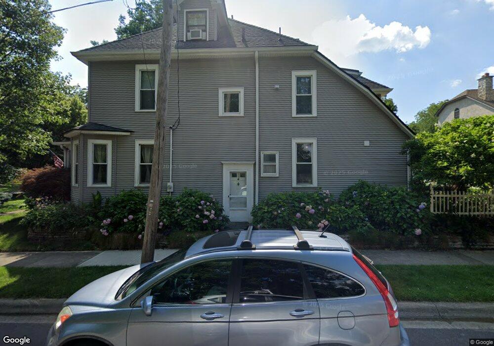
1868 Bluff Ave Columbus, OH 43212
Estimated Value: $892,000 - $1,169,000
5
Beds
3
Baths
3,795
Sq Ft
$262/Sq Ft
Est. Value
About This Home
This home is located at 1868 Bluff Ave, Columbus, OH 43212 and is currently estimated at $995,654, approximately $262 per square foot. 1868 Bluff Ave is a home located in Franklin County with nearby schools including Robert Louis Stevenson Elementary School, Larson Middle School, and Grandview Heights High School.
Ownership History
Date
Name
Owned For
Owner Type
Purchase Details
Closed on
Aug 23, 2001
Sold by
Polas Pommering Thomas L and Polas Phyllis J
Bought by
Pommering Thomas L and Polas Phyllis J
Current Estimated Value
Purchase Details
Closed on
Aug 10, 1998
Sold by
Reich Michael I and Terry Ann B
Bought by
Pommering Thomas L and Polas Phyllis J
Home Financials for this Owner
Home Financials are based on the most recent Mortgage that was taken out on this home.
Original Mortgage
$262,000
Outstanding Balance
$54,991
Interest Rate
6.99%
Estimated Equity
$940,663
Purchase Details
Closed on
Jun 30, 1993
Create a Home Valuation Report for This Property
The Home Valuation Report is an in-depth analysis detailing your home's value as well as a comparison with similar homes in the area
Home Values in the Area
Average Home Value in this Area
Purchase History
| Date | Buyer | Sale Price | Title Company |
|---|---|---|---|
| Pommering Thomas L | -- | -- | |
| Pommering Thomas L | $292,000 | Franklin Abstract | |
| -- | $184,500 | -- |
Source: Public Records
Mortgage History
| Date | Status | Borrower | Loan Amount |
|---|---|---|---|
| Open | Pommering Thomas L | $262,000 |
Source: Public Records
Tax History Compared to Growth
Tax History
| Year | Tax Paid | Tax Assessment Tax Assessment Total Assessment is a certain percentage of the fair market value that is determined by local assessors to be the total taxable value of land and additions on the property. | Land | Improvement |
|---|---|---|---|---|
| 2024 | $21,359 | $254,560 | $105,140 | $149,420 |
| 2023 | $13,006 | $254,555 | $105,140 | $149,415 |
| 2022 | $14,803 | $246,720 | $80,680 | $166,040 |
| 2021 | $13,859 | $246,720 | $80,680 | $166,040 |
| 2020 | $13,801 | $246,720 | $80,680 | $166,040 |
| 2019 | $13,920 | $220,230 | $80,680 | $139,550 |
| 2018 | $13,025 | $220,230 | $80,680 | $139,550 |
| 2017 | $12,979 | $220,230 | $80,680 | $139,550 |
| 2016 | $12,190 | $177,070 | $60,830 | $116,240 |
| 2015 | $12,190 | $177,070 | $60,830 | $116,240 |
| 2014 | $12,227 | $177,070 | $60,830 | $116,240 |
| 2013 | $5,372 | $160,965 | $55,300 | $105,665 |
Source: Public Records
Map
Nearby Homes
- 1313 Lincoln Rd
- 1000 Urlin Ave Unit 1822
- 1000 Urlin Ave Unit 2007
- 1000 Urlin Ave Unit 520
- 1000 Urlin Ave Unit 605
- 1000 Urlin Ave Unit 511
- 1000 Urlin Ave Unit 1007
- 1000 Urlin Ave Unit 518
- 1000 Urlin Ave Unit 1607
- 1459 Elmwood Ave Unit 1459
- 1561 Glenn Ave
- 1475 W 3rd Ave Unit 204
- 1301 Lake Shore Dr Unit 199
- 1359 Bluff Ave Unit A
- 2015 W 5th Ave Unit 211
- 2015 W 5th Ave Unit 102
- 2015 W 5th Ave Unit 108
- 1214 Lake Shore Dr Unit C
- 1631 Roxbury Rd Unit F3
- 1631 Roxbury Rd Unit B6
- 1874 Bluff Ave
- 1894 Bluff Ave
- 1147 Glenn Ave
- 1130 Glenn Ave
- 1860 Bluff Ave
- 1134 Glenn Ave
- 1155 Glenn Ave
- 1114 Wyandotte Rd
- 1871 Bluff Ave
- 1134 Wyandotte Rd
- 1150 Glenn Ave
- 1852 Bluff Ave
- 1148 Wyandotte Rd
- 1166 Wyandotte Rd
- 0 Glenn Ave
- 1857 Bluff Ave
- 1160 Glenn Ave
- 1165 Glenn Ave
- 1172 Wyandotte Rd
- 1117 Wyandotte Rd