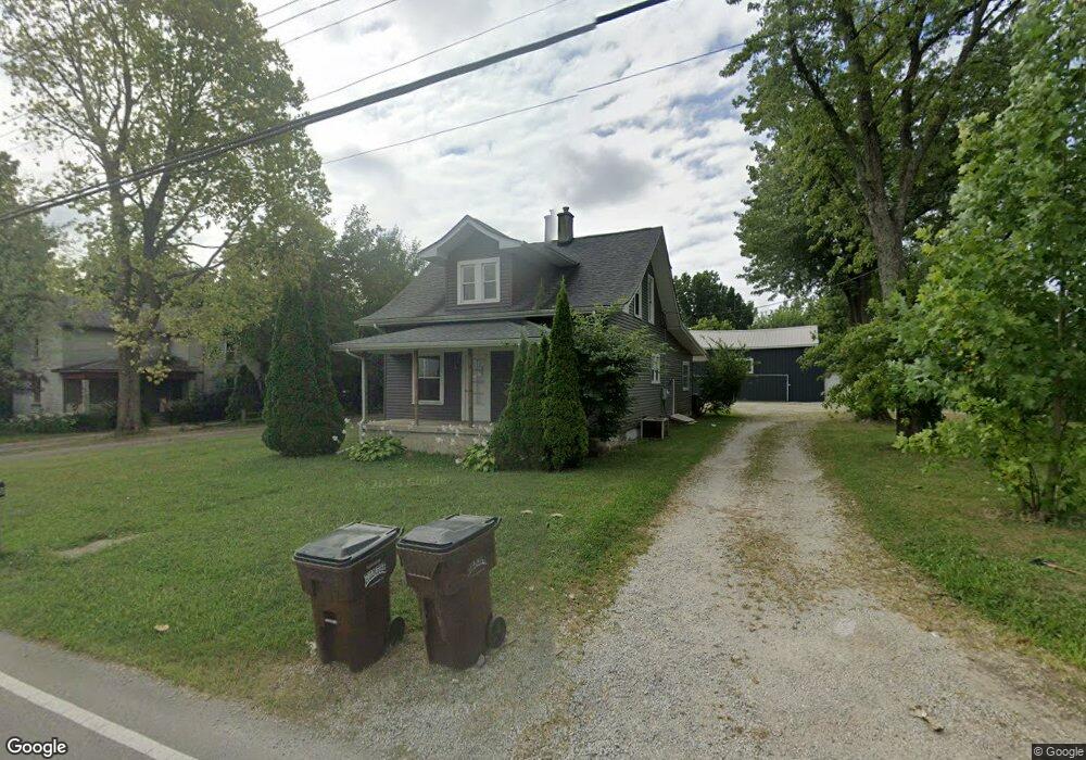
1868 Westbrook Rd Dayton, OH 45415
Estimated Value: $216,000 - $244,000
3
Beds
2
Baths
1,639
Sq Ft
$140/Sq Ft
Est. Value
About This Home
This home is located at 1868 Westbrook Rd, Dayton, OH 45415 and is currently estimated at $228,997, approximately $139 per square foot. 1868 Westbrook Rd is a home located in Montgomery County with nearby schools including Trotwood-Madison Middle School, Trotwood-Madison High School, and Trotwood Preparatory & Fitness Academy.
Ownership History
Date
Name
Owned For
Owner Type
Purchase Details
Closed on
Aug 22, 2007
Sold by
Sparks Group Llc
Bought by
Sparks David B and Sparks Jeffrey S
Current Estimated Value
Purchase Details
Closed on
Mar 21, 2007
Sold by
Abn Amro Mortgage Group Inc
Bought by
Sparks Group Llc
Purchase Details
Closed on
Sep 8, 2006
Sold by
Benton Shirlee V and Benton Shirlee
Bought by
Abn Amro Mortgage Group Inc
Create a Home Valuation Report for This Property
The Home Valuation Report is an in-depth analysis detailing your home's value as well as a comparison with similar homes in the area
Home Values in the Area
Average Home Value in this Area
Purchase History
| Date | Buyer | Sale Price | Title Company |
|---|---|---|---|
| Sparks David B | -- | Attorney | |
| Sparks Group Llc | $40,500 | Titlequest Agency Inc | |
| Abn Amro Mortgage Group Inc | $44,000 | None Available |
Source: Public Records
Tax History Compared to Growth
Tax History
| Year | Tax Paid | Tax Assessment Tax Assessment Total Assessment is a certain percentage of the fair market value that is determined by local assessors to be the total taxable value of land and additions on the property. | Land | Improvement |
|---|---|---|---|---|
| 2024 | $3,452 | $53,140 | $7,500 | $45,640 |
| 2023 | $3,452 | $53,140 | $7,500 | $45,640 |
| 2022 | $2,584 | $35,240 | $4,970 | $30,270 |
| 2021 | $2,606 | $31,000 | $4,970 | $26,030 |
| 2020 | $1,603 | $16,510 | $4,970 | $11,540 |
| 2019 | $1,973 | $21,100 | $4,470 | $16,630 |
| 2018 | $1,975 | $21,100 | $4,470 | $16,630 |
| 2017 | $1,962 | $21,100 | $4,470 | $16,630 |
| 2016 | $1,849 | $19,890 | $4,970 | $14,920 |
| 2015 | $1,818 | $19,890 | $4,970 | $14,920 |
| 2014 | $1,818 | $19,890 | $4,970 | $14,920 |
| 2012 | -- | $21,020 | $4,970 | $16,050 |
Source: Public Records
Map
Nearby Homes
- 5003 Well Fleet Dr Unit 11RKR
- 4269 Willow Creek Dr
- 4250 Willow Creek Dr
- 00 Salem Bend Dr
- 4310 Corydale Ct
- 6505 Taywood Rd
- 6200 Weybridge Dr
- 6624 Stranwood Dr
- 6459 Waywind Dr
- 6600 Afton Dr
- 6473 Waywind Dr
- 4311 Reeves Ct
- 6781 Taywood Rd
- 6701 Park Vista Rd
- 6440 Westanna Dr
- 4507 Skylark Dr
- 3631 Greenbay Dr
- 6325 Garber Rd
- 6583 Benjamin Franklin Dr
- 1206 N Union Rd
- 1884 Westbrook Rd
- 1877 E Westbrook Rd
- 1869 Westbrook Rd
- 1877 Westbrook Rd
- 1940 Westbrook Rd
- 1885 Westbrook Rd
- 1856 Westbrook Rd
- 1994 Westbrook Rd
- 1740 Westbrook Rd
- 5929 Salem Bend Dr
- 1745 Westbrook Rd
- 5907 Salem Bend Dr
- 5897 Salem Bend Dr
- 5932 Salem Bend Dr
- 2050 Westbrook Rd
- 5885 Salem Bend Dr
- 5922 Salem Bend Dr
- 5910 Salem Bend Dr
- 5865 Olive Rd
- 5890 Salem Bend Dr