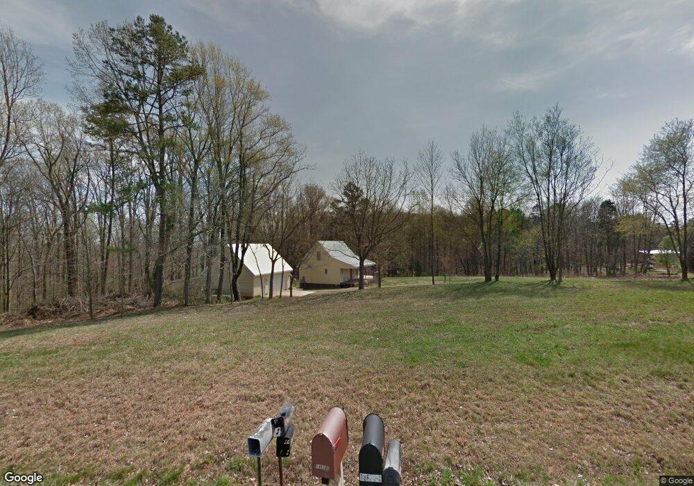
18686 Dusty Rd Locust, NC 28097
Estimated Value: $312,461 - $352,000
1
Bed
2
Baths
813
Sq Ft
$412/Sq Ft
Est. Value
About This Home
This home is located at 18686 Dusty Rd, Locust, NC 28097 and is currently estimated at $334,615, approximately $411 per square foot. 18686 Dusty Rd is a home located in Stanly County with nearby schools including Endy Elementary School, West Stanly Middle School, and West Stanly High School.
Ownership History
Date
Name
Owned For
Owner Type
Purchase Details
Closed on
Feb 24, 2021
Sold by
Goodrich Clarke Jay
Bought by
Vanhoy Michael and Crayton Madison
Current Estimated Value
Home Financials for this Owner
Home Financials are based on the most recent Mortgage that was taken out on this home.
Original Mortgage
$189,000
Outstanding Balance
$172,590
Interest Rate
3.87%
Mortgage Type
New Conventional
Estimated Equity
$162,025
Purchase Details
Closed on
May 17, 2007
Sold by
Mccord Brian M
Bought by
Goodrich Clarke
Home Financials for this Owner
Home Financials are based on the most recent Mortgage that was taken out on this home.
Original Mortgage
$165,000
Interest Rate
6.12%
Mortgage Type
Purchase Money Mortgage
Create a Home Valuation Report for This Property
The Home Valuation Report is an in-depth analysis detailing your home's value as well as a comparison with similar homes in the area
Home Values in the Area
Average Home Value in this Area
Purchase History
| Date | Buyer | Sale Price | Title Company |
|---|---|---|---|
| Vanhoy Michael | $210,000 | None Available | |
| Goodrich Clarke | $165,000 | None Available | |
| Goodrich Clarke | $165,000 | None Available |
Source: Public Records
Mortgage History
| Date | Status | Borrower | Loan Amount |
|---|---|---|---|
| Open | Vanhoy Michael | $189,000 | |
| Previous Owner | Goodrich Clarke | $165,000 |
Source: Public Records
Tax History
| Year | Tax Paid | Tax Assessment Tax Assessment Total Assessment is a certain percentage of the fair market value that is determined by local assessors to be the total taxable value of land and additions on the property. | Land | Improvement |
|---|---|---|---|---|
| 2025 | $1,414 | $214,230 | $102,300 | $111,930 |
| 2024 | $13 | $144,846 | $65,802 | $79,044 |
| 2023 | $15 | $144,846 | $65,802 | $79,044 |
| 2022 | $1,182 | $144,846 | $65,802 | $79,044 |
| 2021 | $1,181 | $144,846 | $65,802 | $79,044 |
| 2020 | $1,131 | $128,757 | $58,630 | $70,127 |
| 2019 | $1,138 | $128,757 | $58,630 | $70,127 |
| 2018 | $408 | $128,757 | $58,630 | $70,127 |
| 2017 | $1,004 | $128,757 | $58,630 | $70,127 |
| 2016 | $930 | $122,327 | $53,515 | $68,812 |
| 2015 | $1,064 | $122,327 | $53,515 | $68,812 |
| 2014 | $990 | $122,327 | $53,515 | $68,812 |
Source: Public Records
Map
Nearby Homes
- 16659 Five Point Rd
- 16138 Substation Rd
- 20420 Ridgecrest Rd
- Parcel 2 Birdhouse Ln
- Parcel 1 Birdhouse Ln
- 24910 Birdhouse Ln Unit 1
- VACANT LAND Pole Running Rd
- VAC Ridgebrook Ln
- 20673 Sam Rd
- 00 Bridge Rd
- 03 Ramsey Rd
- 00 Sugar Hill Rd
- -- Sugar Hill Rd
- 21072 Running Creek Dr
- 20289 Running Creek Church Rd
- 21083 Running Creek Dr
- 21064 Running Creek Dr
- 21079 Running Creek Dr
- 21056 Running Creek Dr
- 21048 Running Creek Dr
- 18670 Dusty Rd
- 18658B Dusty Rd
- 18658 Dusty Rd
- 18642 Dusty Rd
- 18777 Dusty Rd
- 18799 Dusty Rd
- 20044 Dusty Rd
- 18793 Dusty Rd
- 18580 Dusty Rd
- 18590 Dusty Rd
- 20223 Old Mill Rd
- 18835 Old Mill Rd
- 18519B Dusty Rd
- 18519 Dusty Rd
- 20086 Dusty Rd
- 20255 Old Mill Rd
- 20160 Old Mill Rd
- 20230 Old Mill Rd
- 20063 Old Mill Rd
- 20146 Old Mill Rd
Your Personal Tour Guide
Ask me questions while you tour the home.