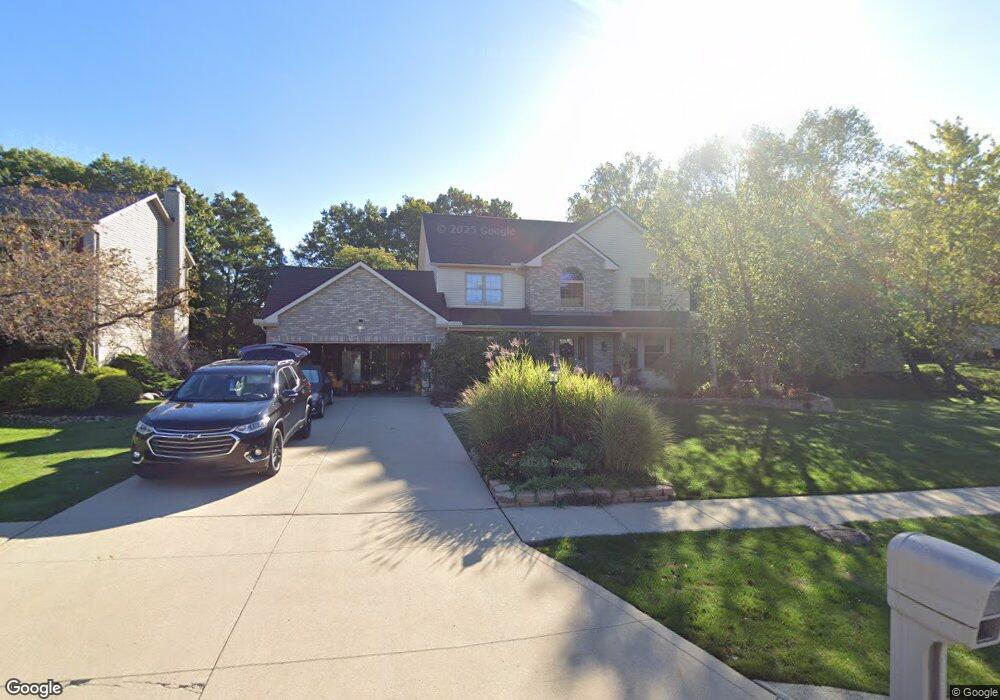
18689 Hunters Pointe Dr Strongsville, OH 44136
Estimated Value: $422,000 - $496,000
4
Beds
3
Baths
2,818
Sq Ft
$162/Sq Ft
Est. Value
About This Home
This home is located at 18689 Hunters Pointe Dr, Strongsville, OH 44136 and is currently estimated at $457,727, approximately $162 per square foot. 18689 Hunters Pointe Dr is a home located in Cuyahoga County with nearby schools including Strongsville High School, Royal Redeemer Lutheran School, and Sts Joseph & John Interparochial School.
Ownership History
Date
Name
Owned For
Owner Type
Purchase Details
Closed on
Jun 19, 1997
Sold by
Panorama Homes Inc
Bought by
Thornton Donald W and Thornton Debora K
Current Estimated Value
Home Financials for this Owner
Home Financials are based on the most recent Mortgage that was taken out on this home.
Original Mortgage
$126,000
Outstanding Balance
$18,077
Interest Rate
8.01%
Mortgage Type
New Conventional
Estimated Equity
$439,650
Create a Home Valuation Report for This Property
The Home Valuation Report is an in-depth analysis detailing your home's value as well as a comparison with similar homes in the area
Home Values in the Area
Average Home Value in this Area
Purchase History
| Date | Buyer | Sale Price | Title Company |
|---|---|---|---|
| Thornton Donald W | $215,500 | -- |
Source: Public Records
Mortgage History
| Date | Status | Borrower | Loan Amount |
|---|---|---|---|
| Open | Thornton Donald W | $126,000 |
Source: Public Records
Tax History Compared to Growth
Tax History
| Year | Tax Paid | Tax Assessment Tax Assessment Total Assessment is a certain percentage of the fair market value that is determined by local assessors to be the total taxable value of land and additions on the property. | Land | Improvement |
|---|---|---|---|---|
| 2024 | $6,327 | $134,750 | $25,445 | $109,305 |
| 2023 | $6,752 | $107,840 | $24,680 | $83,160 |
| 2022 | $6,703 | $107,840 | $24,680 | $83,160 |
| 2021 | $6,650 | $107,840 | $24,680 | $83,160 |
| 2020 | $6,592 | $94,570 | $21,630 | $72,940 |
| 2019 | $6,399 | $270,200 | $61,800 | $208,400 |
| 2018 | $5,685 | $94,570 | $21,630 | $72,940 |
| 2017 | $5,666 | $85,410 | $17,680 | $67,730 |
| 2016 | $5,620 | $85,410 | $17,680 | $67,730 |
| 2015 | $5,699 | $85,410 | $17,680 | $67,730 |
| 2014 | $5,699 | $85,410 | $17,680 | $67,730 |
Source: Public Records
Map
Nearby Homes
- 13448 Compass Point Dr
- 13335 Tradewinds Dr
- 19252 Hidden Woods Ln
- 14132 Walking Stick Way
- 18987 Laurell Cir
- 14558 Drake Rd
- 19813 Cross Trail S
- 14985 Camden Cir
- 106 Briarleigh Dr
- 18680 Bennett Rd
- 15188 Trails Landing
- 3137 Blackburn Ln
- 19694 Benbow Rd
- 19740 Benbow Rd
- 18229 Howe Rd
- 15604-REAR Boston Rd
- 11438 Drake Rd
- 266 Bettie Ln
- 15772 Boston Rd
- 17130 Golden Star Dr
- 18657 Hunters Pointe Dr
- 18625 Hunters Pointe Dr
- 13658 Compass Point Dr
- 13610 Tradewinds Dr
- 13636 Compass Point Dr
- 13672 Compass Point Dr
- 18672 Hunters Pointe Dr
- 18704 Hunters Pointe Dr
- 13582 Tradewinds Dr
- 13610 Compass Point Dr
- 18640 Hunters Pointe Dr
- 18593 Hunters Pointe Dr
- 18736 Hunters Pointe Dr
- 18608 Hunters Pointe Dr
- 13584 Compass Point Dr
- 18768 Hunters Pointe Dr
- 18561 Hunters Pointe Dr
- 18691 Hearthstone Dr
- 18723 Hearthstone Dr
- 13761 Clipper Cove Dr