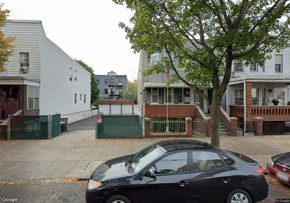
1869-1871 Barnes Ave Bronx, NY 10462
Van Nest NeighborhoodEstimated Value: $935,000 - $1,135,000
--
Bed
--
Bath
2,808
Sq Ft
$369/Sq Ft
Est. Value
About This Home
This home is located at 1869-1871 Barnes Ave, Bronx, NY 10462 and is currently estimated at $1,036,686, approximately $369 per square foot. 1869-1871 Barnes Ave is a home located in Bronx County with nearby schools including P.S. 083 The Donald Hertz School, Bronx Excellence 2, and Bronx Charter School For Excellence 2.
Ownership History
Date
Name
Owned For
Owner Type
Purchase Details
Closed on
Oct 18, 2016
Sold by
Poli Pasquale
Bought by
Poli & Sons Llc
Current Estimated Value
Purchase Details
Closed on
Feb 11, 2011
Sold by
Poli & Sons Llc
Bought by
Poli Pasquale
Purchase Details
Closed on
Jan 4, 2007
Sold by
Desantis Ralph
Bought by
Poli Pasquale
Home Financials for this Owner
Home Financials are based on the most recent Mortgage that was taken out on this home.
Original Mortgage
$488,000
Interest Rate
6.18%
Mortgage Type
Purchase Money Mortgage
Create a Home Valuation Report for This Property
The Home Valuation Report is an in-depth analysis detailing your home's value as well as a comparison with similar homes in the area
Home Values in the Area
Average Home Value in this Area
Purchase History
| Date | Buyer | Sale Price | Title Company |
|---|---|---|---|
| Poli & Sons Llc | -- | -- | |
| Poli Pasquale | -- | -- | |
| Poli Pasquale | $610,000 | -- |
Source: Public Records
Mortgage History
| Date | Status | Borrower | Loan Amount |
|---|---|---|---|
| Previous Owner | Poli Pasquale | $488,000 |
Source: Public Records
Tax History Compared to Growth
Tax History
| Year | Tax Paid | Tax Assessment Tax Assessment Total Assessment is a certain percentage of the fair market value that is determined by local assessors to be the total taxable value of land and additions on the property. | Land | Improvement |
|---|---|---|---|---|
| 2025 | $14,980 | $123,644 | $41,579 | $82,065 |
| 2024 | $14,980 | $119,817 | $42,685 | $77,132 |
| 2023 | $13,611 | $110,958 | $42,734 | $68,224 |
| 2022 | $12,571 | $275,850 | $102,600 | $173,250 |
| 2021 | $0 | $220,500 | $102,600 | $117,900 |
| 2020 | $11,863 | $241,200 | $102,600 | $138,600 |
| 2019 | $11,624 | $243,000 | $102,600 | $140,400 |
| 2018 | $10,856 | $85,352 | $43,245 | $42,107 |
| 2017 | $10,052 | $79,033 | $43,525 | $35,508 |
| 2016 | $9,435 | $73,183 | $43,910 | $29,273 |
| 2015 | $6,125 | $73,162 | $51,012 | $22,150 |
| 2014 | $6,125 | $70,898 | $47,825 | $23,073 |
Source: Public Records
Map
Nearby Homes
- 1907 Barnes Ave
- 1916 Barnes Ave
- 1858 Wallace Ave
- 1914 Holland Ave
- 1961 Wallace Ave
- 1869 Muliner Ave
- 1904 Bronxdale Ave
- 1865 Hunt Ave
- 928 Rhinelander Ave
- 1925 Bogart Ave
- 681 Rhinelander Ave
- 848 Morris Park Ave
- 762 Brady Ave Unit 221
- 762 Brady Ave Unit 621
- 845 Kinsella St
- 953 Rhinelander Ave
- 661 Sagamore St
- 868 Morris Park Ave
- - Morris Park Ave
- 758 Brady Ave Unit 411
- 1869 Barnes Ave Unit 1871
- 1873 Barnes Ave
- 1865 Barnes Ave
- 1863 Barnes Ave
- 776 Rhinelander Ave
- 1861 Barnes Ave
- 1864 Wallace Ave
- 774 Rhinelander Ave
- 1883 Barnes Ave
- 1862 Wallace Ave
- 1859 Barnes Ave
- 1868 Barnes Ave
- 1872 Barnes Ave
- 1866 Barnes Ave
- 1860 Wallace Ave
- 1864 Barnes Ave
- 1901 Barnes Ave
- 1862 Barnes Ave
- 1900 Wallace Ave
- 1860 Barnes Ave