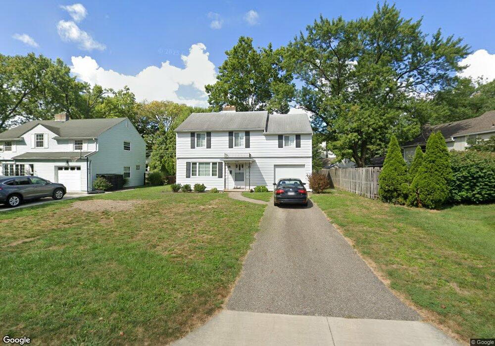
1869 Ashland Ave Columbus, OH 43212
Estimated Value: $526,000 - $615,000
3
Beds
2
Baths
1,500
Sq Ft
$382/Sq Ft
Est. Value
About This Home
This home is located at 1869 Ashland Ave, Columbus, OH 43212 and is currently estimated at $572,280, approximately $381 per square foot. 1869 Ashland Ave is a home located in Franklin County with nearby schools including Barrington Road Elementary School, Jones Middle School, and Upper Arlington High School.
Ownership History
Date
Name
Owned For
Owner Type
Purchase Details
Closed on
Jan 23, 2012
Sold by
Maher Mary Ann and Maher Thomas P
Bought by
Maher Mary Ann and Maher Thomas P
Current Estimated Value
Purchase Details
Closed on
Jan 13, 2012
Sold by
Maher George H
Bought by
Maher Thomas P and Maher Mary Ann
Purchase Details
Closed on
Jan 12, 2012
Sold by
Maher William T
Bought by
Maher Thomas P and Maher Mary Ann
Purchase Details
Closed on
Jan 11, 2012
Sold by
Maher Robert M
Bought by
Maher Thomas P and Maher Mary Ann
Purchase Details
Closed on
Jan 9, 2012
Sold by
Estate Of Margaret A Maher
Bought by
Maher Robert M and Maher Mary Ann
Purchase Details
Closed on
Aug 11, 1964
Bought by
Maher Margaret A
Create a Home Valuation Report for This Property
The Home Valuation Report is an in-depth analysis detailing your home's value as well as a comparison with similar homes in the area
Home Values in the Area
Average Home Value in this Area
Purchase History
| Date | Buyer | Sale Price | Title Company |
|---|---|---|---|
| Maher Mary Ann | -- | None Available | |
| Maher Thomas P | $30,000 | None Available | |
| Maher Thomas P | $30,000 | None Available | |
| Maher Thomas P | $30,000 | None Available | |
| Maher Thomas P | $30,000 | None Available | |
| Maher Robert M | -- | None Available | |
| Maher Robert M | -- | None Available | |
| Maher Margaret A | -- | -- |
Source: Public Records
Tax History Compared to Growth
Tax History
| Year | Tax Paid | Tax Assessment Tax Assessment Total Assessment is a certain percentage of the fair market value that is determined by local assessors to be the total taxable value of land and additions on the property. | Land | Improvement |
|---|---|---|---|---|
| 2024 | $11,396 | $196,850 | $113,650 | $83,200 |
| 2023 | $11,255 | $196,840 | $113,645 | $83,195 |
| 2022 | $7,322 | $104,790 | $41,860 | $62,930 |
| 2021 | $6,482 | $104,790 | $41,860 | $62,930 |
| 2020 | $6,425 | $104,790 | $41,860 | $62,930 |
| 2019 | $6,531 | $94,190 | $41,860 | $52,330 |
| 2018 | $5,822 | $94,190 | $41,860 | $52,330 |
| 2017 | $5,818 | $94,190 | $41,860 | $52,330 |
| 2016 | $5,154 | $77,950 | $33,780 | $44,170 |
| 2015 | $5,149 | $77,950 | $33,780 | $44,170 |
| 2014 | $5,155 | $77,950 | $33,780 | $44,170 |
| 2013 | $2,461 | $70,840 | $30,695 | $40,145 |
Source: Public Records
Map
Nearby Homes
- 1825 Northwest Ct Unit D
- 1733 Elmwood Ave
- 1398 Lower Green Cir Unit 1398
- 1782 Wyandotte Rd
- 1661 Ashland Ave Unit 663
- 1655-1657 Ashland Ave
- 2110 Northwest Blvd
- 1364 W 7th Ave
- 1535 Doone Rd
- 1561 Glenn Ave
- 00 W 7th Ave
- 1459 Elmwood Ave Unit 1459
- 1565 Berkshire Rd
- 2015 W 5th Ave Unit 211
- 2015 W 5th Ave Unit 102
- 2015 W 5th Ave Unit 108
- 1869 Tewksbury Rd
- 1126 King Ave Unit 128
- 1475 W 3rd Ave Unit 204
- 1631 Roxbury Rd Unit A1
- 1861 Ashland Ave
- 1589 Stanford Rd
- 1853 Ashland Ave
- 1601 Stanford Rd
- 1868 Elmwood Ave
- 1868 Elmwood Ave
- 1860 Elmwood Ave
- 1845 Ashland Ave
- 1850 Elmwood Ave
- 1850 Ashland Ave Unit 852
- 1837 Ashland Ave
- 1900 Elmwood Ave
- 1578 Stanford Rd
- 1842 Ashland Ave
- 1842 Elmwood Ave
- 1875 Elmwood Ave
- 1829 Ashland Ave
- 1568 Stanford Rd
- 1865 Elmwood Ave
- 1834 Ashland Ave