NOT LISTED FOR SALE

187 Crooked Rock Path Como, CO 80432

Estimated Value: $49,660 - $64,000

4.26 Acres
$12,962 Price per Acre
185,566 Sq Ft Lot

Last Sold August 09, 2018

Last sale price $34,000

Est. 62% increase in value since last sale

Current estimated payment $381/month

167 Days on Market

About This Lot

As of August 2018

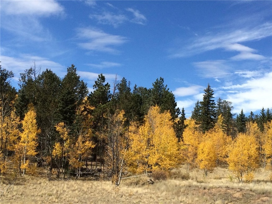
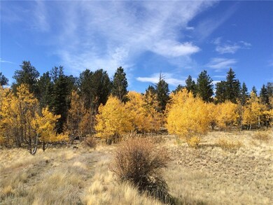
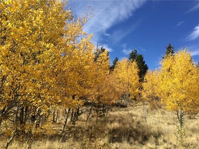
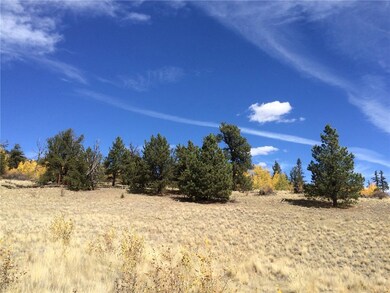
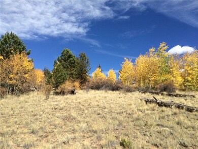
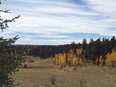
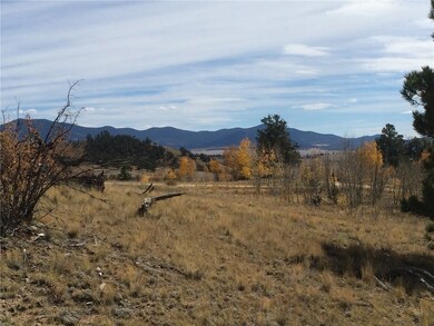
Trees - YES. Power - YES. Phone - YES. Great site with tons of trees and privacy!! Take this property and build your dream escape in the Rockies or set up camp. 4.26 acres that sits less than 5 mins from National Forest! L125 BU F3

Last Agent to Sell the Property

Kevin Copeland

Jefferson Real Estate, Inc. License #ER40013473 Listed on: 01/23/2018

Last Buyer's Agent

Jeremy Root

High Ridge Realty, LLC License #FA100077430

Property Details

Property Type

  • Land

Est. Annual Taxes

  • $140

Lot Details

  • 4.26 Acre Lot
  • Zoning described as Residential Rural

HOA Fees

  • $3 Monthly HOA Fees

Property Views

  • Mountain
  • Meadow

Utilities

  • Propane
  • Well
  • Septic Needed
  • Phone Available
  • Satellite Dish

Community Details

  • Buffalo Subdivision

Listing and Financial Details

  • Assessor Parcel Number 1196

Property Details

Property Type

Land

Est. Annual Taxes

$140

Lot Details

0

HOA Fees

$3 per month

Listing Details

  • Property Sub Type: Unimproved Land
  • Prop. Type: Land
  • Lot Size Acres: 4.26
  • Subdivision Name: BUFFALO (PARK CNTY)
  • Directions: Take CR 15 S, Veer R at the Firehouse. Go another 9 miles to Remington. L @ Remington, 3.6 miles to Crooked Rock Path. Take a L property on the L @ 600'
  • Property Sub Type Additional: Unimproved Land
  • Special Features: None

Interior Features

  • Other Equipment: Satellite Dish

Exterior Features

  • Lot Features: See Remarks
  • View: Meadow, Mountain(s)
  • View: Yes
  • Exclusions: No

Utilities

  • Sewer: Septic Needed
  • Utilities: Electricity Available, Propane, Phone Available, Trash Collection
  • Water Source: Well

Condo/Co-op/Association

  • Association Fee: 40.0
  • Association Fee Frequency: Annually

Fee Information

  • Association Fee Includes: See Remarks

Lot Info

  • Land Lease: No
  • Lot Size Sq Ft: 185565.6
  • Parcel #: 1196
  • Zoning Description: Residential Rural

Tax Info

  • Tax Annual Amount: 140.21
  • Tax Year: 2016

Ownership History

Date Name Owned For Owner Type

Purchase Details

Listed on
Jan 23, 2018
Closed on
Jul 31, 2018
Sold by
Witt Gerald William and Witt Carole Elaine
Bought by
Norton Ryan G and Norton Bradley T
Seller's Agent
Kevin Copeland
Jefferson Real Estate, Inc.
Buyer's Agent
Jeremy Root
High Ridge Realty, LLC
List Price
$34,000
Sold Price
$34,000
Current Estimated Value
$55,220

Home Financials for this Owner

Home Financials are based on the most recent Mortgage that was taken out on this home.
Estimated Appreciation
$21,220
Avg. Annual Appreciation
8.43%
Source: Public Records

Range of Values:

Collateral Analytics

Collateral Analytics Collateral Analytics AVMs (Automated Valuation Model) employ a number of statistical approaches combined with neighborhood-specific comparable selection guarantees the most up-to-date and precise valuations.

Not Available

Collateral Analytics does not have data for the current month. Please view the chart for historical values.

ICE

ICE Mortgage Technology ICE Mortgage Technology’s AVM (Automated Valuation Model) is a state-of-the-art online residential property valuation tool that provides a quick and accurate estimate of the value of almost any home in the U.S.

Not Available

ICE Mortgage Technology does not have data for the current month. Please view the chart for historical values.

First American

First American First American Data & Analytics’ next-generation AVM combines unrivaled data assets with a blended ensemble of valuation models to produce highly accurate, reliable valuations you can trust.

Not Available

First American does not have data for the current month. Please view the chart for historical values.

Quantarium

Quantarium Quantarium’s valuation service, repeatedly proven the industry’s most accurate and comprehensive, is supercharged with a self-learning and auto-tuning AI engine that continually becomes smarter and more accurate as it processes daily inputs from the industry’s leading RE data lake.

Not Available

Quantarium does not have data for the current month. Please view the chart for historical values.

Average Value
Not Available
List Price
Sold Price
Create a Home Valuation Report for This Property
The Home Valuation Report is an in-depth analysis detailing your home's value as well as a comparison with similar homes in the area

Home Values in the Area

Source: Public Records

Average Home Value in this Area


Source: Public Records

Purchase History

Date Buyer Sale Price Title Company
Norton Ryan G $34,000 Fidelity National Title
Source: Public Records

Property History

Date Event Price Change Sq Ft Price
08/09/2018 08/09/18 Sold $34,000 0.0% --
07/10/2018 07/10/18 Pending -- -- --
01/23/2018 01/23/18 For Sale $34,000 -- --
Source: Summit MLS

Tax History Compared to Growth

Source: Public Records

Tax History

Year Tax Paid Tax Assessment Tax Assessment Total Assessment is a certain percentage of the fair market value that is determined by local assessors to be the total taxable value of land and additions on the property. Land Improvement
2024 $876 $15,390 $15,390 $0
2023 $876 $16,001 $16,001 $0
2022 $510 $7,851 $7,851 $0
2021 $502 $7,851 $7,851 $0
2020 $237 $3,610 $3,610 $0
2019 $230 $3,610 $3,610 $0
2018 $204 $3,610 $3,610 $0
2017 $175 $3,130 $3,130 $0
2016 $140 $2,470 $2,470 $0
2015 $143 $2,470 $2,470 $0
2014 -- $0 $0 $0
Source: Public Records

Agents Affiliated with this Home

  • Section Image
See All Agents

Map

Source: Summit MLS

MLS Number: S1007728

Summit MLS

APN: 1196