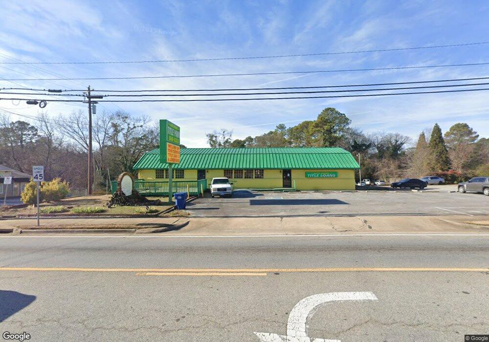
187 E May St Winder, GA 30680
Estimated Value: $900,838
Studio
--
Bath
3,400
Sq Ft
$265/Sq Ft
Est. Value
About This Home
This home is located at 187 E May St, Winder, GA 30680 and is currently estimated at $900,838, approximately $264 per square foot. 187 E May St is a home located in Barrow County with nearby schools including Kennedy Elementary School, Westside Middle School, and Apalachee High School.
Ownership History
Date
Name
Owned For
Owner Type
Purchase Details
Closed on
Feb 4, 2015
Sold by
Moneyline Properties Llc
Bought by
Moneyline Properties Of Ga Llc
Current Estimated Value
Purchase Details
Closed on
Dec 8, 2014
Sold by
Gebreyessys Mekdes
Bought by
Moneyline Properties Llc
Purchase Details
Closed on
Dec 4, 2012
Sold by
The Brand Banking Co
Bought by
The Brand Banking Co
Create a Home Valuation Report for This Property
The Home Valuation Report is an in-depth analysis detailing your home's value as well as a comparison with similar homes in the area
Home Values in the Area
Average Home Value in this Area
Purchase History
| Date | Buyer | Sale Price | Title Company |
|---|---|---|---|
| Moneyline Properties Of Ga Llc | -- | -- | |
| Moneyline Properties Llc | $375,000 | -- | |
| The Brand Banking Co | $191,901 | -- |
Source: Public Records
Tax History
| Year | Tax Paid | Tax Assessment Tax Assessment Total Assessment is a certain percentage of the fair market value that is determined by local assessors to be the total taxable value of land and additions on the property. | Land | Improvement |
|---|---|---|---|---|
| 2025 | $5,377 | $193,510 | $130,200 | $63,310 |
| 2024 | $5,471 | $193,510 | $130,200 | $63,310 |
| 2023 | $5,468 | $193,510 | $130,200 | $63,310 |
| 2022 | $6,599 | $193,510 | $130,200 | $63,310 |
| 2021 | $5,588 | $152,663 | $90,000 | $62,663 |
| 2020 | $5,240 | $152,663 | $90,000 | $62,663 |
| 2019 | $5,313 | $152,663 | $90,000 | $62,663 |
| 2018 | $5,208 | $149,853 | $90,000 | $59,853 |
| 2017 | $4,325 | $144,962 | $90,000 | $54,962 |
| 2016 | $4,529 | $135,564 | $90,000 | $45,564 |
| 2015 | $4,534 | $135,564 | $90,000 | $45,564 |
| 2014 | $3,525 | $104,440 | $50,400 | $54,040 |
| 2013 | -- | $96,055 | $44,100 | $51,955 |
Source: Public Records
Map
Nearby Homes
- 194 Graham St
- 34 Wade St
- 184 Capitol Ave
- 24 Richardson St
- 0 Gordon Ct Unit 10634940
- 88 E Stephens St
- 122 Capitol Ave
- 403 Corinth Church Rd
- 252 Eastbrook Dr
- 209 Georgia Ave
- 0 W Athens St Unit 10544465
- 0 Georgia Highway 211 Unit 7483562
- 208 Shields St
- 337 Mary Alice Dr
- 221 Martin Luther King jr Dr
- 18 E New St
- 1 W Kimball St
- 3 W Kimball St
- 5 W Kimball St
- 31 Huckleberry Ln
- 15 Savannah St
- 17 Savannah St
- 10 Savannah St
- 21 Savannah St
- 0 Atlanta Ave
- 0 Atlanta Ave Unit 7569721
- 0 Atlanta Ave Unit 8121249
- 0 Atlanta Ave Unit 8586888
- 0 Atlanta Ave Unit 8623353
- 0 Atlanta Ave Unit 8623363
- 0 Atlanta Ave Unit 8623377
- 0 Atlanta Ave Unit 8623358
- 20 Savannah St
- 18 Atlanta Ave
- 25 Savannah St
- 11 Atlanta Ave
- 213 E May St
- 19 Atlanta Ave
- 220 E Midland Ave
- 30 Atlanta Ave
Your Personal Tour Guide
Ask me questions while you tour the home.
