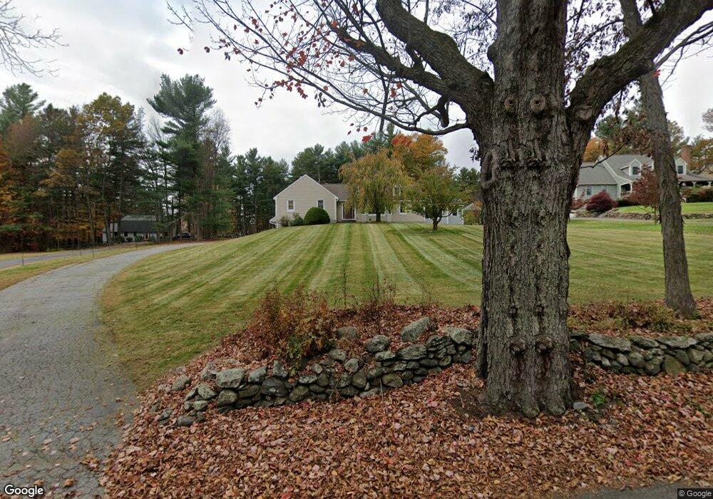
187 Fairbanks St West Boylston, MA 01583
Estimated Value: $663,000 - $841,893
3
Beds
3
Baths
2,158
Sq Ft
$341/Sq Ft
Est. Value
About This Home
This home is located at 187 Fairbanks St, West Boylston, MA 01583 and is currently estimated at $736,473, approximately $341 per square foot. 187 Fairbanks St is a home located in Worcester County with nearby schools including Major Edwards Elementary School and West Boylston Junior/Senior High School.
Ownership History
Date
Name
Owned For
Owner Type
Purchase Details
Closed on
Feb 23, 1993
Sold by
Stillwater Meadows Inc
Bought by
Gore Brian and Gore Susan M
Current Estimated Value
Home Financials for this Owner
Home Financials are based on the most recent Mortgage that was taken out on this home.
Original Mortgage
$65,000
Interest Rate
8.06%
Mortgage Type
Purchase Money Mortgage
Create a Home Valuation Report for This Property
The Home Valuation Report is an in-depth analysis detailing your home's value as well as a comparison with similar homes in the area
Home Values in the Area
Average Home Value in this Area
Purchase History
| Date | Buyer | Sale Price | Title Company |
|---|---|---|---|
| Gore Brian | $191,900 | -- |
Source: Public Records
Mortgage History
| Date | Status | Borrower | Loan Amount |
|---|---|---|---|
| Open | Gore Brian | $116,400 | |
| Closed | Gore Brian | $125,000 | |
| Closed | Gore Brian | $65,000 |
Source: Public Records
Tax History Compared to Growth
Tax History
| Year | Tax Paid | Tax Assessment Tax Assessment Total Assessment is a certain percentage of the fair market value that is determined by local assessors to be the total taxable value of land and additions on the property. | Land | Improvement |
|---|---|---|---|---|
| 2025 | $106 | $767,200 | $161,200 | $606,000 |
| 2024 | $10,512 | $711,200 | $163,400 | $547,800 |
| 2023 | $10,026 | $643,500 | $161,200 | $482,300 |
| 2022 | $9,400 | $531,700 | $161,200 | $370,500 |
| 2021 | $8,813 | $477,400 | $138,500 | $338,900 |
| 2020 | $8,601 | $462,900 | $138,500 | $324,400 |
| 2019 | $8,023 | $425,600 | $138,500 | $287,100 |
| 2018 | $6,078 | $408,200 | $138,500 | $269,700 |
| 2017 | $6,695 | $356,100 | $138,500 | $217,600 |
| 2016 | $6,616 | $358,600 | $131,100 | $227,500 |
| 2015 | $6,423 | $350,200 | $130,300 | $219,900 |
Source: Public Records
Map
Nearby Homes
- 21 Myrtle Ave
- 2 Lakeview Ave
- 4 Buttercup Ln
- 136 Sterling St Unit A3
- 101 Sterling St
- 12 Winthrop St
- 20 Winthrop St
- 0 Boutelle Rd
- 112 N Main St
- 16 N Main St
- 20 Holt St Unit G
- 223 Worcester Rd
- 61 Boutelle Rd
- 26 Townsend Dr
- 20 Woodside Dr
- 6 Belmont Dr
- 113 Newton St
- 64 Worcester St
- 19 James Rd
- 45 Kendall Hill Rd
- 193 Fairbanks St
- 181 Fairbanks St
- 183 Fairbanks St
- 199 Fairbanks St
- 200 Fairbanks St
- 211 Fairbanks St
- 180 Fairbanks St
- 212 Fairbanks St
- 215 Fairbanks St
- 166 Fairbanks St
- 221 Fairbanks St
- 155 Fairbanks St
- 164 Fairbanks St
- 220 Fairbanks St
- 326 Sterling St Unit C11
- 326 Sterling St Unit C10
- 326 Sterling St Unit C9
- 326 Sterling St Unit C8
- 326 Sterling St Unit C7
- 326 Sterling St Unit C6