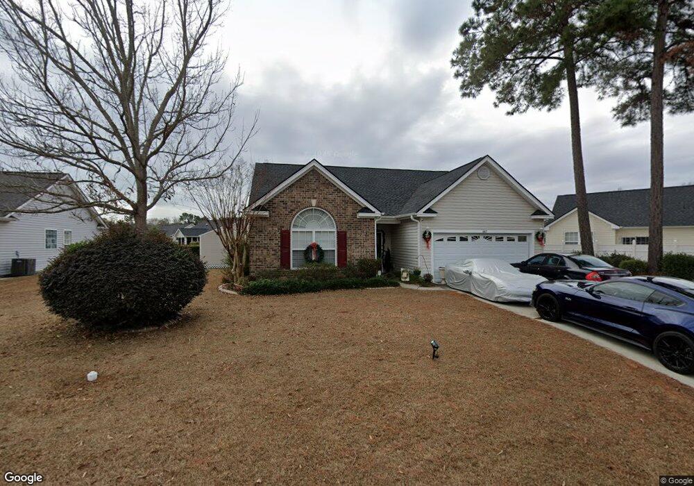
187 Governors Loop Myrtle Beach, SC 29588
Estimated Value: $275,000 - $312,000
3
Beds
2
Baths
1,576
Sq Ft
$185/Sq Ft
Est. Value
About This Home
This home is located at 187 Governors Loop, Myrtle Beach, SC 29588 and is currently estimated at $291,951, approximately $185 per square foot. 187 Governors Loop is a home located in Horry County with nearby schools including Socastee Elementary School, Forestbrook Middle School, and Socastee High School.
Ownership History
Date
Name
Owned For
Owner Type
Purchase Details
Closed on
Sep 2, 2005
Sold by
H & H Properties Llc
Bought by
Norman Shiraid L
Current Estimated Value
Home Financials for this Owner
Home Financials are based on the most recent Mortgage that was taken out on this home.
Original Mortgage
$9,495
Outstanding Balance
$4,928
Interest Rate
5.77%
Mortgage Type
Credit Line Revolving
Estimated Equity
$287,023
Purchase Details
Closed on
Mar 4, 2005
Sold by
Independent Builders Development Inc
Bought by
H & H Properties Llc
Create a Home Valuation Report for This Property
The Home Valuation Report is an in-depth analysis detailing your home's value as well as a comparison with similar homes in the area
Home Values in the Area
Average Home Value in this Area
Purchase History
| Date | Buyer | Sale Price | Title Company |
|---|---|---|---|
| Norman Shiraid L | $189,900 | -- | |
| H & H Properties Llc | $190,000 | -- |
Source: Public Records
Mortgage History
| Date | Status | Borrower | Loan Amount |
|---|---|---|---|
| Open | Norman Shiraid L | $9,495 | |
| Open | Norman Shiraid L | $151,920 |
Source: Public Records
Tax History
| Year | Tax Paid | Tax Assessment Tax Assessment Total Assessment is a certain percentage of the fair market value that is determined by local assessors to be the total taxable value of land and additions on the property. | Land | Improvement |
|---|---|---|---|---|
| 2025 | $557 | $0 | $0 | $0 |
| 2024 | $557 | $11,640 | $2,633 | $9,007 |
| 2023 | $557 | $6,166 | $1,511 | $4,655 |
| 2021 | $673 | $7,672 | $1,596 | $6,076 |
| 2020 | $581 | $7,672 | $1,596 | $6,076 |
| 2019 | $581 | $7,672 | $1,596 | $6,076 |
| 2018 | $525 | $5,361 | $1,313 | $4,048 |
| 2017 | $510 | $5,361 | $1,313 | $4,048 |
| 2016 | -- | $5,361 | $1,313 | $4,048 |
| 2015 | $519 | $5,362 | $1,314 | $4,048 |
| 2014 | $481 | $5,362 | $1,314 | $4,048 |
Source: Public Records
Map
Nearby Homes
- TBD W Oak Circle Dr
- 188 Governors Loop
- 1412 Reid Ct
- 811 Luttie Rd
- 245 Colby Ct
- 244 Colby Ct
- 708 Luttie Rd
- 31 Smith Blvd
- 13 Smith Blvd
- 525 Sims Dr Unit MB
- 240 Foxpath Loop
- 252 Stonebrook Dr
- 101 Horizon River Dr Unit H8
- 53 Smith Blvd
- 111 Horizon River Dr Unit F-8
- 3704 Chapel Ln
- 104 Meredith Ct Unit 104 Meredith Court
- 4101 John Luther Rd
- 66 Smith Blvd
- 202 Luttie Rd
- 183 Governors Loop
- 564 W Oak Circle Dr
- 560 W Oak Circle Dr
- 204 Governors Loop
- 179 Governors Loop
- 556 W Oak Circle Dr
- 184 Governors Loop
- Lot 172 W Oak Cir
- Lot 165 W Oak Cir
- Lot 164 W Oak Cir
- Lot 163 W Oak Cir
- Lot 145 W Oak Circle Dr
- 568 W Oak Circle Dr
- 192 Governors Loop
- 192 Governors Loop Unit Lawsons Landing
- 180 Governors Loop
- 565 W Oak Circle Dr
- 552 W Oak Circle Dr
- 561 W Oak Circle Dr
- 175 Governors Loop
Your Personal Tour Guide
Ask me questions while you tour the home.