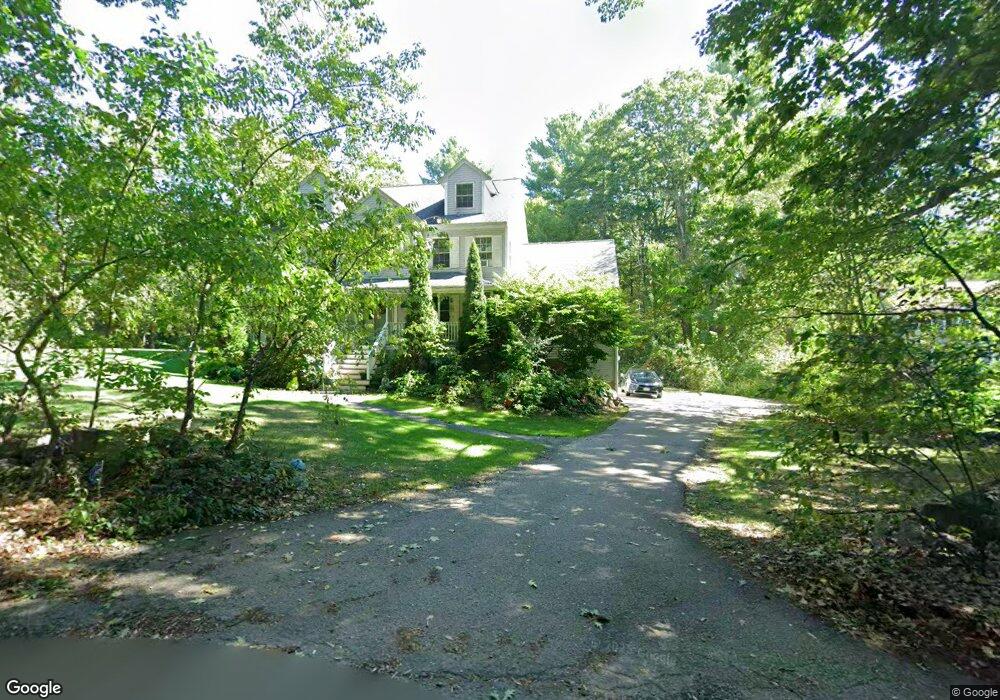
187 Hardy St Dunstable, MA 01827
Estimated Value: $776,000 - $931,000
3
Beds
3
Baths
2,548
Sq Ft
$334/Sq Ft
Est. Value
About This Home
This home is located at 187 Hardy St, Dunstable, MA 01827 and is currently estimated at $850,098, approximately $333 per square foot. 187 Hardy St is a home located in Middlesex County with nearby schools including Groton Dunstable Regional High School and World Academy.
Ownership History
Date
Name
Owned For
Owner Type
Purchase Details
Closed on
Apr 29, 2004
Sold by
Hardy St Rt
Bought by
Woytaszek Thomas and Deangelis-Woytaszek Robyn
Current Estimated Value
Home Financials for this Owner
Home Financials are based on the most recent Mortgage that was taken out on this home.
Original Mortgage
$440,000
Outstanding Balance
$204,264
Interest Rate
5.36%
Mortgage Type
Purchase Money Mortgage
Estimated Equity
$645,834
Purchase Details
Closed on
Aug 21, 2003
Sold by
Melendy Inc
Bought by
Hardy Street Rt and Deptula Francis J
Home Financials for this Owner
Home Financials are based on the most recent Mortgage that was taken out on this home.
Original Mortgage
$371,000
Interest Rate
5.52%
Mortgage Type
Purchase Money Mortgage
Create a Home Valuation Report for This Property
The Home Valuation Report is an in-depth analysis detailing your home's value as well as a comparison with similar homes in the area
Home Values in the Area
Average Home Value in this Area
Purchase History
| Date | Buyer | Sale Price | Title Company |
|---|---|---|---|
| Woytaszek Thomas | $555,000 | -- | |
| Hardy Street Rt | $197,000 | -- |
Source: Public Records
Mortgage History
| Date | Status | Borrower | Loan Amount |
|---|---|---|---|
| Open | Woytaszek Thomas | $440,000 | |
| Previous Owner | Hardy Street Rt | $371,000 |
Source: Public Records
Tax History
| Year | Tax Paid | Tax Assessment Tax Assessment Total Assessment is a certain percentage of the fair market value that is determined by local assessors to be the total taxable value of land and additions on the property. | Land | Improvement |
|---|---|---|---|---|
| 2025 | $10,194 | $741,400 | $214,400 | $527,000 |
| 2024 | $9,906 | $709,600 | $209,200 | $500,400 |
| 2023 | $9,811 | $655,400 | $209,200 | $446,200 |
| 2022 | $9,055 | $593,800 | $209,200 | $384,600 |
| 2021 | $19,571 | $544,500 | $185,400 | $359,100 |
| 2020 | $0 | $521,300 | $177,200 | $344,100 |
| 2019 | $8,545 | $500,900 | $177,200 | $323,700 |
| 2018 | $8,340 | $475,500 | $176,200 | $299,300 |
| 2017 | $8,076 | $474,500 | $176,200 | $298,300 |
| 2016 | $7,400 | $447,100 | $151,700 | $295,400 |
| 2015 | $7,560 | $451,900 | $148,500 | $303,400 |
| 2014 | $7,126 | $451,900 | $148,500 | $303,400 |
Source: Public Records
Map
Nearby Homes
- 6 Green Heron Ln Unit U22
- 38 Georgetown Dr
- 20 Georgetown Dr
- 4 Strawberry Bank Rd Unit 12
- 4 Heritage Village Dr
- 2 Strawberry Bank Rd Unit 17
- 11 Lojko Dr
- 210 Brook Village Rd Unit U43
- 210 Brook Village Rd Unit U38
- 4 Lisa Dr
- 4 Thorndike St
- 8 Wilderness Dr
- 58 Wilderness Dr
- 65 Wilderness Dr
- 8 Hikers Ln
- 4 Hikers Ln
- 4 Wilderness Dr
- 1 Wilderness Dr
- 79 Wilderness Dr
- 2 Wilderness Dr
- 177 Hardy St
- 182 Hardy St
- 217 Hardy St
- 167 Hardy St
- 167 Hardy St Unit 1
- 172 Hardy St
- 157 Hardy St
- 166 Hardy St
- 166 Hardy St Unit 1
- 410 E Dunstable Rd
- 401 E Dunstable Rd
- 7 Southgate Dr
- L Southgate Dr
- 147 Hardy St
- 9 Southgate Dr
- 400 E Dunstable Rd
- 2 Southgate Dr
- 130 Hardy St
- 4 Southgate Dr
- 397 E Dunstable Rd
Your Personal Tour Guide
Ask me questions while you tour the home.