Estimated Value: $810,241 - $911,000
3
Beds
3
Baths
2,314
Sq Ft
$368/Sq Ft
Est. Value
About This Home
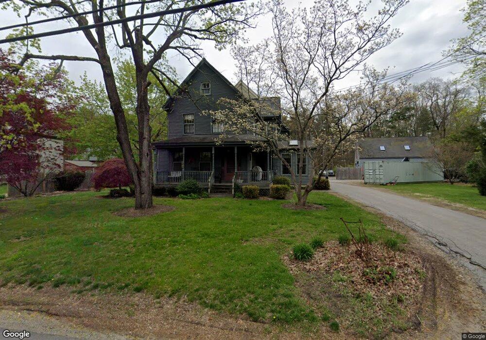
This home is located at 187 Main St, Acton, MA 01720 and is currently estimated at $852,560, approximately $368 per square foot. 187 Main St is a home located in Middlesex County with nearby schools including Acton-Boxborough Regional High School, Maynard Knowledge Beginnings, and The Imago School.
Ownership History
Date
Name
Owned For
Owner Type
Purchase Details
Closed on
Jan 2, 2009
Sold by
Merrill Ernest O
Bought by
Ernest O Merrill Lt and Merrill Ernest O
Current Estimated Value
Purchase Details
Closed on
Jun 2, 2003
Sold by
Merrill Rose M and Merrill Ernest O
Bought by
Merrill Ernest O
Home Financials for this Owner
Home Financials are based on the most recent Mortgage that was taken out on this home.
Original Mortgage
$323,000
Interest Rate
5.86%
Purchase Details
Closed on
Jul 30, 1999
Sold by
Cobleigh William L
Bought by
Merrill Ernest O and Merrill Rose M
Create a Home Valuation Report for This Property
The Home Valuation Report is an in-depth analysis detailing your home's value as well as a comparison with similar homes in the area
Home Values in the Area
Average Home Value in this Area
Purchase History
| Date | Buyer | Sale Price | Title Company |
|---|---|---|---|
| Ernest O Merrill Lt | -- | -- | |
| Merrill Ernest O | -- | -- | |
| Merrill Ernest O | $25,000 | -- |
Source: Public Records
Mortgage History
| Date | Status | Borrower | Loan Amount |
|---|---|---|---|
| Previous Owner | Merrill Ernest O | $323,000 | |
| Previous Owner | Merrill Ernest O | $120,000 |
Source: Public Records
Tax History Compared to Growth
Tax History
| Year | Tax Paid | Tax Assessment Tax Assessment Total Assessment is a certain percentage of the fair market value that is determined by local assessors to be the total taxable value of land and additions on the property. | Land | Improvement |
|---|---|---|---|---|
| 2025 | $11,317 | $659,900 | $280,700 | $379,200 |
| 2024 | $11,301 | $677,900 | $280,700 | $397,200 |
| 2023 | $11,230 | $639,500 | $255,300 | $384,200 |
| 2022 | $10,919 | $561,400 | $222,000 | $339,400 |
| 2021 | $10,611 | $524,500 | $205,600 | $318,900 |
| 2020 | $10,199 | $530,100 | $205,600 | $324,500 |
| 2019 | $9,685 | $500,000 | $205,600 | $294,400 |
| 2018 | $9,580 | $494,300 | $205,600 | $288,700 |
| 2017 | $9,242 | $484,900 | $205,600 | $279,300 |
| 2016 | $9,180 | $477,400 | $205,600 | $271,800 |
| 2015 | $8,845 | $464,300 | $195,400 | $268,900 |
| 2014 | $8,671 | $445,800 | $195,400 | $250,400 |
Source: Public Records
Map
Nearby Homes
- 169 Main St
- 129 Main St Unit 129
- 129 Main St
- 131 Main St
- 19 Railroad St Unit C2
- 86 School St
- 40 High St
- 8 Laurel Ct
- 128 Audubon Dr
- 70 River St
- 5 Oakwood Rd
- 4,7,8 Crestwood Ln
- 12 Brewster Ln
- 89 Windsor Ave
- 25 Main St
- 90 Willow St Unit 1
- 92 Willow St Unit 3
- 92 Willow St Unit 2
- 2 Clover Hill Rd
- 285 Central St Unit 285