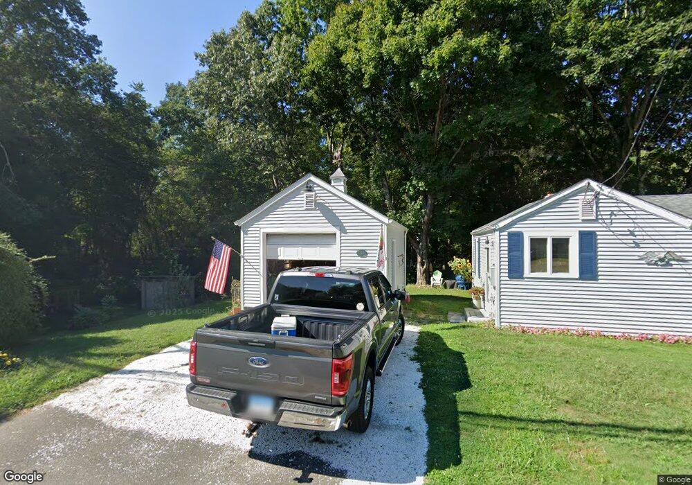
187 Pond Meadow Rd Westbrook, CT 06498
Estimated Value: $205,000 - $257,000
1
Bed
1
Bath
500
Sq Ft
$458/Sq Ft
Est. Value
About This Home
This home is located at 187 Pond Meadow Rd, Westbrook, CT 06498 and is currently estimated at $228,859, approximately $457 per square foot. 187 Pond Meadow Rd is a home located in Middlesex County with nearby schools including Daisy Ingraham School, Westbrook Middle School, and Westbrook High School.
Ownership History
Date
Name
Owned For
Owner Type
Purchase Details
Closed on
Nov 3, 1997
Sold by
Mansfield Daniel L and Mansfield Sandra R
Bought by
Dmytruch Elizabeth A
Current Estimated Value
Home Financials for this Owner
Home Financials are based on the most recent Mortgage that was taken out on this home.
Original Mortgage
$73,000
Interest Rate
7.31%
Mortgage Type
Purchase Money Mortgage
Create a Home Valuation Report for This Property
The Home Valuation Report is an in-depth analysis detailing your home's value as well as a comparison with similar homes in the area
Home Values in the Area
Average Home Value in this Area
Purchase History
| Date | Buyer | Sale Price | Title Company |
|---|---|---|---|
| Dmytruch Elizabeth A | $72,900 | -- |
Source: Public Records
Mortgage History
| Date | Status | Borrower | Loan Amount |
|---|---|---|---|
| Closed | Dmytruch Elizabeth A | $78,000 | |
| Closed | Dmytruch Elizabeth A | $73,000 | |
| Previous Owner | Dmytruch Elizabeth A | $42,341 | |
| Previous Owner | Dmytruch Elizabeth A | $55,500 |
Source: Public Records
Tax History Compared to Growth
Tax History
| Year | Tax Paid | Tax Assessment Tax Assessment Total Assessment is a certain percentage of the fair market value that is determined by local assessors to be the total taxable value of land and additions on the property. | Land | Improvement |
|---|---|---|---|---|
| 2025 | $2,806 | $124,690 | $67,520 | $57,170 |
| 2024 | $2,706 | $124,690 | $67,520 | $57,170 |
| 2023 | $2,658 | $124,690 | $67,520 | $57,170 |
| 2022 | $2,589 | $124,690 | $67,520 | $57,170 |
| 2021 | $2,109 | $84,370 | $35,810 | $48,560 |
| 2020 | $2,109 | $84,370 | $35,810 | $48,560 |
| 2019 | $2,081 | $84,370 | $35,810 | $48,560 |
| 2018 | $2,056 | $84,370 | $35,810 | $48,560 |
| 2017 | $2,056 | $84,370 | $35,810 | $48,560 |
| 2016 | $2,125 | $91,840 | $38,370 | $53,470 |
| 2015 | $2,067 | $91,840 | $38,370 | $53,470 |
| 2014 | $2,003 | $91,920 | $38,370 | $53,550 |
Source: Public Records
Map
Nearby Homes
- 11a/11b Pond Circle Rd
- 1110 Old Clinton Rd
- 87 McVeagh Rd
- 951 Old Clinton Rd Unit 15
- 30 Dowd Rd
- 912 Boston Post Rd
- 49 Seaside Ave
- 41 Trolley Rd
- 29 Salt Island Rd
- 166 Fiske Ln
- 155 Fawn Hill Dr
- 610 Marina Way Landing Unit 610
- 0 Boston Post Rd Unit 24080344
- 821 Essex Rd
- 321 Old Clinton Rd
- 8 Cook Terrace
- 86 Grove Beach Rd N
- 448 A - B Grove Beach Rd N
- 407 Grove Beach Rd N
- 51 Linden Ave N
- 21 Bushnell Ln
- 186 Pond Meadow Rd
- 177 Pond Meadow Rd
- 165 Pond Meadow Rd
- 51 Bushnell Ln
- 235 Pond Meadow Rd
- 143 Pond Meadow Rd
- 30 Pond Meadow Rd
- 232 Pond Meadow Rd
- 247 Pond Meadow Rd
- 240 Pond Meadow Rd
- 248 Pond Meadow Rd
- 71 Bushnell Ln
- 117 Pond Meadow Rd
- 1202 Old Clinton Rd
- 1218 Old Clinton Rd
- 1190 Old Clinton Rd
- 258 Pond Meadow Rd
- 1180 Old Clinton Rd
- 1170 Old Clinton Rd