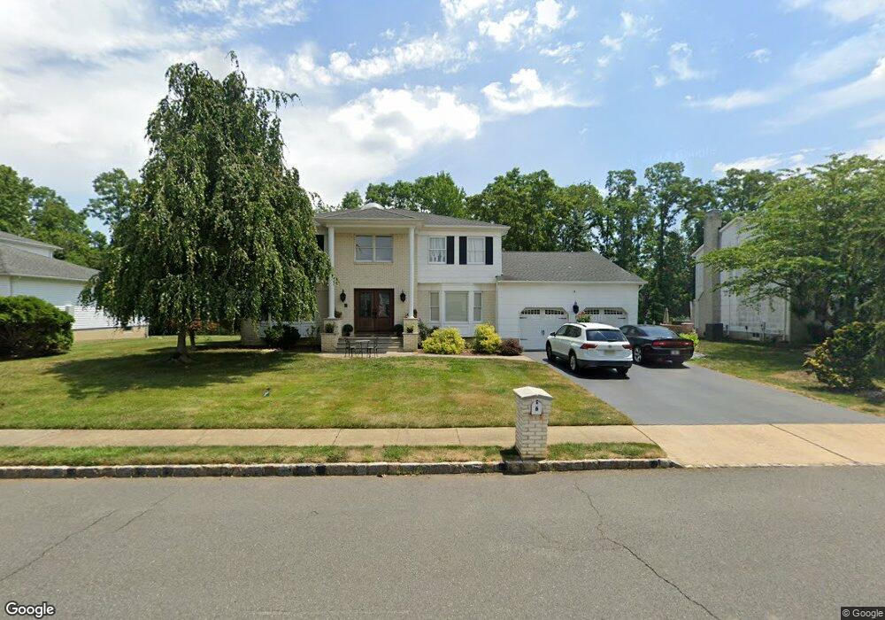
187 State Route 79 N Marlboro, NJ 07746
Estimated Value: $425,000 - $1,061,000
4
Beds
2
Baths
1,971
Sq Ft
$354/Sq Ft
Est. Value
About This Home
This home is located at 187 State Route 79 N, Marlboro, NJ 07746 and is currently estimated at $698,147, approximately $354 per square foot. 187 State Route 79 N is a home located in Monmouth County with nearby schools including Frank Defino Central Elementary School, Marlboro Memorial Middle School, and Marlboro High School.
Ownership History
Date
Name
Owned For
Owner Type
Purchase Details
Closed on
Aug 9, 2019
Sold by
Moriarty Karen M and Fitzgerlad William T
Bought by
Moriarty Karen M and Fitzgerald William
Current Estimated Value
Purchase Details
Closed on
May 1, 1984
Bought by
Fitzgerald William T and Fitzgerald Lorraine C
Create a Home Valuation Report for This Property
The Home Valuation Report is an in-depth analysis detailing your home's value as well as a comparison with similar homes in the area
Home Values in the Area
Average Home Value in this Area
Purchase History
| Date | Buyer | Sale Price | Title Company |
|---|---|---|---|
| Moriarty Karen M | -- | None Available | |
| Fitzgerald William T | $95,000 | -- |
Source: Public Records
Tax History Compared to Growth
Tax History
| Year | Tax Paid | Tax Assessment Tax Assessment Total Assessment is a certain percentage of the fair market value that is determined by local assessors to be the total taxable value of land and additions on the property. | Land | Improvement |
|---|---|---|---|---|
| 2025 | $5,841 | $231,500 | $97,200 | $134,300 |
| 2024 | $5,588 | $231,500 | $97,200 | $134,300 |
| 2023 | $5,588 | $231,500 | $97,200 | $134,300 |
| 2022 | $5,431 | $231,500 | $97,200 | $134,300 |
| 2021 | $5,357 | $231,500 | $97,200 | $134,300 |
| 2020 | $5,352 | $231,500 | $97,200 | $134,300 |
| 2019 | $5,357 | $231,500 | $97,200 | $134,300 |
| 2018 | $5,264 | $231,500 | $97,200 | $134,300 |
| 2017 | $5,162 | $231,500 | $97,200 | $134,300 |
| 2016 | $5,142 | $231,500 | $97,200 | $134,300 |
| 2015 | $4,989 | $228,000 | $97,200 | $130,800 |
| 2014 | $5,094 | $230,300 | $114,200 | $116,100 |
Source: Public Records
Map
Nearby Homes
- 193 Highway 79
- 157 Route 520
- 50 Shawnee Way
- 16 Pleasant Valley Rd
- 222 Everton Blvd
- 138 Briarcliff Dr
- 219 Everton Blvd
- 1801 Wrangler Ave
- 142 Scarborough Way
- 30 Pleasant Valley Rd
- 333 Van Dusen Dr
- 211 Bradwick Way
- 108 Scarborough Way
- 18 Egret Ln
- 680 - 21.04 County Road 520
- 680 - 21.1 County Road 520
- 680 - 21.21 County Road 520
- 680 County Road 520
- 680 - 21.15 County Road 520
- 680 - 21.19 County Road 520
- 189 State Route 79 N
- 40 Cape May Dr
- 38 Cape May Dr
- 193 State Route 79 N
- 42 Cape May Dr
- 36 Cape May Dr
- 44 Cape May Dr
- 183 State Route 79 N
- 195 State Route 79 N
- 34 Cape May Dr
- 46 Cape May Dr
- 54 Burlington Dr
- 41 Cape May Dr
- 43 Cape May Dr
- 197 State Route 79 N
- 182 State Route 79 N
- 32 Cape May Dr
- 45 Cape May Dr
- 52 Burlington Dr