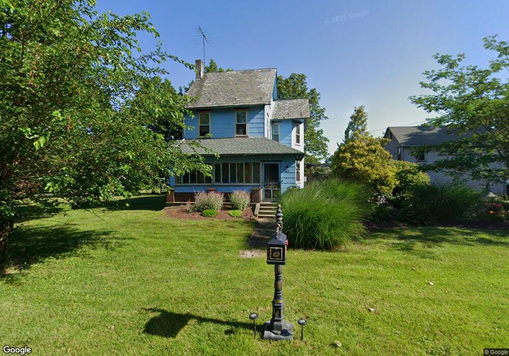
187 Station Ave Quakertown, PA 18951
Richland NeighborhoodEstimated Value: $348,250 - $464,000
4
Beds
1
Bath
1,816
Sq Ft
$221/Sq Ft
Est. Value
About This Home
This home is located at 187 Station Ave, Quakertown, PA 18951 and is currently estimated at $401,563, approximately $221 per square foot. 187 Station Ave is a home located in Bucks County with nearby schools including Richland Elementary School, Strayer Middle School, and Quakertown Community Senior High School.
Ownership History
Date
Name
Owned For
Owner Type
Purchase Details
Closed on
Jul 12, 1996
Sold by
Lyons David W and Lyons Penny L
Bought by
Lyons David W
Current Estimated Value
Home Financials for this Owner
Home Financials are based on the most recent Mortgage that was taken out on this home.
Original Mortgage
$109,800
Outstanding Balance
$7,247
Interest Rate
7.25%
Estimated Equity
$394,316
Purchase Details
Closed on
Nov 21, 1990
Bought by
Lyons David W and Lyons Penny L
Create a Home Valuation Report for This Property
The Home Valuation Report is an in-depth analysis detailing your home's value as well as a comparison with similar homes in the area
Home Values in the Area
Average Home Value in this Area
Purchase History
| Date | Buyer | Sale Price | Title Company |
|---|---|---|---|
| Lyons David W | -- | -- | |
| Lyons David W | $116,000 | -- |
Source: Public Records
Mortgage History
| Date | Status | Borrower | Loan Amount |
|---|---|---|---|
| Open | Lyons David W | $109,800 |
Source: Public Records
Tax History Compared to Growth
Tax History
| Year | Tax Paid | Tax Assessment Tax Assessment Total Assessment is a certain percentage of the fair market value that is determined by local assessors to be the total taxable value of land and additions on the property. | Land | Improvement |
|---|---|---|---|---|
| 2025 | $3,411 | $16,000 | $3,520 | $12,480 |
| 2024 | $3,411 | $16,000 | $3,520 | $12,480 |
| 2023 | $3,343 | $16,000 | $3,520 | $12,480 |
| 2022 | $3,289 | $16,000 | $3,520 | $12,480 |
| 2021 | $3,289 | $16,000 | $3,520 | $12,480 |
| 2020 | $3,289 | $16,000 | $3,520 | $12,480 |
| 2019 | $3,202 | $16,000 | $3,520 | $12,480 |
| 2018 | $3,096 | $16,000 | $3,520 | $12,480 |
| 2017 | $3,005 | $16,000 | $3,520 | $12,480 |
| 2016 | $3,005 | $16,000 | $3,520 | $12,480 |
| 2015 | -- | $16,000 | $3,520 | $12,480 |
| 2014 | -- | $16,000 | $3,520 | $12,480 |
Source: Public Records
Map
Nearby Homes
- 262 Fairview Ave
- 21 Beaver Run Dr
- 9 Maple St
- 141 S 2nd St
- 5 Essex Ct
- 1068 Freedom Ct
- 1033 Glen Manor Dr
- 1351 Creekside Ln
- 27 S 7th St
- 803 W Broad St
- 1133 Mariwill Dr
- 1142 Mariwill Dr
- 232 S 10th St
- 811 W Mill St
- 112 Jefferson Ct
- 92 Laurel Ct
- 1125 Arbour Ln
- 1086 Huntington Rd
- 2228 Blue Gill Dr Unit 54
- 1206 Arbor Ct
- 165 Hellertown St
- 228 Station Ave
- 240 Station Ave
- 145 Hellertown St
- 143 Hellertown St
- 184 Perkasie Ave
- 168 Hellertown St
- 186 Hellertown St
- 164 Perkasie Ave
- 156 Hellertown St
- 258 Station Ave
- 176 Hellertown St
- 135 Hellertown St
- 260 Station Ave
- 146 Perkasie Ave
- 121 Hellertown St
- 210 Perkasie Ave
- 248 Fairview Ave
- 224 Fairview Ave
- 161 Perkasie Ave