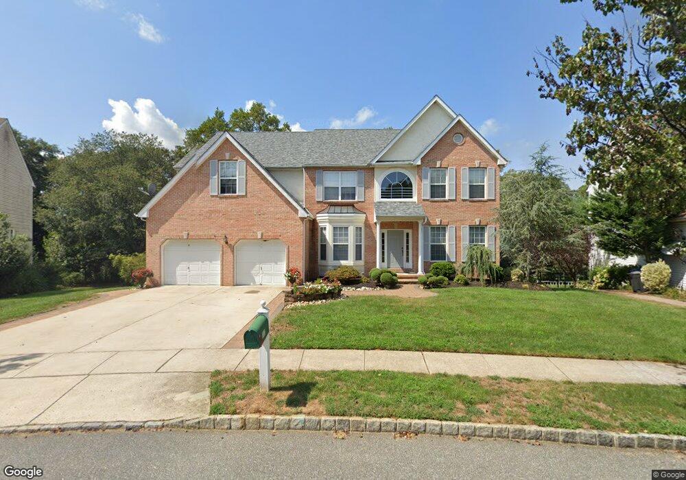
187 Yorktown Rd Swedesboro, NJ 08085
Woolwich Township NeighborhoodEstimated Value: $594,000 - $697,000
--
Bed
--
Bath
3,196
Sq Ft
$200/Sq Ft
Est. Value
About This Home
This home is located at 187 Yorktown Rd, Swedesboro, NJ 08085 and is currently estimated at $639,716, approximately $200 per square foot. 187 Yorktown Rd is a home located in Gloucester County with nearby schools including Margaret C Clifford School, Gov. Charles C. Stratton School, and Gen. Charles G. Harker School.
Ownership History
Date
Name
Owned For
Owner Type
Purchase Details
Closed on
Nov 14, 2011
Sold by
Vuong Hai
Bought by
Tran Kim Thu
Current Estimated Value
Purchase Details
Closed on
Aug 15, 2003
Sold by
Poplar Point Llc
Bought by
Vuong Hai
Home Financials for this Owner
Home Financials are based on the most recent Mortgage that was taken out on this home.
Original Mortgage
$180,000
Interest Rate
6.02%
Mortgage Type
Purchase Money Mortgage
Create a Home Valuation Report for This Property
The Home Valuation Report is an in-depth analysis detailing your home's value as well as a comparison with similar homes in the area
Home Values in the Area
Average Home Value in this Area
Purchase History
| Date | Buyer | Sale Price | Title Company |
|---|---|---|---|
| Tran Kim Thu | -- | None Available | |
| Vuong Hai | $270,000 | Title America Agency Corp |
Source: Public Records
Mortgage History
| Date | Status | Borrower | Loan Amount |
|---|---|---|---|
| Previous Owner | Vuong Hai | $180,000 |
Source: Public Records
Tax History Compared to Growth
Tax History
| Year | Tax Paid | Tax Assessment Tax Assessment Total Assessment is a certain percentage of the fair market value that is determined by local assessors to be the total taxable value of land and additions on the property. | Land | Improvement |
|---|---|---|---|---|
| 2025 | $14,413 | $429,200 | $59,600 | $369,600 |
| 2024 | $14,159 | $429,200 | $59,600 | $369,600 |
| 2023 | $14,159 | $429,200 | $59,600 | $369,600 |
| 2022 | $14,451 | $429,200 | $59,600 | $369,600 |
| 2021 | $14,747 | $429,200 | $59,600 | $369,600 |
| 2020 | $14,726 | $429,200 | $59,600 | $369,600 |
| 2019 | $13,942 | $371,200 | $59,600 | $311,600 |
| 2018 | $13,887 | $371,200 | $59,600 | $311,600 |
| 2017 | $13,616 | $371,200 | $59,600 | $311,600 |
| 2016 | $13,482 | $371,200 | $59,600 | $311,600 |
| 2015 | $13,174 | $371,200 | $59,600 | $311,600 |
| 2014 | $12,517 | $371,200 | $59,600 | $311,600 |
Source: Public Records
Map
Nearby Homes
- 114 Saratoga Ln
- 1406 Lexington Mews
- 1801 Lexington Mews
- 2501 Lexington Mews
- 2101 Lexington Mews
- 277 Wilshire Blvd
- 220 Wilshire Blvd
- 1030 Auburn Rd
- 1 Hylton Rd
- 4 Hylton Rd
- 95 Weston Dr
- 24 Brighton Place
- 105 Sammy St
- 1736 Kings Hwy
- 174 Spruce Trail
- 213 Dalton Dr
- 501 Sammy St
- 41 Buckeye Rd
- 607 Sammy St
- 1602 Kings Hwy
- 185 Yorktown Rd
- 189 Yorktown Rd
- 190 Yorktown Rd
- 188 Yorktown Rd
- 191 Yorktown Rd
- 183 Yorktown Rd
- 193 Yorktown Rd
- 184 Yorktown Rd
- 181 Yorktown Rd
- 192 Yorktown Rd
- 195 Yorktown Rd
- 179 Yorktown Rd
- 172 Yorktown Rd
- 158 Yorktown Rd
- 156 Yorktown Rd
- 194 Yorktown Rd
- 175 Yorktown Rd
- 150 Yorktown Rd
- 111 Saratoga Ln
- 109 Saratoga Ln