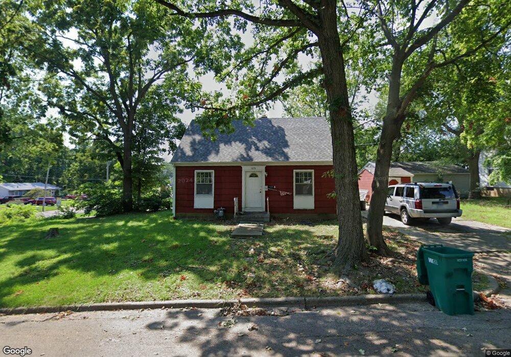
1870 E Cantrell St Unit 5 HOME PACKAGE Decatur, IL 62521
Lions Park NeighborhoodEstimated Value: $46,573 - $193,000
2
Beds
1
Bath
7,263
Sq Ft
$12/Sq Ft
Est. Value
About This Home
This home is located at 1870 E Cantrell St Unit 5 HOME PACKAGE, Decatur, IL 62521 and is currently estimated at $84,393, approximately $11 per square foot. 1870 E Cantrell St Unit 5 HOME PACKAGE is a home located in Macon County with nearby schools including Muffley Elementary School, Stephen Decatur Middle School, and Robertson Charter School.
Ownership History
Date
Name
Owned For
Owner Type
Purchase Details
Closed on
Jul 29, 2022
Sold by
Rudow Carla M
Bought by
Fhl Holdings Llc
Current Estimated Value
Purchase Details
Closed on
Mar 18, 2022
Sold by
Rudow Douglas G and Rudow Carla M
Bought by
Spirit Of Life Church
Purchase Details
Closed on
Sep 1, 2003
Create a Home Valuation Report for This Property
The Home Valuation Report is an in-depth analysis detailing your home's value as well as a comparison with similar homes in the area
Home Values in the Area
Average Home Value in this Area
Purchase History
| Date | Buyer | Sale Price | Title Company |
|---|---|---|---|
| Fhl Holdings Llc | $25,000 | Chiligiris Andrew P | |
| Fhl Holdings Llc | $25,000 | None Listed On Document | |
| Spirit Of Life Church | $150,000 | None Listed On Document | |
| -- | $24,000 | -- |
Source: Public Records
Tax History Compared to Growth
Tax History
| Year | Tax Paid | Tax Assessment Tax Assessment Total Assessment is a certain percentage of the fair market value that is determined by local assessors to be the total taxable value of land and additions on the property. | Land | Improvement |
|---|---|---|---|---|
| 2024 | $1,456 | $15,038 | $1,272 | $13,766 |
| 2023 | $1,444 | $14,506 | $1,227 | $13,279 |
| 2022 | $1,392 | $13,609 | $1,135 | $12,474 |
| 2021 | $1,336 | $12,982 | $1,060 | $11,922 |
| 2020 | $1,316 | $12,379 | $1,011 | $11,368 |
| 2019 | $1,316 | $12,379 | $1,011 | $11,368 |
| 2018 | $1,403 | $13,349 | $1,590 | $11,759 |
| 2017 | $1,436 | $13,705 | $1,632 | $12,073 |
| 2016 | $1,463 | $13,845 | $1,649 | $12,196 |
| 2015 | $1,390 | $13,600 | $1,620 | $11,980 |
| 2014 | $1,291 | $13,465 | $1,604 | $11,861 |
| 2013 | $1,334 | $13,970 | $1,664 | $12,306 |
Source: Public Records
Map
Nearby Homes
- 2039 E Whitmer St
- 632 S 17th St
- 2104 E Whitmer St
- 1155 S 20th St
- 1127 S 21st St
- 729 S 22nd St
- 1136 S 21st St
- 1952 Florida Ct
- 1764 E Johns Ave
- 1753 E Clay St
- 2152 E Decatur St
- 245 S 20th St
- 1605 E Clay St
- 1263 E Dickinson Ave
- 1645 E Wood St
- 2111 E Wood St
- 1656 E Wood St
- 1104 E Moore St
- 1232 E Johns Ave
- 1408 E Buena Vista Ave
- 1870 E Cantrell St
- 1860 E Cantrell St
- 775 S 19th St
- 1850 E Cantrell St
- 765 S 19th St
- 1840 E Cantrell St
- 759 S 19th St
- 1905 E Cantrell St
- 1865 E Cantrell St
- 1838 E Cantrell St
- 1855 E Cantrell St
- 1925 E Cantrell St
- 1855 E Moore St
- 1825 E Cantrell St
- 1849 E Moore St
- 1828 E Cantrell St
- 1898 E Moore St
- 1829 E Moore St
- 1818 E Cantrell St
- 1966 E Cantrell St