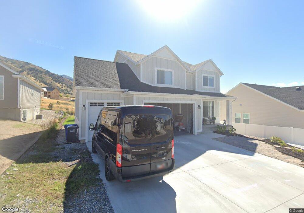
1870 Southpointe Ct Unit 68 Logan, UT 84341
Hillcrest NeighborhoodEstimated Value: $665,785 - $814,000
--
Bed
--
Bath
2,789
Sq Ft
$259/Sq Ft
Est. Value
About This Home
This home is located at 1870 Southpointe Ct Unit 68, Logan, UT 84341 and is currently estimated at $722,946, approximately $259 per square foot. 1870 Southpointe Ct Unit 68 is a home located in Cache County with nearby schools including Hillcrest Elementary School, Mount Logan Middle School, and Logan High School.
Ownership History
Date
Name
Owned For
Owner Type
Purchase Details
Closed on
Sep 28, 2021
Sold by
Folland Michael
Bought by
Folland Michael and He Shan
Current Estimated Value
Home Financials for this Owner
Home Financials are based on the most recent Mortgage that was taken out on this home.
Original Mortgage
$273,000
Outstanding Balance
$247,868
Interest Rate
2.8%
Mortgage Type
Credit Line Revolving
Estimated Equity
$475,078
Purchase Details
Closed on
Oct 7, 2020
Sold by
Suhaka Stephen J
Bought by
Folland Michael
Home Financials for this Owner
Home Financials are based on the most recent Mortgage that was taken out on this home.
Original Mortgage
$363,200
Interest Rate
2.9%
Mortgage Type
New Conventional
Purchase Details
Closed on
Mar 11, 2020
Sold by
Suhaka Stephen J
Bought by
Suhaka Stephen J
Home Financials for this Owner
Home Financials are based on the most recent Mortgage that was taken out on this home.
Original Mortgage
$315,000
Interest Rate
3.5%
Mortgage Type
Construction
Purchase Details
Closed on
Oct 2, 2019
Sold by
Solare Land Holdings Llc
Bought by
Suhaka Stephen J
Home Financials for this Owner
Home Financials are based on the most recent Mortgage that was taken out on this home.
Original Mortgage
$57,600
Interest Rate
3.5%
Mortgage Type
Balloon
Purchase Details
Closed on
Sep 15, 2006
Sold by
Deer Crest Heights Llc
Bought by
Solare Land Holdings Llc
Home Financials for this Owner
Home Financials are based on the most recent Mortgage that was taken out on this home.
Original Mortgage
$1,000,000
Interest Rate
6.56%
Mortgage Type
Construction
Purchase Details
Closed on
Mar 16, 2006
Sold by
Solare Land Holdings Llc
Bought by
Deer Crest Heights Llc
Home Financials for this Owner
Home Financials are based on the most recent Mortgage that was taken out on this home.
Original Mortgage
$3,889,433
Interest Rate
6.19%
Mortgage Type
Purchase Money Mortgage
Create a Home Valuation Report for This Property
The Home Valuation Report is an in-depth analysis detailing your home's value as well as a comparison with similar homes in the area
Home Values in the Area
Average Home Value in this Area
Purchase History
| Date | Buyer | Sale Price | Title Company |
|---|---|---|---|
| Folland Michael | -- | American Secure Ttl Brigham | |
| Folland Michael | -- | Advanced Title | |
| Suhaka Stephen J | -- | Advanced Title | |
| Suhaka Stephen J | -- | Pinnacle Title Ins Agcy Inc | |
| Solare Land Holdings Llc | -- | Heritage West Title | |
| Deer Crest Heights Llc | -- | Heritage West Title |
Source: Public Records
Mortgage History
| Date | Status | Borrower | Loan Amount |
|---|---|---|---|
| Open | Folland Michael | $273,000 | |
| Closed | Folland Michael | $363,200 | |
| Previous Owner | Suhaka Stephen J | $315,000 | |
| Previous Owner | Suhaka Stephen J | $57,600 | |
| Previous Owner | Solare Land Holdings Llc | $1,000,000 | |
| Previous Owner | Deer Crest Heights Llc | $3,889,433 |
Source: Public Records
Tax History Compared to Growth
Tax History
| Year | Tax Paid | Tax Assessment Tax Assessment Total Assessment is a certain percentage of the fair market value that is determined by local assessors to be the total taxable value of land and additions on the property. | Land | Improvement |
|---|---|---|---|---|
| 2025 | $3,061 | $395,840 | $0 | $0 |
| 2024 | $2,988 | $374,275 | $0 | $0 |
| 2023 | $3,126 | $373,285 | $0 | $0 |
| 2022 | $3,348 | $373,285 | $0 | $0 |
| 2021 | $3,240 | $558,100 | $65,000 | $493,100 |
| 2020 | $762 | $65,000 | $65,000 | $0 |
| 2019 | $797 | $65,000 | $65,000 | $0 |
| 2018 | $873 | $65,000 | $65,000 | $0 |
| 2017 | $908 | $65,000 | $0 | $0 |
| 2016 | $941 | $65,000 | $0 | $0 |
| 2015 | $942 | $65,000 | $0 | $0 |
| 2014 | $760 | $58,000 | $0 | $0 |
| 2013 | $751 | $58,000 | $0 | $0 |
Source: Public Records
Map
Nearby Homes
- 1901 Southpointe Ct
- 1586 N Sharptail Cir
- 1891 E 1500 N
- 1949 Deer Crest Cir Unit 49
- 1902 E 1500 N
- 1727 E 1500 N
- 1465 N Stonecrest Ln Unit 14
- 1451 N Aspen Dr
- 1405 N Aspen Dr
- 1872 N 1850 E
- 1810 N 2070 E Unit 10
- 1454 N 1400 E
- 2025 N 1550 E
- 1285 E 1600 N
- 1901 N 1380 E
- 1395 E Talmage Ln Unit 31
- 1374 N 1250 E
- Sydney Plan at Mountainside Estates
- Providence Plan at Mountainside Estates
- Maryland Plan at Mountainside Estates
- 1870 Southpointe Ct
- 1880 Southpointe Ct Unit 69
- 1860 Southpointe Ct Unit 67
- 1860 Southpointe Ct
- 1890 Southpointe Ct Unit 70
- 1890 Southpointe Ct
- 1879 Southpointe Ct Unit 64
- 1889 Southpointe Ct Unit 63
- 1889 Southpointe Ct
- 1599 N Sharptail Cir Unit 3
- 1859 Southpointe Ct
- 1900 Southpointe Ct Unit 71
- 1901 Southpointe Ct Unit 62
- 1910 Southpointe Ct Unit 72
- 1910 Southpointe Ct
- 1878 Northpointe Ct Unit 57
- 1878 Northpointe Ct
- 1868 Northpointe Ct
- 1868 Northpointe Ct Unit 25
- 1888 Northpointe Ct Unit 58