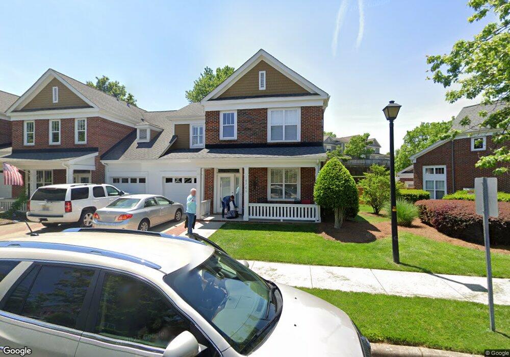
18706 Ramsey Cove Dr Unit 25 Cornelius, NC 28031
Estimated Value: $482,000 - $603,000
3
Beds
3
Baths
1,699
Sq Ft
$308/Sq Ft
Est. Value
About This Home
This home is located at 18706 Ramsey Cove Dr Unit 25, Cornelius, NC 28031 and is currently estimated at $523,548, approximately $308 per square foot. 18706 Ramsey Cove Dr Unit 25 is a home located in Mecklenburg County with nearby schools including J.V. Washam Elementary School, Bailey Middle School, and William Amos Hough High School.
Ownership History
Date
Name
Owned For
Owner Type
Purchase Details
Closed on
Sep 29, 2003
Sold by
Hovis Betty Schmieder and Hovis Lawrence Walter
Bought by
Stringer Gregory C and Stringer Penny M
Current Estimated Value
Home Financials for this Owner
Home Financials are based on the most recent Mortgage that was taken out on this home.
Original Mortgage
$148,400
Outstanding Balance
$69,395
Interest Rate
6.24%
Mortgage Type
Purchase Money Mortgage
Estimated Equity
$454,153
Purchase Details
Closed on
Oct 21, 1998
Sold by
Harborside At Ramsey Cove Llc
Bought by
Schmieder Peter J and Schmieder Betty S
Home Financials for this Owner
Home Financials are based on the most recent Mortgage that was taken out on this home.
Original Mortgage
$156,000
Interest Rate
6.76%
Mortgage Type
Purchase Money Mortgage
Create a Home Valuation Report for This Property
The Home Valuation Report is an in-depth analysis detailing your home's value as well as a comparison with similar homes in the area
Home Values in the Area
Average Home Value in this Area
Purchase History
| Date | Buyer | Sale Price | Title Company |
|---|---|---|---|
| Stringer Gregory C | $165,000 | -- | |
| Schmieder Peter J | $195,500 | -- |
Source: Public Records
Mortgage History
| Date | Status | Borrower | Loan Amount |
|---|---|---|---|
| Open | Stringer Gregory C | $148,400 | |
| Previous Owner | Schmieder Peter J | $156,000 |
Source: Public Records
Tax History Compared to Growth
Tax History
| Year | Tax Paid | Tax Assessment Tax Assessment Total Assessment is a certain percentage of the fair market value that is determined by local assessors to be the total taxable value of land and additions on the property. | Land | Improvement |
|---|---|---|---|---|
| 2025 | -- | $425,864 | -- | $425,864 |
| 2024 | -- | $425,864 | -- | $425,864 |
| 2023 | $2,051 | $425,864 | $0 | $425,864 |
| 2022 | $2,051 | $244,500 | $0 | $244,500 |
| 2021 | $2,051 | $244,500 | $0 | $244,500 |
| 2020 | $2,051 | $244,500 | $0 | $244,500 |
| 2019 | $2,085 | $244,500 | $0 | $244,500 |
| 2018 | $2,038 | $186,500 | $60,000 | $126,500 |
| 2017 | $2,021 | $186,500 | $60,000 | $126,500 |
| 2016 | $2,017 | $186,500 | $60,000 | $126,500 |
| 2015 | $1,986 | $186,500 | $60,000 | $126,500 |
| 2014 | $1,984 | $186,500 | $60,000 | $126,500 |
Source: Public Records
Map
Nearby Homes
- 18405 Harborside Dr Unit 9
- 18511 Harborside Dr Unit 4
- 18631 Harborside Dr Unit 35
- 18643 Harborside Dr Unit 36
- 19527 Crosstrees Ln Unit 62
- 18812 Ramsey Cove Dr Unit 35
- 7845 Village Harbor Dr Unit 5V
- 7836 Village Harbor Dr
- 7822 Village Harbor Dr Unit 20
- 18809 Nautical Dr Unit 302
- 18701 Nautical Dr Unit 103
- 18742 Nautical Dr Unit 301
- 18742 Nautical Dr Unit 305
- 18709 Nautical Dr Unit 105
- 8273 Viewpoint Ln
- 18840 Nautical Dr Unit 65
- 8326 Viewpoint Ln Unit 802
- 18333 the Commons Blvd
- 18009 Kings Point Dr Unit I
- 18009 Kings Point Dr Unit M
- 18714 Ramsey Cove Dr Unit 27
- 18710 Ramsey Cove Dr Unit 26
- 18718 Ramsey Cove Dr Unit 28
- 18424 Harborside Dr Unit 24
- 18420 Harborside Dr Unit 23
- 19425 Booth Bay Ct Unit 36T
- 18410 Harborside Dr Unit 20
- 18719 Ramsey Cove Dr Unit 69
- 18416 Harborside Dr Unit 21
- 19423 Booth Bay Ct Unit 37T
- 19421 Booth Bay Ct Unit 38T
- 19417 Booth Bay Ct Unit 40T
- 19506 Crosstrees Ln Unit 68
- 19510 Crosstrees Ln Unit 67
- 18723 Ramsey Cove Dr Unit 70
- 19522 Crosstrees Ln Unit 64
- 19518 Crosstrees Ln Unit 65
- 18727 Ramsey Cove Dr Unit 71
- 19514 Crosstrees Ln Unit 66
- 19435 Booth Bay Ct Unit 34T