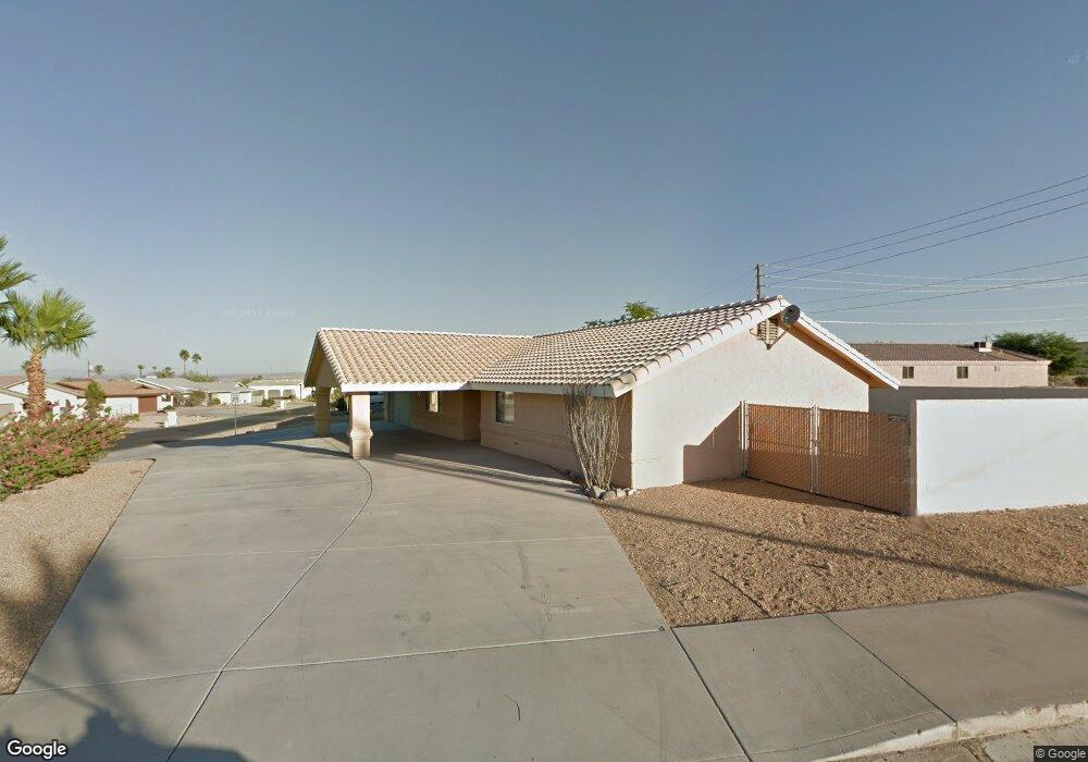
1871 Beavertail Dr Lake Havasu City, AZ 86403
Estimated Value: $432,000 - $484,000
3
Beds
1
Bath
1,769
Sq Ft
$264/Sq Ft
Est. Value
About This Home
This home is located at 1871 Beavertail Dr, Lake Havasu City, AZ 86403 and is currently estimated at $467,051, approximately $264 per square foot. 1871 Beavertail Dr is a home located in Mohave County with nearby schools including Smoketree Elementary School, Thunderbolt Middle School, and Lake Havasu High School.
Ownership History
Date
Name
Owned For
Owner Type
Purchase Details
Closed on
Apr 6, 2021
Sold by
Mendoza Jose and Mendoza Melanie
Bought by
Mendoza Jose L and Mendoza Melanie L
Current Estimated Value
Home Financials for this Owner
Home Financials are based on the most recent Mortgage that was taken out on this home.
Original Mortgage
$145,000
Outstanding Balance
$130,917
Interest Rate
3%
Mortgage Type
New Conventional
Estimated Equity
$336,134
Purchase Details
Closed on
Dec 30, 2011
Sold by
Mendoza Jose L and Mendoza Melanie L
Bought by
Mendoza Jose and Mendoza Melanie
Home Financials for this Owner
Home Financials are based on the most recent Mortgage that was taken out on this home.
Original Mortgage
$171,990
Interest Rate
3.96%
Mortgage Type
New Conventional
Purchase Details
Closed on
May 21, 2011
Sold by
Mendoza Jose and Mendoza Melanie
Bought by
Mendoza Jose L and Mendoza Melanie L
Purchase Details
Closed on
Apr 9, 2008
Sold by
Deutsche Bank National Trust Co
Bought by
Mendoza Jose and Mendoza Melanie
Home Financials for this Owner
Home Financials are based on the most recent Mortgage that was taken out on this home.
Original Mortgage
$175,500
Interest Rate
6.11%
Mortgage Type
New Conventional
Purchase Details
Closed on
Jan 9, 2007
Sold by
Calton Michael G
Bought by
Deutsche Bank National Trust Co
Purchase Details
Closed on
Jun 30, 2003
Sold by
Calton Janet L
Bought by
Carlton Michael G
Home Financials for this Owner
Home Financials are based on the most recent Mortgage that was taken out on this home.
Original Mortgage
$140,800
Interest Rate
5.17%
Mortgage Type
Purchase Money Mortgage
Purchase Details
Closed on
Jan 8, 2003
Sold by
Brown Martin R and Brown Christine
Bought by
Vincent Andrew L
Home Financials for this Owner
Home Financials are based on the most recent Mortgage that was taken out on this home.
Original Mortgage
$128,800
Interest Rate
5.97%
Create a Home Valuation Report for This Property
The Home Valuation Report is an in-depth analysis detailing your home's value as well as a comparison with similar homes in the area
Home Values in the Area
Average Home Value in this Area
Purchase History
| Date | Buyer | Sale Price | Title Company |
|---|---|---|---|
| Mendoza Jose L | -- | Chicago Title Agency Inc | |
| Mendoza Jose | -- | None Available | |
| Mendoza Jose L | -- | None Available | |
| Mendoza Jose | $195,000 | First American Title Insuran | |
| Deutsche Bank National Trust Co | $277,350 | First American Title Ins Co | |
| Carlton Michael G | -- | First American Title Ins Co | |
| Calton Michael G | $176,000 | First American Title Ins Co | |
| Vincent Andrew L | $161,000 | First American Title Ins Co |
Source: Public Records
Mortgage History
| Date | Status | Borrower | Loan Amount |
|---|---|---|---|
| Open | Mendoza Jose L | $145,000 | |
| Closed | Mendoza Jose | $171,990 | |
| Closed | Mendoza Jose | $175,500 | |
| Previous Owner | Calton Michael G | $140,800 | |
| Previous Owner | Vincent Andrew L | $128,800 | |
| Closed | Vincent Andrew L | $32,200 |
Source: Public Records
Tax History Compared to Growth
Tax History
| Year | Tax Paid | Tax Assessment Tax Assessment Total Assessment is a certain percentage of the fair market value that is determined by local assessors to be the total taxable value of land and additions on the property. | Land | Improvement |
|---|---|---|---|---|
| 2026 | $828 | -- | -- | -- |
| 2025 | $1,678 | $33,247 | $0 | $0 |
| 2024 | $1,678 | $49,046 | $0 | $0 |
| 2023 | $1,678 | $35,654 | $0 | $0 |
| 2022 | $1,450 | $28,903 | $0 | $0 |
| 2021 | $1,648 | $25,221 | $0 | $0 |
| 2019 | $1,567 | $22,257 | $0 | $0 |
| 2018 | $1,515 | $21,839 | $0 | $0 |
| 2017 | $1,489 | $20,922 | $0 | $0 |
| 2016 | $1,320 | $19,357 | $0 | $0 |
| 2015 | $1,285 | $17,441 | $0 | $0 |
Source: Public Records
Map
Nearby Homes
- 1926 Swanson Ave
- 1939 Pine Ln
- 1910 Swanson Ave Unit A22
- 1910 Swanson Ave Unit B11
- 1910 Swanson Ave Unit B19
- 1962 Cliffrose Dr
- 1806 Swanson Ave Unit 205
- 1806 Swanson Ave Unit 103
- 1806 Swanson Ave Unit 226
- 1806 Swanson Ave Unit 108
- 211 Columbine Dr
- 1776 Swanson Ave
- 1760 Swanson Ave
- 1760/1776 Swanson
- 72 Mariposa Dr Unit D
- 0000 Sunrise Plan On Your Lot
- 2042 Swanson Ave Unit A
- 2042 Swanson Ave Unit H
- 1661 Magnolia Dr Unit 2
- 1775 Los Lagos Dr Unit B
- 1865 Beavertail Dr
- 1890 Magnolia Dr
- 1880 Magnolia Dr
- 1880 Magnolia Dr Unit 103
- 1880 Magnolia Dr Unit 101
- 1857 Beavertail Dr
- 147 Smoketree Ave S
- 112 Smoketree Ave S
- 124 Smoketree Ave S
- 1864 Beavertail Dr
- 1870 Magnolia Dr
- 1870 Magnolia Dr Unit 104
- 1870 Magnolia Dr Unit 103
- 1910 Magnolia Dr Unit A
- 1910 Magnolia Dr
- 1849 Beavertail Dr
- 1856 Beavertail Dr
- 136 Smoketree Ave S
- 1943 Pine Ln
- 2291 Caboose