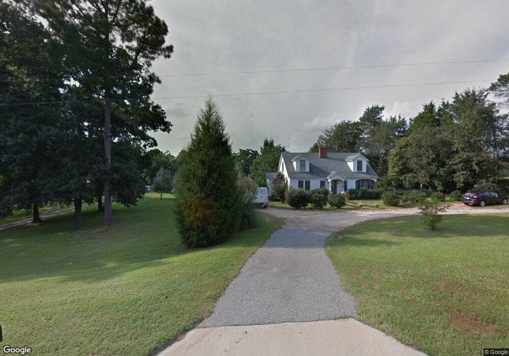
1871 E Broad St Greensboro, GA 30642
Estimated Value: $248,000 - $269,000
3
Beds
2
Baths
1,894
Sq Ft
$136/Sq Ft
Est. Value
About This Home
This home is located at 1871 E Broad St, Greensboro, GA 30642 and is currently estimated at $257,742, approximately $136 per square foot. 1871 E Broad St is a home located in Greene County with nearby schools including Greene County High School.
Ownership History
Date
Name
Owned For
Owner Type
Purchase Details
Closed on
Jul 26, 2000
Sold by
Rivers Cynthia T and Rivers Travis
Bought by
Rivers Cynthia Terrell
Current Estimated Value
Purchase Details
Closed on
Jul 25, 2000
Sold by
Dot-R and W-
Bought by
Rivers Cynthia T and Rivers Travis
Purchase Details
Closed on
Jun 11, 1998
Sold by
Terrell Cynthia
Bought by
Dot-R and W-
Purchase Details
Closed on
Aug 17, 1992
Sold by
Farmers Home Adm
Bought by
Terrell Cynthia
Purchase Details
Closed on
Nov 30, 1991
Sold by
Meadows Sylvan L
Bought by
Farmers Home Adm
Purchase Details
Closed on
Jan 1, 1975
Sold by
Wilson William R
Bought by
Meadows Sylvan L
Create a Home Valuation Report for This Property
The Home Valuation Report is an in-depth analysis detailing your home's value as well as a comparison with similar homes in the area
Home Values in the Area
Average Home Value in this Area
Purchase History
| Date | Buyer | Sale Price | Title Company |
|---|---|---|---|
| Rivers Cynthia Terrell | -- | -- | |
| Rivers Cynthia T | -- | -- | |
| Dot-R | -- | -- | |
| Terrell Cynthia | $11,600 | -- | |
| Farmers Home Adm | -- | -- | |
| Meadows Sylvan L | -- | -- | |
| Wilson William R | -- | -- |
Source: Public Records
Tax History Compared to Growth
Tax History
| Year | Tax Paid | Tax Assessment Tax Assessment Total Assessment is a certain percentage of the fair market value that is determined by local assessors to be the total taxable value of land and additions on the property. | Land | Improvement |
|---|---|---|---|---|
| 2024 | $1,350 | $69,784 | $13,600 | $56,184 |
| 2023 | $705 | $65,692 | $13,600 | $52,092 |
| 2022 | $1,000 | $55,484 | $8,000 | $47,484 |
| 2021 | $878 | $41,080 | $8,000 | $33,080 |
| 2020 | $880 | $37,680 | $6,800 | $30,880 |
| 2019 | $795 | $37,680 | $6,800 | $30,880 |
| 2018 | $892 | $37,680 | $6,800 | $30,880 |
| 2017 | $843 | $37,719 | $6,800 | $30,919 |
| 2016 | $862 | $38,718 | $6,800 | $31,918 |
| 2015 | $824 | $38,718 | $6,800 | $31,918 |
| 2014 | $765 | $34,796 | $6,800 | $27,996 |
Source: Public Records
Map
Nearby Homes
- 1131 Planing Mill Rd
- 1141 Planing Mill Rd
- LOT 1 Penfield
- 1531 E Broad St
- 0 Railroad St Unit 218854
- 0 Railroad St Unit 10578007
- 0 Railroad St Unit 531919
- 1020 Horton Dr
- 1060 Twin Pines Cir
- 301 N East St
- 0 Union Point Hwy Unit 69532
- 0 Union Point Hwy Unit 7607786
- 0 Union Point Hwy Unit 10555176
- 504 Martin Luther King Junior Dr
- 15 South St Unit Siloam Road
- 0 Canaan St
- 0 Cunningham Rd
- 2260 Cunningham Rd
- 0 Shady Side Ln
- 109 Reynolds Dr
- 1881 E Broad St
- 1891 E Broad St
- 1880 E Broad St
- 1801 E Broad St
- 1911 E Broad St
- 1821 E Broad St
- 1820 E Broad St
- 1860 E Broad St
- 1011 Pool Rd
- 0 Broad St Unit 65ac 8141641
- 0 Broad St Unit 7143501
- 1951 E Broad St
- 1031 Pool Rd
- 1961 E Broad St
- 1760 E Broad St
- 1971 E Broad St
- 65 ac Broad St
- 1740 E Broad St
- 1990 E Broad St
- 1081 Pool Rd