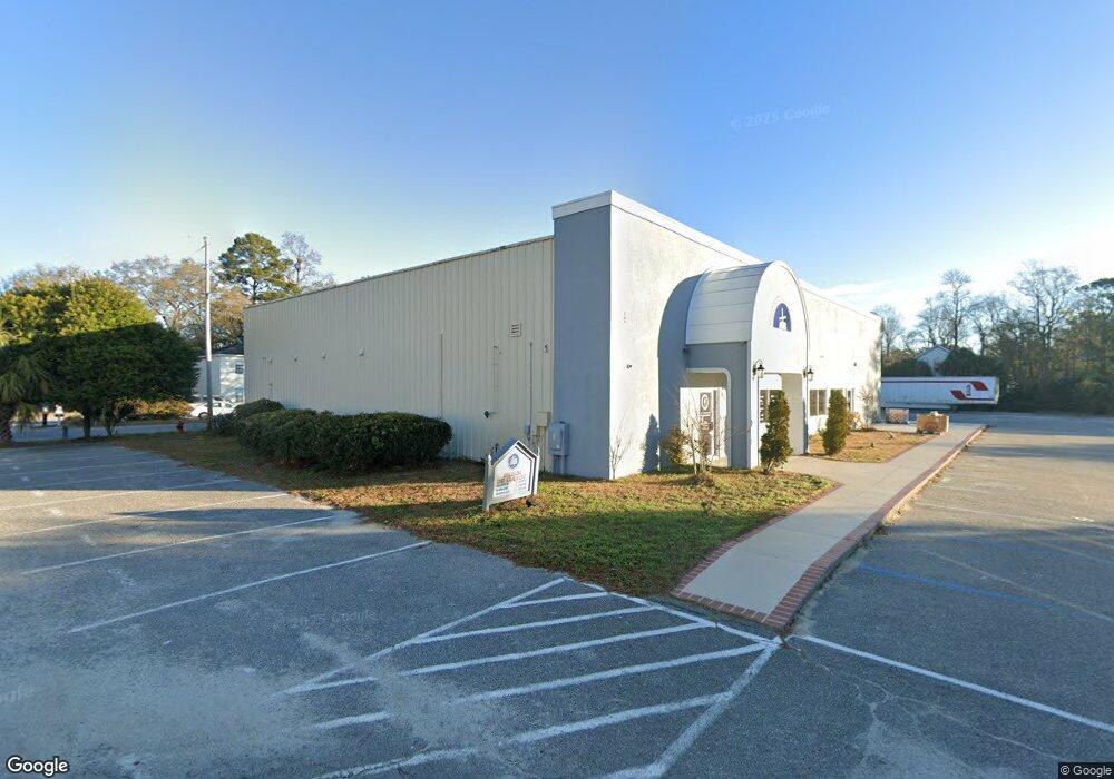
1871 Highway 544 Conway, SC 29526
Estimated Value: $729,084
--
Bed
--
Bath
7,100
Sq Ft
$103/Sq Ft
Est. Value
About This Home
This home is located at 1871 Highway 544, Conway, SC 29526 and is currently estimated at $729,084, approximately $102 per square foot. 1871 Highway 544 is a home located in Horry County with nearby schools including Palmetto Bays Elementary School, Black Water Middle School, and Carolina Forest High School.
Ownership History
Date
Name
Owned For
Owner Type
Purchase Details
Closed on
Feb 21, 2018
Sold by
Nashcor Llc
Bought by
Iglesia Pentecostal Mision
Current Estimated Value
Home Financials for this Owner
Home Financials are based on the most recent Mortgage that was taken out on this home.
Original Mortgage
$240,000
Outstanding Balance
$204,069
Interest Rate
4.15%
Mortgage Type
New Conventional
Estimated Equity
$525,015
Purchase Details
Closed on
Aug 9, 2004
Sold by
M & A Investments Llc
Bought by
Nashcor Llc
Create a Home Valuation Report for This Property
The Home Valuation Report is an in-depth analysis detailing your home's value as well as a comparison with similar homes in the area
Home Values in the Area
Average Home Value in this Area
Purchase History
| Date | Buyer | Sale Price | Title Company |
|---|---|---|---|
| Iglesia Pentecostal Mision | $440,000 | -- | |
| Nashcor Llc | $610,000 | -- |
Source: Public Records
Mortgage History
| Date | Status | Borrower | Loan Amount |
|---|---|---|---|
| Open | Iglesia Pentecostal Mision | $240,000 |
Source: Public Records
Tax History Compared to Growth
Tax History
| Year | Tax Paid | Tax Assessment Tax Assessment Total Assessment is a certain percentage of the fair market value that is determined by local assessors to be the total taxable value of land and additions on the property. | Land | Improvement |
|---|---|---|---|---|
| 2024 | $722 | $45,792 | $18,347 | $27,445 |
| 2023 | $722 | $27,600 | $3,600 | $24,000 |
| 2021 | $722 | $44,400 | $2,400 | $42,000 |
| 2020 | $358 | $44,400 | $2,400 | $42,000 |
| 2019 | $358 | $44,400 | $2,400 | $42,000 |
| 2018 | $8,486 | $42,929 | $18,347 | $24,582 |
| 2017 | $8,358 | $42,929 | $18,347 | $24,582 |
| 2016 | -- | $42,929 | $18,347 | $24,582 |
| 2015 | $8,358 | $42,930 | $18,348 | $24,582 |
| 2014 | $8,083 | $42,930 | $18,348 | $24,582 |
Source: Public Records
Map
Nearby Homes
- 1874 Rolling Hills Dr
- Fairview Plan at Meadows Edge - Single Family Homes
- Woodford Plan at Meadows Edge - Single Family Homes
- Torrey Plan at Meadows Edge - Single Family Homes
- Sequoia Plan at Meadows Edge - Single Family Homes
- 2047 Palm Meadows Way Unit Lot 103
- 1023 Oak Meadow Dr Unit Lot 170
- 1008 Oak Meadow Dr Unit Lot 105
- Poplar Plan at Meadows Edge - Townhomes
- 800 Riverbirch Dr
- 1096 Oak Meadow Dr Unit Lot 126
- 451 Oak Meadows Dr Unit Lot 131
- 384 Myrtle Meadows Dr Unit 421D
- 38 Myrtle Meadows Dr Unit 421E
- 1075 Oak Meadow Dr Unit Lot 160
- 938 Fox Hollow Rd
- 383 Myrtle Meadows Dr Unit 421E
- 385 Myrtle Meadows Dr Unit 421D
- 387 Myrtle Meadows Dr Unit 421C
- 1087 Oak Meadows Dr Unit Lot 157
- 984 Fox Hollow Rd Unit 1853 Hwy 544, and 97
- 984 Fox Hollow Rd Unit 974,976, 980 Fox Hol
- 1867 Highway 544 Unit A
- 1867 Highway 544 Unit A, Big Easy Pla
- 1867 Highway 544
- 1867 Highway 544 Unit A, The Big Easy
- 1867 Highway 544 Unit The Big Easy, Unit B
- 981 Fox Hollow Rd
- 981 Fox Hollow Rd
- 1853 Highway 544
- 1853 Highway 544 Unit 1853 SC-544
- 213 William Bradford Place
- 209 William Bradford Place
- 1853 Fox Hollow Rd
- 1841 Highway 544
- 205 William Bradford Place
- 201 William Bradford Place
- 201 William Bradford Place Unit 201, 205, 209, 213
- 201 Wm Bradford Place
- 201/205/20 William Bradford Place