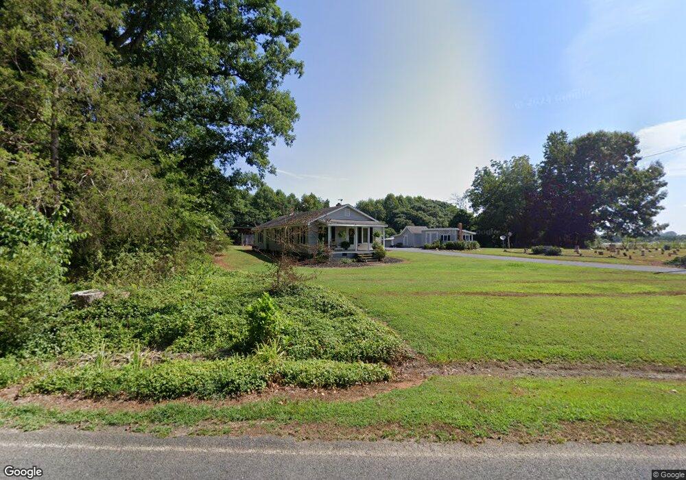
1871 Mill Creek Rd Ramseur, NC 27316
Estimated Value: $137,216 - $209,000
--
Bed
1
Bath
1,424
Sq Ft
$126/Sq Ft
Est. Value
About This Home
This home is located at 1871 Mill Creek Rd, Ramseur, NC 27316 and is currently estimated at $180,054, approximately $126 per square foot. 1871 Mill Creek Rd is a home located in Randolph County with nearby schools including Ramseur Elementary School, Southeastern Randolph Middle School, and Eastern Randolph High School.
Ownership History
Date
Name
Owned For
Owner Type
Purchase Details
Closed on
Feb 1, 2018
Bought by
Allen Eric Thomas
Current Estimated Value
Home Financials for this Owner
Home Financials are based on the most recent Mortgage that was taken out on this home.
Original Mortgage
$240,000
Outstanding Balance
$203,962
Interest Rate
4.22%
Estimated Equity
-$23,908
Purchase Details
Closed on
Jan 22, 1991
Bought by
Allen Eric T
Create a Home Valuation Report for This Property
The Home Valuation Report is an in-depth analysis detailing your home's value as well as a comparison with similar homes in the area
Home Values in the Area
Average Home Value in this Area
Purchase History
| Date | Buyer | Sale Price | Title Company |
|---|---|---|---|
| Allen Eric Thomas | -- | -- | |
| Allen Eric T | $15,000 | -- |
Source: Public Records
Mortgage History
| Date | Status | Borrower | Loan Amount |
|---|---|---|---|
| Open | Allen Eric Thomas | $240,000 | |
| Closed | Allen Eric Thomas | -- |
Source: Public Records
Tax History Compared to Growth
Tax History
| Year | Tax Paid | Tax Assessment Tax Assessment Total Assessment is a certain percentage of the fair market value that is determined by local assessors to be the total taxable value of land and additions on the property. | Land | Improvement |
|---|---|---|---|---|
| 2025 | $596 | $99,350 | $32,200 | $67,150 |
| 2024 | $596 | $99,350 | $32,200 | $67,150 |
| 2023 | $596 | $99,350 | $32,200 | $67,150 |
| 2022 | $479 | $65,340 | $19,800 | $45,540 |
| 2021 | $479 | $65,340 | $19,800 | $45,540 |
| 2020 | $462 | $65,340 | $19,800 | $45,540 |
| 2019 | $462 | $65,340 | $19,800 | $45,540 |
| 2018 | $412 | $56,170 | $16,600 | $39,570 |
| 2016 | $412 | $56,174 | $16,600 | $39,574 |
| 2015 | $413 | $56,174 | $16,600 | $39,574 |
| 2014 | -- | $56,174 | $16,600 | $39,574 |
Source: Public Records
Map
Nearby Homes
- 4319 Young Rd
- 1001 Meadowood Dr
- 2110 Newell St
- 2050 Welborn Cir
- 5182 Foushee Rd
- 545 Coleridge Rd
- 3875 Sycamore Trail
- 1802 Grantville Ln Unit 17
- 1802 Grantville Ln Unit 53
- 321 Coleridge Rd
- 715 Liberty St
- 0 Willie Wright Rd
- 324 Elam Ave
- 507 Columbia Ave
- 5713 Us Highway 64 E
- 1737 Woodglo Dr
- 309 Elam Ave
- 0 State Highway 49
- 7187 Jordan Rd
- 4737 Huntingwood Rd
- 1839 Mill Creek Rd
- 1866 Mill Creek Rd
- 00 Mill Creek Rd
- 1887 Mill Creek Rd
- 1940 Mill Creek Rd
- 2043 Mill Creek Rd
- 1669 Mill Creek Rd
- 1687 Mill Creek Rd
- 1594 Mill Creek Rd
- 1594 Mill Creek
- 2122 Mill Creek Rd
- 1579 Mill Creek Rd
- 5977 Buffalo Ford Rd
- 2205 Mill Creek Rd
- 4763 Rainbow Trail
- 1471 Mill Creek Rd
- 1443 Mill Creek Rd
- 2206 Nc Hwy 22 S
- 5290 Parkwood Rd
- 4690 York River Rd