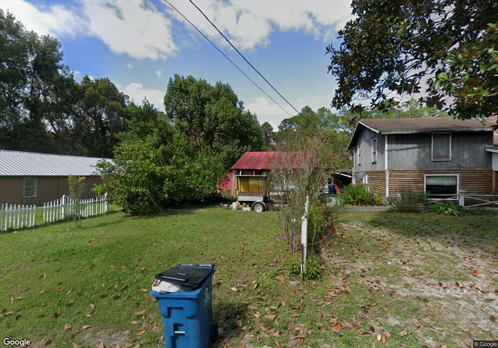
1871 Mount Pleasant Rd Waycross, GA 31503
Estimated Value: $105,585 - $259,000
3
Beds
1
Bath
1,664
Sq Ft
$113/Sq Ft
Est. Value
About This Home
This home is located at 1871 Mount Pleasant Rd, Waycross, GA 31503 and is currently estimated at $187,896, approximately $112 per square foot. 1871 Mount Pleasant Rd is a home located in Ware County with nearby schools including Williams Heights Elementary School, Waycross Middle School, and Ware County High School.
Ownership History
Date
Name
Owned For
Owner Type
Purchase Details
Closed on
May 29, 2020
Sold by
Davenport Jeffrey P
Bought by
Pleasant Financial Holdings Llc
Current Estimated Value
Purchase Details
Closed on
Jun 5, 2018
Sold by
Polatis Eliza
Bought by
Davenport Jeffery
Purchase Details
Closed on
Aug 4, 2006
Sold by
Polatis Dean
Bought by
Polatis Eliza
Purchase Details
Closed on
Sep 30, 2004
Sold by
Cranford Janie B
Bought by
Polatis Dean J
Purchase Details
Closed on
Feb 3, 2003
Sold by
Cranford Joseph W
Bought by
Cranford Janie B
Purchase Details
Closed on
Dec 8, 1997
Sold by
Campbell James
Bought by
Cranford Joseph W
Purchase Details
Closed on
Jan 1, 1984
Create a Home Valuation Report for This Property
The Home Valuation Report is an in-depth analysis detailing your home's value as well as a comparison with similar homes in the area
Home Values in the Area
Average Home Value in this Area
Purchase History
| Date | Buyer | Sale Price | Title Company |
|---|---|---|---|
| Pleasant Financial Holdings Llc | -- | -- | |
| Davenport Jeffery | $7,600 | -- | |
| Polatis Eliza | -- | -- | |
| Polatis Dean J | -- | -- | |
| Cranford Janie B | -- | -- | |
| Cranford Joseph W | $21,000 | -- | |
| -- | -- | -- |
Source: Public Records
Tax History Compared to Growth
Tax History
| Year | Tax Paid | Tax Assessment Tax Assessment Total Assessment is a certain percentage of the fair market value that is determined by local assessors to be the total taxable value of land and additions on the property. | Land | Improvement |
|---|---|---|---|---|
| 2024 | $767 | $30,395 | $3,906 | $26,489 |
| 2023 | $782 | $17,922 | $880 | $17,042 |
| 2022 | $487 | $16,862 | $880 | $15,982 |
| 2021 | $346 | $11,032 | $880 | $10,152 |
| 2020 | $336 | $10,609 | $880 | $9,729 |
| 2019 | $529 | $16,353 | $880 | $15,473 |
| 2018 | $510 | $15,642 | $880 | $14,762 |
| 2017 | $510 | $15,642 | $880 | $14,762 |
| 2016 | $510 | $15,642 | $880 | $14,762 |
| 2015 | $515 | $15,642 | $880 | $14,762 |
| 2014 | $514 | $15,642 | $880 | $14,762 |
| 2013 | -- | $15,642 | $880 | $14,762 |
Source: Public Records
Map
Nearby Homes
- 807 City Blvd
- 7438 Central Ave
- 1312 Atlantic Ave
- 1204 Richmond Ave
- 1100 Atlantic Ave
- 914 Barkley St
- 1205 Dean Dr
- 0 Brunswick Hwy Unit 1648370
- 1100 Euclid Ave
- 955 Lynn Dr
- 713 Magnolia Dr
- 1009 Euclid Ave
- 0 Goodwin St
- 907 Euclid Ave
- 723 St Bernard Trail
- 808 Satilla Blvd
- 1502 Seminole Trail
- 1001 Coral Rd
- 00 Seminole Trail
- 0 Saint Marys Dr Unit (TRACT 2 0.25 ACRES)
- 1883 Mount Pleasant Rd
- 1865 Mount Pleasant Rd
- 1862 Mount Pleasant Rd
- 1909 Mount Pleasant Rd
- 1934 Mount Pleasant Rd
- 1836 Mount Pleasant Rd
- 1833 Mount Pleasant Rd
- 1815 Mount Pleasant Rd
- 1946 Mount Pleasant Rd
- 1894 Mount Pleasant Rd
- 1943 Mount Pleasant Rd
- 1961 Mount Pleasant Rd
- 1964 Mount Pleasant Rd
- 1819 Mt Pleasant Rd
- 1966 Mount Pleasant Rd
- 603 City Blvd
- 1819 Mount Pleasant Rd
- 700 Mount Pleasant Rd
- 2004 Central Ave
- 748 Mount Pleasant Rd