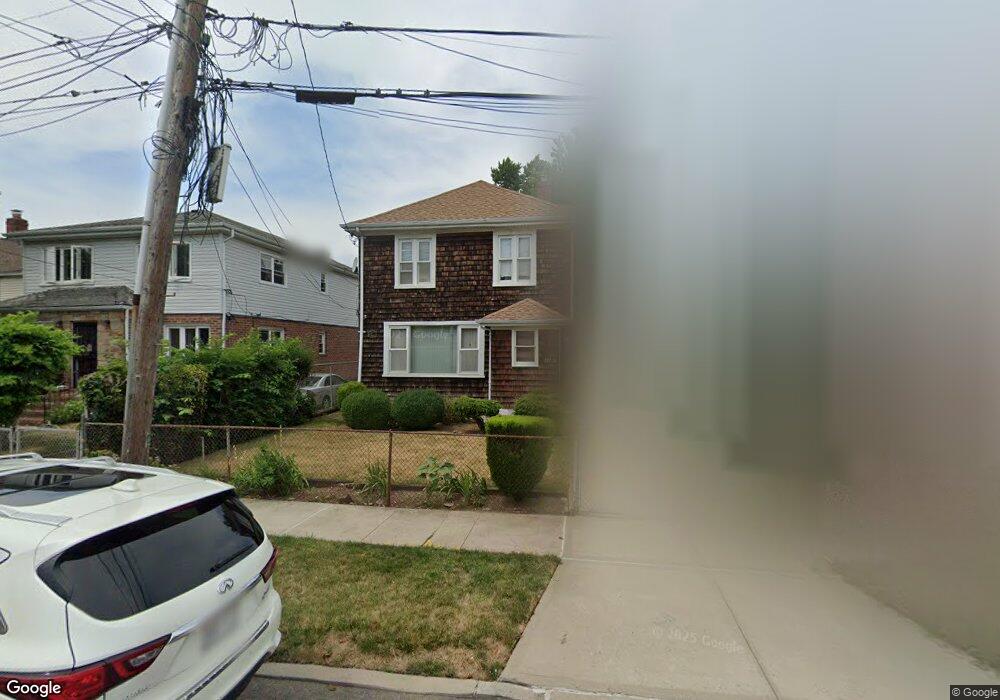
18711 Ludlum Ave Saint Albans, NY 11412
Hollis NeighborhoodEstimated Value: $561,000 - $807,000
--
Bed
--
Bath
1,368
Sq Ft
$508/Sq Ft
Est. Value
About This Home
This home is located at 18711 Ludlum Ave, Saint Albans, NY 11412 and is currently estimated at $694,957, approximately $508 per square foot. 18711 Ludlum Ave is a home located in Queens County with nearby schools including P.S. 118 Lorraine Hansberry, I.S. 192 The Linden, and Wellspring Elementary & Middle.
Ownership History
Date
Name
Owned For
Owner Type
Purchase Details
Closed on
Mar 26, 1998
Sold by
Sutton Parnel and Sutton Claudette G
Bought by
Sutton Claudette G
Current Estimated Value
Home Financials for this Owner
Home Financials are based on the most recent Mortgage that was taken out on this home.
Original Mortgage
$95,000
Interest Rate
7.12%
Create a Home Valuation Report for This Property
The Home Valuation Report is an in-depth analysis detailing your home's value as well as a comparison with similar homes in the area
Home Values in the Area
Average Home Value in this Area
Purchase History
| Date | Buyer | Sale Price | Title Company |
|---|---|---|---|
| Sutton Claudette G | -- | Commonwealth Land Title Ins | |
| Sutton Claudette G | -- | Commonwealth Land Title Ins |
Source: Public Records
Mortgage History
| Date | Status | Borrower | Loan Amount |
|---|---|---|---|
| Closed | Sutton Claudette G | $95,000 |
Source: Public Records
Tax History Compared to Growth
Tax History
| Year | Tax Paid | Tax Assessment Tax Assessment Total Assessment is a certain percentage of the fair market value that is determined by local assessors to be the total taxable value of land and additions on the property. | Land | Improvement |
|---|---|---|---|---|
| 2025 | $5,236 | $27,469 | $8,746 | $18,723 |
| 2024 | $5,248 | $27,469 | $9,142 | $18,327 |
| 2023 | $5,100 | $26,794 | $9,892 | $16,902 |
| 2022 | $4,760 | $31,860 | $12,360 | $19,500 |
| 2021 | $4,810 | $31,560 | $12,360 | $19,200 |
| 2020 | $4,549 | $30,540 | $12,360 | $18,180 |
| 2019 | $4,496 | $29,160 | $12,360 | $16,800 |
| 2018 | $4,254 | $22,328 | $9,036 | $13,292 |
| 2017 | $3,995 | $21,067 | $11,071 | $9,996 |
| 2016 | $3,732 | $21,067 | $11,071 | $9,996 |
| 2015 | $2,177 | $19,076 | $9,415 | $9,661 |
| 2014 | $2,177 | $19,076 | $11,288 | $7,788 |
Source: Public Records
Map
Nearby Homes
- 102-35 187th St
- 187-23 Brinkerhoff Ave
- 10533 Farmers Blvd
- 10220 189th St
- 10211 187th St
- 19027 109th Rd
- 190-30 103rd Ave
- 10532 192nd St
- 185-05 Henderson Ave
- 102-13 183rd Place
- 184-15 Henderson Ave
- 183-09 Dunlop Ave
- 183-29 Brinkerhoff Ave
- 193-21 109th Rd
- 104-40 194th St
- 183-12 Elmira Ave
- 111-06 Farmers Blvd
- 186-16 Hilburn Ave
- 19319 109th Rd
- 194-10 Hollis Ave
- 18715 Ludlum Ave
- 18707 Ludlum Ave
- 187-19 Ludlum Ave
- 10419 187th St
- 18719 Ludlum Ave
- 10422 188th St
- 18701 Ludlum Ave
- 10419 187th St
- 187-15 Ludlum Ave
- 10417 187th St
- 10420 188th St
- 10420 188th St
- 10415 187th St
- 10418 188th St
- 18708 Ludlum Ave
- 10414 188th St
- 10413 187th St
- 187-06 Ludlum Ave
- 18710 Ludlum Ave
- 18712 Ludlum Ave