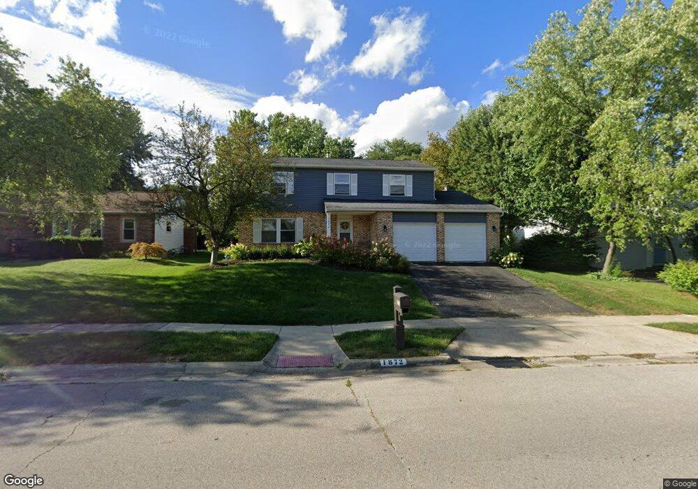
1872 Plains Blvd Powell, OH 43065
Western Hills NeighborhoodEstimated Value: $394,000 - $471,000
4
Beds
3
Baths
2,036
Sq Ft
$217/Sq Ft
Est. Value
About This Home
This home is located at 1872 Plains Blvd, Powell, OH 43065 and is currently estimated at $442,796, approximately $217 per square foot. 1872 Plains Blvd is a home located in Franklin County with nearby schools including Liberty Elementary School, McCord Middle School, and Worthington Kilbourne High School.
Ownership History
Date
Name
Owned For
Owner Type
Purchase Details
Closed on
Jul 8, 2021
Sold by
Maurice Henry Alton
Bought by
Alton M Henry And Evelyn C Henry Revocable Li and Hen Evelyn
Current Estimated Value
Purchase Details
Closed on
Sep 5, 2018
Sold by
Henry Alton M and Henry Evelyn C
Bought by
Henry Alton M and Henry Evelyn C
Purchase Details
Closed on
Oct 30, 1992
Bought by
Henry Alton M and Henry Evelyn C
Purchase Details
Closed on
Oct 1, 1990
Purchase Details
Closed on
Mar 1, 1985
Create a Home Valuation Report for This Property
The Home Valuation Report is an in-depth analysis detailing your home's value as well as a comparison with similar homes in the area
Home Values in the Area
Average Home Value in this Area
Purchase History
| Date | Buyer | Sale Price | Title Company |
|---|---|---|---|
| Alton M Henry And Evelyn C Henry Revocable Li | -- | -- | |
| Henry Alton M | -- | None Available | |
| Henry Alton M | $118,000 | -- | |
| -- | $117,000 | -- | |
| -- | -- | -- |
Source: Public Records
Tax History Compared to Growth
Tax History
| Year | Tax Paid | Tax Assessment Tax Assessment Total Assessment is a certain percentage of the fair market value that is determined by local assessors to be the total taxable value of land and additions on the property. | Land | Improvement |
|---|---|---|---|---|
| 2024 | $8,327 | $135,630 | $33,990 | $101,640 |
| 2023 | $7,963 | $135,625 | $33,985 | $101,640 |
| 2022 | $6,788 | $91,740 | $19,180 | $72,560 |
| 2021 | $6,262 | $91,740 | $19,180 | $72,560 |
| 2020 | $6,032 | $91,740 | $19,180 | $72,560 |
| 2019 | $5,532 | $75,920 | $15,960 | $59,960 |
| 2018 | $5,055 | $75,920 | $15,960 | $59,960 |
| 2017 | $4,854 | $75,920 | $15,960 | $59,960 |
| 2016 | $4,751 | $66,920 | $14,210 | $52,710 |
| 2015 | $4,752 | $66,920 | $14,210 | $52,710 |
| 2014 | $4,750 | $66,920 | $14,210 | $52,710 |
| 2013 | $2,363 | $66,920 | $14,210 | $52,710 |
Source: Public Records
Map
Nearby Homes
- 8345 Smoky Row Rd Unit 8345
- 8351 Smoky Row Rd Unit 48351
- 7898 Sarahurst Dr
- 1914 Laramie Dr Unit 26
- 8266 Waco Ln
- 1949 Hamrock Dr
- 2053 Stancrest Rd
- 8594 Broadacre Dr
- 2013 Summit Row Blvd
- 1486 Clubview Blvd S
- 8741 Jamey Ct
- 2280 Saberly Ct
- 2228 Gnarled Pine Dr
- 2168 Summit Row Blvd
- 8796 Yates Point Ct
- 8803 Yates Point Ct
- 2074 Hard Rd
- 8292 Breckenridge Way
- 1399 Briarmeadow Dr
- 2120 Sharwood Ct
- 1880 Plains Blvd
- 1864 Plains Blvd
- 1889 High Ridge Place
- 1888 Plains Blvd
- 1856 Plains Blvd
- 1897 High Ridge Place
- 8327 Seabright Dr
- 1881 High Ridge Place
- 1877 Plains Blvd
- 1896 Plains Blvd
- 8335 Seabright Dr
- 1851 Plains Blvd
- 1905 High Ridge Place
- 8275 Lone Tree Dr
- 1885 Plains Blvd
- 1843 Plains Blvd
- 1904 Plains Blvd
- 1890 High Ridge Place
- 8343 Seabright Dr
- 1913 High Ridge Place