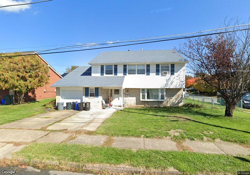
1873 Kentwood St Philadelphia, PA 19116
Somerton NeighborhoodEstimated Value: $418,066 - $548,000
--
Bed
--
Bath
2,070
Sq Ft
$234/Sq Ft
Est. Value
About This Home
This home is located at 1873 Kentwood St, Philadelphia, PA 19116 and is currently estimated at $484,767, approximately $234 per square foot. 1873 Kentwood St is a home located in Philadelphia County with nearby schools including Frank Anne School, CCA Baldi Middle School, and George Washington High School.
Ownership History
Date
Name
Owned For
Owner Type
Purchase Details
Closed on
Dec 9, 2003
Sold by
Roletter John J
Bought by
Roletter John J and Roletter Debra A
Current Estimated Value
Home Financials for this Owner
Home Financials are based on the most recent Mortgage that was taken out on this home.
Original Mortgage
$90,000
Interest Rate
5.39%
Mortgage Type
New Conventional
Purchase Details
Closed on
Apr 29, 1996
Sold by
Grofcsik Herbert F and Grofcsik Mary A
Bought by
Roletter John J
Create a Home Valuation Report for This Property
The Home Valuation Report is an in-depth analysis detailing your home's value as well as a comparison with similar homes in the area
Home Values in the Area
Average Home Value in this Area
Purchase History
| Date | Buyer | Sale Price | Title Company |
|---|---|---|---|
| Roletter John J | -- | -- | |
| Roletter John J | $123,500 | -- |
Source: Public Records
Mortgage History
| Date | Status | Borrower | Loan Amount |
|---|---|---|---|
| Closed | Roletter John J | $90,000 |
Source: Public Records
Tax History Compared to Growth
Tax History
| Year | Tax Paid | Tax Assessment Tax Assessment Total Assessment is a certain percentage of the fair market value that is determined by local assessors to be the total taxable value of land and additions on the property. | Land | Improvement |
|---|---|---|---|---|
| 2025 | $4,969 | $427,500 | $85,500 | $342,000 |
| 2024 | $4,969 | $427,500 | $85,500 | $342,000 |
| 2023 | $4,969 | $355,000 | $71,000 | $284,000 |
| 2022 | $3,516 | $310,000 | $71,000 | $239,000 |
| 2021 | $4,146 | $0 | $0 | $0 |
| 2020 | $4,146 | $0 | $0 | $0 |
| 2019 | $3,970 | $0 | $0 | $0 |
| 2018 | $3,693 | $0 | $0 | $0 |
| 2017 | $3,693 | $0 | $0 | $0 |
| 2016 | $3,273 | $0 | $0 | $0 |
| 2015 | $3,133 | $0 | $0 | $0 |
| 2014 | -- | $263,800 | $96,152 | $167,648 |
| 2012 | -- | $34,912 | $8,399 | $26,513 |
Source: Public Records
Map
Nearby Homes
- 1861 Kentwood St
- 1912 Tomlinson Rd
- 1829 Tomlinson Rd
- 10123 Alexandra Ln
- 1724 Nathaniel Dr
- 1207 Friel Place
- 2044 Gorman St
- 9990 Sandy Rd
- 9987 Hardy Rd
- 11003 Stevens Rd
- 831 Lawler St
- 9926 00 Haldeman Ave
- 9926 Haldeman Unit#133 Ave
- 9921 Bustleton Ave Unit K11
- 9921 Bustleton Ave Unit P3
- 9926 Haldeman Ave
- 9839 Haldeman Ave
- 9837 Haldeman Ave
- 9823 Bonner St
- 9854 Clark St
- 1871 Kentwood St
- 1874 Garth Rd
- 10209 Clark St
- 1869 Kentwood St
- 10211 Clark St
- 1870 Kentwood St
- 10207 Clark St
- 1870 Garth Rd
- 1868 Kentwood St
- 10213 Clark St
- 10205 Clark St
- 1866 Kentwood St
- 1868 Garth Rd
- 1867 Kentwood St
- 10215 Clark St
- 10203 Clark St
- 1925 Kentwood St
- 10220 Clark St
- 1924 Kentwood St
- 1869 Greymont St