Estimated Value: $230,000 - $261,000
3
Beds
1
Bath
1,836
Sq Ft
$131/Sq Ft
Est. Value
About This Home
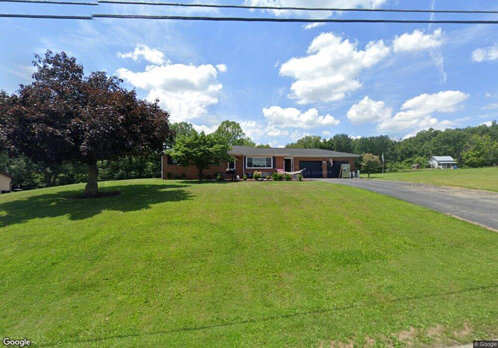
This home is located at 1874 Lucas North Rd, Lucas, OH 44843 and is currently estimated at $240,486, approximately $130 per square foot. 1874 Lucas North Rd is a home located in Richland County with nearby schools including Lucas Elementary School, Lucas Heritage Middle School, and Lucas High School.
Ownership History
Date
Name
Owned For
Owner Type
Purchase Details
Closed on
Oct 19, 2024
Sold by
Stevens Andrea Elizabeth
Bought by
Stevens Andrea and Stevens Brent
Current Estimated Value
Purchase Details
Closed on
Aug 6, 2021
Sold by
Basquin Scott D and Basquin Denise C
Bought by
Stevens Andrea Elizabeth
Home Financials for this Owner
Home Financials are based on the most recent Mortgage that was taken out on this home.
Original Mortgage
$157,712
Interest Rate
2.8%
Mortgage Type
FHA
Purchase Details
Closed on
Oct 8, 2018
Sold by
Basquin Scott D
Bought by
Basquin Scott D and Basquin Denise C
Purchase Details
Closed on
Oct 12, 2011
Sold by
Basquin Karen L and Basquin Scott D
Bought by
Basquin Karen L and Basquin Scott D
Create a Home Valuation Report for This Property
The Home Valuation Report is an in-depth analysis detailing your home's value as well as a comparison with similar homes in the area
Purchase History
| Date | Buyer | Sale Price | Title Company |
|---|---|---|---|
| Stevens Andrea | -- | None Listed On Document | |
| Stevens Andrea Elizabeth | -- | None Listed On Document | |
| Basquin Scott D | -- | None Available | |
| Basquin Karen L | -- | Attorney |
Source: Public Records
Mortgage History
| Date | Status | Borrower | Loan Amount |
|---|---|---|---|
| Previous Owner | Stevens Andrea Elizabeth | $157,712 |
Source: Public Records
Tax History
| Year | Tax Paid | Tax Assessment Tax Assessment Total Assessment is a certain percentage of the fair market value that is determined by local assessors to be the total taxable value of land and additions on the property. | Land | Improvement |
|---|---|---|---|---|
| 2025 | $2,648 | $64,550 | $9,930 | $54,620 |
| 2024 | $2,648 | $64,550 | $9,930 | $54,620 |
| 2023 | $2,712 | $64,550 | $9,930 | $54,620 |
| 2022 | $2,340 | $49,750 | $8,880 | $40,870 |
| 2021 | $2,401 | $49,750 | $8,880 | $40,870 |
| 2020 | $2,440 | $49,750 | $8,880 | $40,870 |
| 2019 | $2,230 | $42,750 | $7,530 | $35,220 |
| 2018 | $2,243 | $42,750 | $7,530 | $35,220 |
| 2017 | $2,258 | $42,750 | $7,530 | $35,220 |
| 2016 | $2,302 | $44,090 | $6,780 | $37,310 |
| 2015 | $2,302 | $44,090 | $6,780 | $37,310 |
| 2014 | $2,313 | $44,090 | $6,780 | $37,310 |
| 2012 | $1,139 | $44,090 | $6,780 | $37,310 |
Source: Public Records
Map
Nearby Homes
- 28 N Union St
- 2778 Lucas Perrysville Rd
- 2130 State Route 39
- 0 Mount Zion Rd Unit 226009674
- 0 Mount Zion Rd Unit 9072801
- 2804 Rd
- 0 State Route 39 & I-71 Northeast Quadrant
- 2011 Ohio 39
- 0 State Route 39 & I-71 Southeast Quadrant
- 0 Pleasant Valley Rd
- 4281 Lucas Perrysville Rd
- 1715 Mansfield Lucas Rd
- 3405 Hastings Newville Rd
- 744 E Hanley Rd
- 0 McBride Road Parcel # 1 Unit 9066028
- 0 Mcelroy Rd
- 474 Biscayne Dr
- 59 Ridge Rd S
- 57 S Walker Ave
- 625 Mansfield Lucas Rd
- 1894 Lucas North Rd
- 1922 Lucas North Rd
- 1848 Lucas North Rd
- 1816 Lucas North Rd
- 1796 Lucas North Rd
- 149 Leiter Rd
- 1788 Lucas North Rd
- 1788 Lucas North Rd
- 131 Leiter Rd
- 115 Leiter Rd
- 138 Leiter Rd
- 140 Leiter Rd
- 89 Leiter Rd
- 2122 Leiter Rd
- 1751 Lucas North Rd
- 0 Leiter Rd 60 - 78 Richland Unit 6206704-11615216
- 87 Bond St
- 84 Bond St
- 2053 Leiter Rd
- 75 Lucas North Rd
Your Personal Tour Guide
Ask me questions while you tour the home.