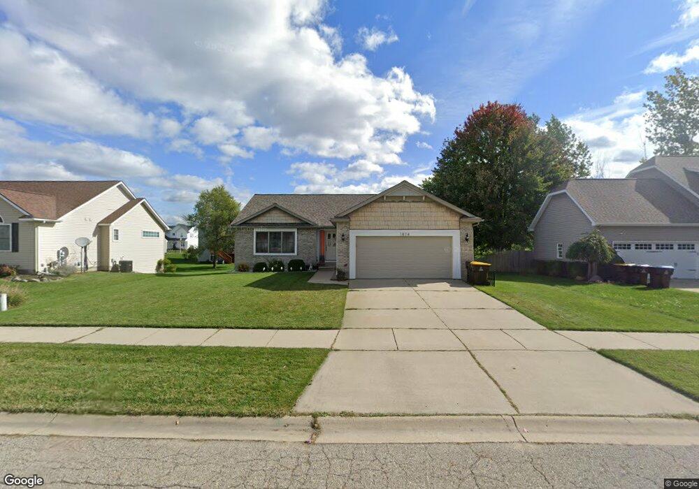
1874 Mockingbird Ln Delhi Charter Township, MI 48842
Estimated Value: $333,388 - $364,000
3
Beds
3
Baths
1,600
Sq Ft
$221/Sq Ft
Est. Value
About This Home
This home is located at 1874 Mockingbird Ln, Delhi Charter Township, MI 48842 and is currently estimated at $352,847, approximately $220 per square foot. 1874 Mockingbird Ln is a home located in Ingham County with nearby schools including Horizon Elementary School, Washington Woods Middle School, and Holt Junior High School.
Ownership History
Date
Name
Owned For
Owner Type
Purchase Details
Closed on
Aug 16, 2018
Sold by
Chidura Satish and Kathury Sangeetha
Bought by
Spitzley Adam F and Spitzley Tracy A
Current Estimated Value
Home Financials for this Owner
Home Financials are based on the most recent Mortgage that was taken out on this home.
Original Mortgage
$189,000
Outstanding Balance
$164,139
Interest Rate
4.5%
Mortgage Type
New Conventional
Estimated Equity
$188,708
Purchase Details
Closed on
Apr 23, 2004
Sold by
Delhi Inc
Bought by
Chidura Satish and Katthury Sangeetha
Home Financials for this Owner
Home Financials are based on the most recent Mortgage that was taken out on this home.
Original Mortgage
$168,000
Interest Rate
5.5%
Mortgage Type
Balloon
Create a Home Valuation Report for This Property
The Home Valuation Report is an in-depth analysis detailing your home's value as well as a comparison with similar homes in the area
Home Values in the Area
Average Home Value in this Area
Purchase History
| Date | Buyer | Sale Price | Title Company |
|---|---|---|---|
| Spitzley Adam F | $210,000 | Ata National Title Group Llc | |
| Chidura Satish | $40,000 | Metro |
Source: Public Records
Mortgage History
| Date | Status | Borrower | Loan Amount |
|---|---|---|---|
| Open | Spitzley Adam F | $189,000 | |
| Previous Owner | Chidura Satish | $168,000 |
Source: Public Records
Tax History Compared to Growth
Tax History
| Year | Tax Paid | Tax Assessment Tax Assessment Total Assessment is a certain percentage of the fair market value that is determined by local assessors to be the total taxable value of land and additions on the property. | Land | Improvement |
|---|---|---|---|---|
| 2025 | $6,200 | $153,900 | $28,600 | $125,300 |
| 2024 | $15 | $147,100 | $25,900 | $121,200 |
| 2023 | $5,791 | $135,400 | $21,700 | $113,700 |
| 2022 | $5,467 | $121,500 | $23,500 | $98,000 |
| 2021 | $5,303 | $109,800 | $17,500 | $92,300 |
| 2020 | $5,402 | $105,700 | $17,500 | $88,200 |
| 2019 | $6,404 | $99,100 | $13,100 | $86,000 |
| 2018 | $6,241 | $93,200 | $13,100 | $80,100 |
| 2017 | $5,826 | $93,200 | $13,100 | $80,100 |
| 2016 | $5,776 | $90,900 | $17,400 | $73,500 |
| 2015 | $4,156 | $85,400 | $34,721 | $50,679 |
| 2014 | $4,156 | $83,000 | $34,721 | $48,279 |
Source: Public Records
Map
Nearby Homes
- The Newton Plan at Meadow Ridge
- The Windsor Plan at Meadow Ridge
- The Hickory Plan at Meadow Ridge
- The Hatfield Plan at Meadow Ridge
- The Norway Plan at Meadow Ridge
- The Waverly Plan at Meadow Ridge
- The Westfield Plan at Meadow Ridge
- The Nantucket Plan at Meadow Ridge
- The Hartwell Plan at Meadow Ridge
- 1851 Hollowbrook Dr
- 1915 Hollowbrook Dr
- 1812 Hollowbrook Dr
- 1819 Merganser Dr
- 1820 Merganser Dr
- 2134 Cedar Bend Dr
- 1800 N Onondaga Rd
- 2174 Cedar Bend Dr
- 5909 Hemlock Dr
- 5386 Auben Ln
- 1946 Gunn Rd
- 1874 Mockingbird Dr
- 1868 Mockingbird Ln
- 1868 Mockingbird Dr
- 1882 Mockingbird Dr
- 1875 Nightingale Dr
- 1883 Nightingale Dr
- 1869 Nightingale Dr
- 1860 Mockingbird Dr
- 1860 Mockingbird Ln
- 1890 Mockingbird Dr
- 1877 Mockingbird Ln
- 1856 Hollowbrook Dr
- 1877 Mockingbird Dr
- 1891 Nightingale Dr
- 1898 Mockingbird Ln
- 1885 Mockingbird Ln
- 1852 Hollowbrook Dr
- 1885 Mockingbird Dr
- 1898 Mockingbird Dr
- 1853 Nightingale