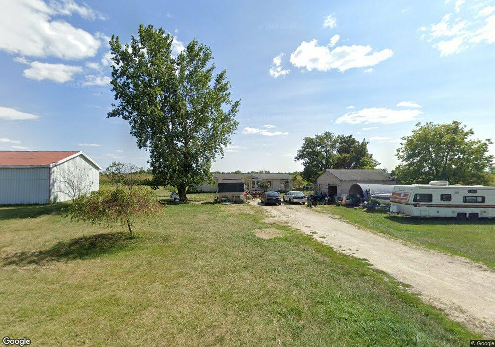
1874 Schroeder Rd Celina, OH 45822
Estimated Value: $172,000 - $532,000
3
Beds
3
Baths
1,836
Sq Ft
$148/Sq Ft
Est. Value
About This Home
This home is located at 1874 Schroeder Rd, Celina, OH 45822 and is currently estimated at $271,672, approximately $147 per square foot. 1874 Schroeder Rd is a home located in Mercer County with nearby schools including Celina Middle School and Celina High School.
Ownership History
Date
Name
Owned For
Owner Type
Purchase Details
Closed on
Jun 5, 2010
Sold by
Wycuff Shawn A and Wycuff Trista D
Bought by
Banks Billiejo
Current Estimated Value
Home Financials for this Owner
Home Financials are based on the most recent Mortgage that was taken out on this home.
Original Mortgage
$71,518
Outstanding Balance
$47,406
Interest Rate
5.14%
Mortgage Type
Seller Take Back
Estimated Equity
$224,266
Purchase Details
Closed on
Apr 4, 2005
Sold by
Davenport Anthony W and Davenport Jessica
Bought by
First Place Bank
Create a Home Valuation Report for This Property
The Home Valuation Report is an in-depth analysis detailing your home's value as well as a comparison with similar homes in the area
Purchase History
| Date | Buyer | Sale Price | Title Company |
|---|---|---|---|
| Banks Billiejo | $71,518 | None Available | |
| First Place Bank | $35,334 | None Available |
Source: Public Records
Mortgage History
| Date | Status | Borrower | Loan Amount |
|---|---|---|---|
| Open | Banks Billiejo | $71,518 |
Source: Public Records
Tax History
| Year | Tax Paid | Tax Assessment Tax Assessment Total Assessment is a certain percentage of the fair market value that is determined by local assessors to be the total taxable value of land and additions on the property. | Land | Improvement |
|---|---|---|---|---|
| 2025 | $1,953 | $47,990 | $8,190 | $39,800 |
| 2024 | $1,959 | $47,990 | $8,190 | $39,800 |
| 2023 | $1,953 | $47,990 | $8,190 | $39,800 |
| 2022 | $1,591 | $33,880 | $6,720 | $27,160 |
| 2021 | $1,595 | $33,880 | $6,720 | $27,160 |
| 2020 | $1,347 | $33,880 | $6,720 | $27,160 |
| 2019 | $1,347 | $31,820 | $6,060 | $25,760 |
| 2018 | $1,399 | $31,820 | $6,060 | $25,760 |
| 2017 | $1,312 | $31,820 | $6,060 | $25,760 |
| 2016 | $1,225 | $28,250 | $4,730 | $23,520 |
| 2015 | $1,191 | $28,250 | $4,730 | $23,520 |
| 2014 | $1,193 | $28,250 | $4,730 | $23,520 |
| 2013 | $1,501 | $33,220 | $5,530 | $27,690 |
Source: Public Records
Map
Nearby Homes
- 4295 William Ave
- 0 Springer 1-6 & Roadway 14-16 Unit 1044131
- 0 Anderson Lots 10 11 & 12 Ln Unit 1044138
- 0 Harbor Lots 26 27 & 38 Dr Unit 1044287
- 0 Harbor Lots 24 & 25 Dr Unit 1044267
- 0 Anderson 13&14 & Roadway 12&13 Unit 1044236
- 6764 Silver Lakes Dr
- 513 W Main St
- 309 N 2nd St
- 309 E Vine St
- 4978 Buschor Rd
- 420 S 1st St
- 515 E Plum St
- 8720 E 50 N
- 4519 Fleetfoot Rd
- 116 S Elm St
- 1312 Michael Ave
- 1125 W Bank Rd Unit 1125 107
- 1001 N Sugar St
- 906 N Sugar St
Your Personal Tour Guide
Ask me questions while you tour the home.