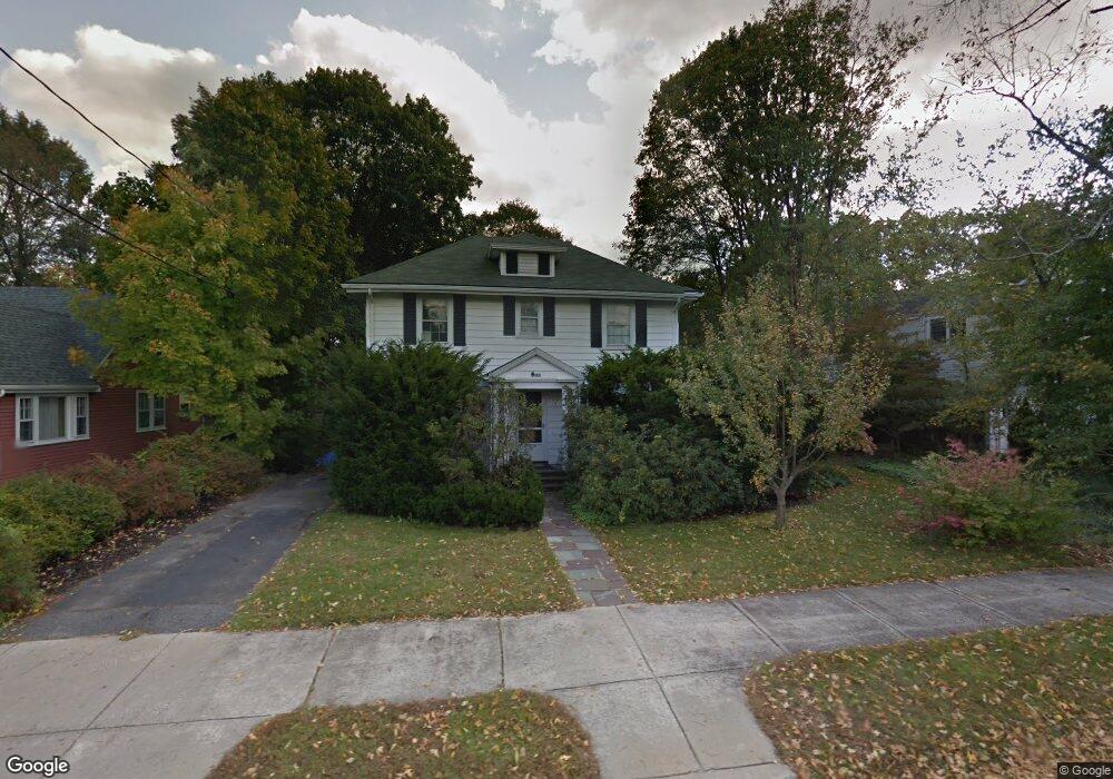
1875 Commonwealth Ave Auburndale, MA 02466
Auburndale NeighborhoodEstimated Value: $1,408,000 - $1,517,000
3
Beds
4
Baths
1,922
Sq Ft
$750/Sq Ft
Est. Value
About This Home
This home is located at 1875 Commonwealth Ave, Auburndale, MA 02466 and is currently estimated at $1,440,886, approximately $749 per square foot. 1875 Commonwealth Ave is a home located in Middlesex County with nearby schools including Williams Elementary School, Charles E Brown Middle School, and Newton South High School.
Ownership History
Date
Name
Owned For
Owner Type
Purchase Details
Closed on
Jan 18, 2022
Sold by
Cohen Edward and Stockton Deborah J
Bought by
Commonwealth Ave 1875 Rt
Current Estimated Value
Purchase Details
Closed on
Dec 1, 1983
Bought by
Cohen Edward and Stockton Deborah J
Create a Home Valuation Report for This Property
The Home Valuation Report is an in-depth analysis detailing your home's value as well as a comparison with similar homes in the area
Home Values in the Area
Average Home Value in this Area
Purchase History
| Date | Buyer | Sale Price | Title Company |
|---|---|---|---|
| Commonwealth Ave 1875 Rt | -- | None Available | |
| Cohen Edward | $131,000 | -- |
Source: Public Records
Mortgage History
| Date | Status | Borrower | Loan Amount |
|---|---|---|---|
| Previous Owner | Cohen Edward | $142,000 | |
| Previous Owner | Cohen Edward | $85,700 | |
| Previous Owner | Cohen Edward | $86,500 |
Source: Public Records
Tax History
| Year | Tax Paid | Tax Assessment Tax Assessment Total Assessment is a certain percentage of the fair market value that is determined by local assessors to be the total taxable value of land and additions on the property. | Land | Improvement |
|---|---|---|---|---|
| 2025 | $11,176 | $1,140,400 | $989,700 | $150,700 |
| 2024 | $10,806 | $1,107,200 | $960,900 | $146,300 |
| 2023 | $10,283 | $1,010,100 | $741,000 | $269,100 |
| 2022 | $9,839 | $935,300 | $686,100 | $249,200 |
| 2021 | $9,495 | $882,400 | $647,300 | $235,100 |
| 2020 | $9,212 | $882,400 | $647,300 | $235,100 |
| 2019 | $8,953 | $856,700 | $628,400 | $228,300 |
| 2018 | $8,521 | $787,500 | $568,800 | $218,700 |
| 2017 | $8,261 | $742,900 | $536,600 | $206,300 |
| 2016 | $7,901 | $694,300 | $501,500 | $192,800 |
| 2015 | $7,534 | $648,900 | $468,700 | $180,200 |
Source: Public Records
Map
Nearby Homes
- 1917 Commonwealth Ave Unit 1917
- 194 Auburn St Unit 2
- 7 Sharon Ave Unit 7
- 226 Auburn St Unit 226
- 283 Woodland Rd
- 0 Duncan Rd Unit 72925240
- 8 Curve St
- 1754 Washington St
- 27 Tennyson Rd
- 17 Lasell St
- 283 Melrose St
- 232 Melrose St Unit 2
- 160 Pine St Unit 15
- 160 Pine St Unit 12
- 10 Higgins St
- 2202 Commonwealth Ave Unit 1
- 12 Oakwood Rd
- 40 Sewall St
- 18 Sewall St
- 383 Cherry St Unit 383
- 1863 Commonwealth Ave
- 1881 Commonwealth Ave
- 122 Auburn St
- 1855 Commonwealth Ave
- 1887 Commonwealth Ave
- 1845 Commonwealth Ave
- 116 Auburn St
- 1874 Commonwealth Ave
- 1878 Commonwealth Ave
- 19 Brae Burn Rd
- 1870 Commonwealth Ave
- 1841 Commonwealth Ave
- 29 Brae Burn Rd
- 1888 Commonwealth Ave
- 35 Brae Burn Rd
- 11 Central St
- 11 Brae Burn Rd
- 127 Auburn St Unit 129
- 1897 Commonwealth Ave Unit 1899
- 1897 Commonwealth Ave Unit 1
Your Personal Tour Guide
Ask me questions while you tour the home.