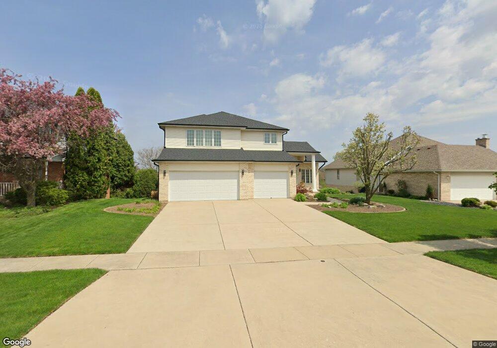
1875 Cornell Dr New Lenox, IL 60451
Estimated Value: $530,000 - $573,000
--
Bed
--
Bath
--
Sq Ft
9,583
Sq Ft Lot
About This Home
This home is located at 1875 Cornell Dr, New Lenox, IL 60451 and is currently estimated at $548,518. 1875 Cornell Dr is a home located in Will County with nearby schools including Spencer Trail, Spencer Crossing Intermediate School, and Spencer Pointe.
Ownership History
Date
Name
Owned For
Owner Type
Purchase Details
Closed on
Oct 27, 2021
Sold by
Bessette Paul A and Bessette Marie T
Bought by
Bessette Paul A and Bessette Maria T
Current Estimated Value
Purchase Details
Closed on
Nov 8, 1996
Sold by
Nlsb
Bought by
Bessette Paul A and Bessette Maria T
Home Financials for this Owner
Home Financials are based on the most recent Mortgage that was taken out on this home.
Original Mortgage
$150,000
Outstanding Balance
$14,900
Interest Rate
8.18%
Estimated Equity
$533,618
Create a Home Valuation Report for This Property
The Home Valuation Report is an in-depth analysis detailing your home's value as well as a comparison with similar homes in the area
Home Values in the Area
Average Home Value in this Area
Purchase History
| Date | Buyer | Sale Price | Title Company |
|---|---|---|---|
| Bessette Paul A | -- | Attorney | |
| Bessette Paul A | $235,000 | -- |
Source: Public Records
Mortgage History
| Date | Status | Borrower | Loan Amount |
|---|---|---|---|
| Open | Bessette Paul A | $150,000 |
Source: Public Records
Tax History Compared to Growth
Tax History
| Year | Tax Paid | Tax Assessment Tax Assessment Total Assessment is a certain percentage of the fair market value that is determined by local assessors to be the total taxable value of land and additions on the property. | Land | Improvement |
|---|---|---|---|---|
| 2024 | $11,989 | $194,973 | $36,393 | $158,580 |
| 2023 | $11,989 | $177,733 | $33,175 | $144,558 |
| 2022 | $13,215 | $163,734 | $30,562 | $133,172 |
| 2021 | $12,532 | $153,987 | $28,743 | $125,244 |
| 2020 | $12,609 | $148,492 | $27,717 | $120,775 |
| 2019 | $12,075 | $143,888 | $26,858 | $117,030 |
| 2018 | $11,804 | $138,928 | $25,932 | $112,996 |
| 2017 | $11,222 | $134,933 | $25,186 | $109,747 |
| 2016 | $10,899 | $131,322 | $24,512 | $106,810 |
| 2015 | $10,562 | $127,188 | $23,740 | $103,448 |
| 2014 | $10,562 | $125,618 | $23,447 | $102,171 |
| 2013 | $10,562 | $127,311 | $23,763 | $103,548 |
Source: Public Records
Map
Nearby Homes
- 214 Somerset Ct
- 1351 E Lincoln Hwy
- 1535 Glenbrooke Ln
- 641 Lisson Grove
- 701 Bishops Gate
- 125 N Anderson Rd
- 805 Regent St
- 513 Somerset Ln
- 1212 Georgias Way
- 1245 Georgias Way
- 1193 Georgias Way
- 651 Schooner Dr
- 1017 E Lincoln Hwy
- 1139 Georgias Way
- 621 Chatfield Rd
- 1125 Georgias Way
- 2667 E Lincoln Hwy
- 2758 Bluestone Bay Dr
- 117 Walona Ave
- 1920 Tessington Ct
- 1885 Cornell Dr
- 1863 Cornell Dr
- 1891 Cornell Dr
- 1855 Cornell Dr
- 1874 Cornell Dr
- 1884 Cornell Dr
- 1862 Cornell Dr
- 1909 Cornell Dr
- 1890 Cornell Dr
- 1908 Cornell Dr
- 1842 Cornell Dr Unit 2
- 1919 Cornell Dr
- 1865 Regent St
- 1885 Regent St
- 1849 Regent St
- 1918 Cornell Dr
- 1891 Regent St
- 1933 Cornell Dr
- 1833 Regent St
- 1839 Cornell Dr