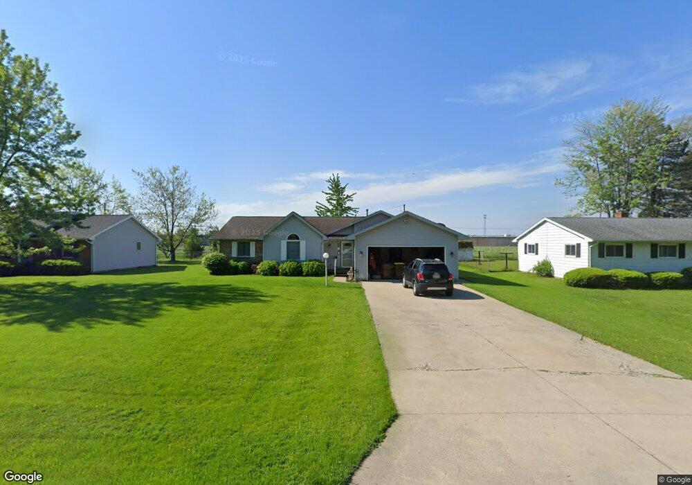
1875 Maumee Dr Defiance, OH 43512
Estimated Value: $192,000 - $215,549
2
Beds
2
Baths
1,704
Sq Ft
$121/Sq Ft
Est. Value
About This Home
This home is located at 1875 Maumee Dr, Defiance, OH 43512 and is currently estimated at $206,137, approximately $120 per square foot. 1875 Maumee Dr is a home located in Defiance County with nearby schools including Defiance Elementary School, Defiance Middle School, and Defiance High School.
Ownership History
Date
Name
Owned For
Owner Type
Purchase Details
Closed on
Apr 20, 2017
Sold by
Loch Bonnie L and Loch Kenneth E
Bought by
Hannon Brian C
Current Estimated Value
Home Financials for this Owner
Home Financials are based on the most recent Mortgage that was taken out on this home.
Original Mortgage
$118,131
Outstanding Balance
$98,303
Interest Rate
4.21%
Mortgage Type
FHA
Estimated Equity
$107,834
Purchase Details
Closed on
Aug 30, 2001
Bought by
Benson Bonnie L
Purchase Details
Closed on
Dec 18, 1998
Bought by
Benson Bonnie L
Create a Home Valuation Report for This Property
The Home Valuation Report is an in-depth analysis detailing your home's value as well as a comparison with similar homes in the area
Home Values in the Area
Average Home Value in this Area
Purchase History
| Date | Buyer | Sale Price | Title Company |
|---|---|---|---|
| Hannon Brian C | $129,000 | None Available | |
| Benson Bonnie L | -- | -- | |
| Benson Bonnie L | $112,000 | -- |
Source: Public Records
Mortgage History
| Date | Status | Borrower | Loan Amount |
|---|---|---|---|
| Open | Hannon Brian C | $118,131 |
Source: Public Records
Tax History Compared to Growth
Tax History
| Year | Tax Paid | Tax Assessment Tax Assessment Total Assessment is a certain percentage of the fair market value that is determined by local assessors to be the total taxable value of land and additions on the property. | Land | Improvement |
|---|---|---|---|---|
| 2024 | $2,485 | $64,510 | $3,760 | $60,750 |
| 2023 | $2,485 | $64,510 | $3,760 | $60,750 |
| 2022 | $1,983 | $46,010 | $3,710 | $42,300 |
| 2021 | $1,983 | $46,010 | $3,710 | $42,300 |
| 2020 | $1,999 | $46,010 | $3,710 | $42,300 |
| 2019 | $1,877 | $42,260 | $3,710 | $38,550 |
| 2018 | $1,827 | $42,260 | $3,710 | $38,550 |
| 2017 | $1,802 | $42,262 | $3,713 | $38,549 |
| 2016 | $1,636 | $38,175 | $3,696 | $34,479 |
| 2015 | $613 | $38,511 | $3,696 | $34,815 |
| 2014 | $613 | $38,511 | $3,696 | $34,815 |
| 2013 | $613 | $38,511 | $3,696 | $34,815 |
| 2012 | $613 | $38,511 | $3,696 | $34,815 |
Source: Public Records
Map
Nearby Homes
- 1819 Maumee Dr
- 1744 Lora Ln
- 1613 E 2nd St
- 649 Burning Tree Dr
- 1408 Heatherdowns Dr
- 655 Burning Tree Dr
- 1365 Heatherdowns Dr
- 673 Burning Tree Dr
- 679 Burning Tree Dr
- 1459 Deerwood Dr
- 00 Carpenter Rd
- 846 Deerwood Dr
- 850 Deerwood Dr
- 600 Euclid St
- 1275 Pinehurst Dr
- 905 Hees Ct
- 0 Domersville Rd
- 1050 Madison Ave
- 420 Highland St
- 0 Carpenter Rd Unit 10001359
- 1879 Maumee Dr
- 1847 Maumee Dr
- 1845 Maumee Dr
- 1885 Maumee Dr
- 1876 Maumee Dr
- 1839 Maumee Dr
- 1880 Maumee Dr
- 1889 Maumee Dr
- 1835 Maumee Dr
- 1888 Maumee Dr
- 1876 Riverview Dr
- 1893 Maumee Dr
- 1862 Riverview Dr
- 1880 Riverview Dr
- 1831 Maumee Dr
- 1892 Maumee Dr
- 1886 Riverview Dr
- 1899 Maumee Dr
- 1827 Maumee Dr
- 1896 Maumee Dr